Internet-enabled GIS Using Free and Open Source Tools
16 likes1,604 views

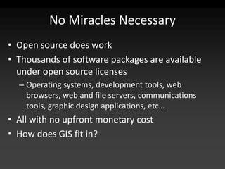
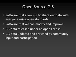
Internet-enabled GIS can be developed using free and open source tools like MapServer, GeoServer, TileCache, and OpenLayers. Open source GIS software allows data and applications to be freely shared, adapted, and improved by a community. Pre-rendering map tiles improves rendering speed compared to generating maps from source data for each request. The open source GIS community collaborates to build and enhance software and data.
1 of 41


Ad
Recommended
DATABASE & WEBGIS - GIS BOOTCAMP
DATABASE & WEBGIS - GIS BOOTCAMPKevin Ng'eno This document provides an overview of databases and WebGIS. It discusses different types of databases including MySQL, PostgreSQL, and spatially-enabled databases. It compares MySQL and PostgreSQL, covering when each would be used. It also covers database data conversions between formats like JSON, GeoJSON, CSV, SHP, and KML/KMZ. For WebGIS, it defines it as a distributed information system comprising a server and client, where the server is a GIS server and client a web browser. It discusses purposes, technologies, languages/frameworks like Python, JavaScript, GeoDjango, and case studies for building WebGIS systems.
FOSS4G2011 Report
FOSS4G2011 ReportMeg Murakami The document discusses the FOSS4G 2011 conference held in Denver from September 9th-17th. It focuses on presentations about geospatial open source software including PostGIS, Neo4j, MapServer, GeoServer, OpenLayers, Leaflet, GeoScript, GeoKettle, and MapCache. New features and tips for using these tools were provided.
Integrating PostGIS in Web Applications
Integrating PostGIS in Web ApplicationsCommand Prompt., Inc Leo Hsu and Regina Obe
We'll demonstrate integrating PostGIS in both PHP and ASP.NET applications.
We'll demonstrate using the new PostGIS 1.5 geography offering to extend existing web applications with proximity analysis.
More advanced use to display maps and stats using OpenLayers, WMS/WFS services and roll your own WFS like service using the PostGIS KML/GML/and or GeoJSON output functions.
Web gis implementation notes
Web gis implementation notespaoloverri 1) WebGIS architecture separates the geographic data storage and map generation on a remote server from the map interaction which occurs in the user's browser.
2) Setting up a WebGIS involves configuring the WebGIS architecture, producing and managing geographic data in a PostGIS database, configuring MapServer maps, and enabling map-user interaction through JavaScript libraries.
3) Key components for developing a WebGIS are PostGIS for geographic data storage, MapServer for generating maps from the database, and JavaScript libraries like OpenLayers and GeoExt for basic and complex user interaction with the maps in a web browser.
GeoCamp 2012 - Open Source WebMapping
GeoCamp 2012 - Open Source WebMappingHugo Martins This document discusses several open source web mapping frameworks: OpenLayers, ExtJS, and GeoExt. OpenLayers is a JavaScript library that supports OGC standards and has a large user and developer community. ExtJS is a JavaScript framework for building rich web applications with user interface components like forms and tables. GeoExt brings together OpenLayers and ExtJS to allow building of spatial rich internet applications with maps integrated with user interface elements like toolbars, legends, and tables.
Introduction to WebGIS- Esri norsk BK 2014
Introduction to WebGIS- Esri norsk BK 2014Geodata AS The document summarizes a technical workshop on the ArcGIS platform and web GIS. It outlines the evolution of GIS technology towards more integrated software and services. It then reviews the key components of the ArcGIS platform, including ArcGIS Desktop, ArcGIS Online, Portal for ArcGIS, and ArcGIS Server. It demonstrates how GIS data and resources can be centralized in a portal and accessed through web apps by users on desktops, web, and mobile devices. The workshop concludes with advice on implementing web GIS within an organization.
Gis meetup 111913
Gis meetup 111913Josh Gage This document discusses visualizing geospatial data using CartoDB and D3.js. CartoDB is a cloud-based platform for GIS and web mapping that allows for easy data import and has a user-friendly interface. It can be used to build standalone web maps or serve tiles for custom applications. D3.js is an open-source JavaScript library that renders dynamic graphics in the browser's DOM using SVG.
Cosmosdb graph
Cosmosdb graphMohit Chhabra SQL databases use a relational model and are vertically scalable, while NoSQL databases are non-relational, horizontally scalable, and support semi-structured or unstructured data. NoSQL databases provide eventual consistency and are easier for programmers to use compared to SQL databases, which support atomic transactions but can be more difficult for programmers. Common types of NoSQL databases include document, graph, key-value pair, and column-oriented databases.
Whitebox GAT - an introduction by its developer
Whitebox GAT - an introduction by its developerRobin Lovelace John Lindsay, the main developer of the little known but extremely powerful GIS program Whitebox Geospatial Analysis Tools, describes his software at GISRUK 2014 in Glasgow.
introduction to Neo4j (Tabriz Software Open Talks)
introduction to Neo4j (Tabriz Software Open Talks)Farzin Bagheri This document provides an overview of Neo4j, a graph database. It begins with definitions of relational and NoSQL databases, categorizing NoSQL into key-value, document, column-oriented, and graph databases. Graph databases are explained to contain nodes, relationships, and properties. Neo4j is introduced as an example graph database, with Cypher listed as its query language. Examples of using Cypher to create nodes and relationships are provided. Finally, potential uses of Neo4j are listed, including social networks, network analysis, recommendations, and more.
Presentation
Presentationgrimster The document summarizes Orangeleaf Systems' Collections Base solution for aggregating and indexing cultural heritage collection data across multiple partner sites. The solution allows partners to upload and reupload data using common standards, indexes the data at enterprise scale using Solr, and provides an open API and portal built on WordPress for faceted browsing, searching, and specialized views of the collections. It has been implemented with over 50 partners and 2.1 million records.
MongoDB for Spatio-Behavioral Data Analysis and Visualization
MongoDB for Spatio-Behavioral Data Analysis and VisualizationMongoDB T-Sciences offers iSpatial - a web-based Spatial Data Infrastructure (SDI) to enable integration of third-party applications with geo-visualization tools. The iHarvest tool further enables the mining and analysis of data aggregated in the iSpatial platform for spatio-temporal behavior modelling. At the back-end of both products is MongoDB, providing fundamental framework capabilities for the spatial indexing and data analysis techniques. Come witness how Thermopylae Sciences and Technology leveraged the aggregation framework, and extended the spatial capabilities of MongoDB to tackle dynamic spatio-behavioral data at scale.
Mobile LBS
Mobile LBSJaak Laineste This document provides an overview of mobile location-based apps and geographic information systems (GIS). It discusses location-based services and popular apps, challenges in the field, and trends for the future, including augmented reality and indoor mapping. It also covers GIS concepts like data models, layers, projections and coordinate systems, and sources of map data, including proprietary, open, and crowdsourced options like OpenStreetMap.
No(Geo)SQL
No(Geo)SQLNicolasgmail.com Helleringer This document discusses using NoSQL databases for geographic search and location-based services. It explains that geographic data is complex to store in SQL databases due to its multiple dimensions and large size. NoSQL databases provide alternatives like quadtrees and R-trees to index and search geographic data more efficiently. The document provides examples of geographic implementations in databases like MongoDB, Lucene, ElasticSearch, and Neo4j. It also gives examples of building point of interest search using technologies like SQL, Lucene, and Hibernate Search.
Architecture, Historical Data Conversion and Management Process
Architecture, Historical Data Conversion and Management ProcessAmy Gwin This document describes the development of a Historical Site Management Tool to help the Mississippi Department of Archives and History better manage their inventory of historic sites and resources. Key aspects of the tool include:
1) Creating a SQL database with a web interface to digitally store information on historic sites like documents, photos and maps that were previously only in physical files.
2) Developing a system to geocode and map the locations of over 47,000 historic properties, 93% of which now have a recorded location.
3) Prioritizing properties based on their historic designation and developing scripts to continuously update and manage the large dataset.
4Developers 2018: Przetwarzanie Big Data w oparciu o architekturę Lambda na p...
4Developers 2018: Przetwarzanie Big Data w oparciu o architekturę Lambda na p...PROIDEA Według szacunków do 2020 roku wygenerujmy 40 Zetta byte’ów, a do roku 2025 aż 163 Zetta byte’ów różnego rodzaju danych, a ich dokładna analiza ACpozwali na odkrywanie nowych zjawisk, optymalizacje procesów, czy wspomaganie procesów decyzyjnych. Aby efektywnie przetwarzać tak duże zbiory danych potrzebujemy nowych technik analizy danych oraz innowacyjnych rozwiązań technologicznych. Ważną role pełni tutaj chmura Azure, która oferuje szereg usług, przy użyciu których możemy tworzyć rozwiązania na potrzeby przetwarzania Big Data zarówno w trybie batch’owych jak i ‘near real time’. Podczas sesji stworzymy przykładowe rozwiązanie przetwarzania Big Data oparte o architekturę Lambda , z wykorzystaniem usług platformy Azure, takich jak Azure Data Factory, Azure Stream Analytics, Azure HdInsight, Azure Event (IoT) Hub, czy Azure Data Lake.
Improve Your Work with Esri Contents
Improve Your Work with Esri ContentsEsri Esri Spain provides various GIS content and basemaps for use in ArcGIS systems. This includes national basemaps containing vector and imagery data from sources like IGN/CNIG. Regional and local basemaps are also available at different scales. Thematic content covers topics like land use, census data, and business directories. Partners like TeleAtlas and Navteq contribute additional street and reference data. Intermap provides high-resolution elevation and imagery datasets globally. ArcGIS Online acts as a repository for maps, apps, tools and data shared by Esri, its partners, and user communities.
Practical Use of a NoSQL
Practical Use of a NoSQLIBM Cloud Data Services In the world of NoSQL, each database has its own strengths and weaknesses. Understanding which open source database is "the right tool for the job" is half the battle if you want to start building better applications quickly. IBM developer advocate Glynn Bird explores practical examples of how two popular NoSQL databases - the Cloudant JSON document store and the Redis in-memory key-value store - can be used together to create performant and scalable Web applications. It also includes real world use cases you can try today, for free, using the IBM Cloud Data Services suite of fully managed NoSQL databases-as-a-service.
Oss as a competitive advantage
Oss as a competitive advantageRegunath B Slides from my talk at SiliconIndia OSS conference in Bangalore Nov 2012. Talks about use of OSS as a competitive advantage, especially in areas like eCommerce citing Flipkart as an example.
Cloud Computing and the Microsoft Developer - A Down-to-Earth Analysis
Cloud Computing and the Microsoft Developer - A Down-to-Earth AnalysisAndrew Brust Slides from my Keynote at Visual Studio Live Las Vegas 2011 (Day 2).
Closely compares Azure to AWS, and discusses Force.com, Google, Rackspace, VMWare and Red Hat.
Discussion includes capabilities, pricing, strategy.
Geographical information system
Geographical information systemBipin Karki The document provides an overview of geographical information systems (GIS). It defines GIS as a system for capturing, storing, manipulating, analyzing and presenting spatial or geographic data. It describes the core components of GIS as hardware, software, data, people and methods. It outlines several applications of GIS in fields such as agriculture, natural resource management, transportation, military, business and more. It also discusses concepts such as data types, map scale and resolution, and provides examples of GIS terminology.
ITResumeKlonWaldrip
ITResumeKlonWaldripKlon Waldrip Klon Joseph Waldrip is an experienced stormwater infrastructure specialist and GIS analyst seeking a position providing skills in data management, analysis, and spatial analysis. He has a background in authoring NPDES and SWMP reports for Rockdale County and helping to educate county staff on GIS benefits. His skills include remote sensing, geospatial analysis, Python programming, database management, and LiDAR processing.
Dirty Data? Clean it up! - Rocky Mountain DataCon 2016
Dirty Data? Clean it up! - Rocky Mountain DataCon 2016Dan Lynn Dan Lynn and Patrick Russell discuss data cleaning, data engineering, and how to operationalize data science at Rocky Mountain DataCon 2016.
NoSQL for SQL Users
NoSQL for SQL UsersIBM Cloud Data Services SQL-based databases have been around for decades and they power a wide range of applications. So what exactly do NoSQL databases bring to the table? In this webcast, you'll find out how NoSQL can liberate your development cycle, allow your application to scale and improve your system's uptime.
An Introduction to Big Data, NoSQL and MongoDB
An Introduction to Big Data, NoSQL and MongoDBWilliam LaForest The document introduces MongoDB as an open source, high performance database that is a popular NoSQL option. It discusses how MongoDB stores data as JSON-like documents, supports dynamic schemas, and scales horizontally across commodity servers. MongoDB is seen as a good alternative to SQL databases for applications dealing with large volumes of diverse data that need to scale.
Introduction to basic data analytics tools
Introduction to basic data analytics toolsNascenia IT This document introduces basic data analytics tools. It discusses the data analytics pipeline of collecting, refining, storing, analyzing, and presenting data. It describes tools for each step including Requests and BeautifulSoup for data acquisition, Pandas and SQLAlchemy for data processing and storage, R and RStudio for data analysis, and Plotly and Matplotlib for data visualization. Apache Superset is highlighted as a tool for data visualization and exploration. Challenges of data analytics like data quality, privacy, and scaling are also outlined.
Back to Basics 2017 - Introduction to NoSQL
Back to Basics 2017 - Introduction to NoSQLJoe Drumgoole This document provides an overview of an introduction to NoSQL webinar. It discusses why NoSQL databases were created, the different types of NoSQL databases including key-value stores, column stores, graph stores, multi-model databases and document stores. It provides details on MongoDB, describing how MongoDB stores data as JSON-like documents with dynamic schemas and supports features like indexing, aggregation and geospatial queries. The webinar agenda is also outlined.
Using MongoDB For BigData in 20 Minutes
Using MongoDB For BigData in 20 MinutesAndrás Fehér This document provides an overview of using MongoDB for big data applications. It describes what MongoDB is, including that it is a open-source, document-oriented NoSQL database. It then covers some key MongoDB concepts and features like replica sets for high availability, sharding for horizontal scaling, and using MapReduce and Apache Spark with MongoDB. The document concludes that MongoDB is a fast, flexible, and scalable database solution for big data, though deploying sharded clusters requires planning.
Web Based GIS LeadGen Introduction
Web Based GIS LeadGen IntroductionInteractiveGIS This document provides an overview of the key features and functionality of a web-based geographic information system (GIS). It describes the main components including databases, mapping capabilities, and interactive tools. The system allows users to search for and view property data, print maps, and export/import data in common formats. Detailed information and help documents are accessible through an online help button.
Overview of Google spreadsheet API for Java by Nazar Kostiv 
Overview of Google spreadsheet API for Java by Nazar Kostiv IT Booze The document provides an overview of the Google Spreadsheet API for Java, covering authorization, working with worksheets and cells, and list-based and cell-based feeds. It discusses how to create a spreadsheet service, get authorization credentials, retrieve spreadsheet and worksheet feeds, add and update worksheets and cells, and perform queries. The document also lists the required Java libraries and provides links for additional documentation.
Ad
More Related Content
What's hot (20)
Whitebox GAT - an introduction by its developer
Whitebox GAT - an introduction by its developerRobin Lovelace John Lindsay, the main developer of the little known but extremely powerful GIS program Whitebox Geospatial Analysis Tools, describes his software at GISRUK 2014 in Glasgow.
introduction to Neo4j (Tabriz Software Open Talks)
introduction to Neo4j (Tabriz Software Open Talks)Farzin Bagheri This document provides an overview of Neo4j, a graph database. It begins with definitions of relational and NoSQL databases, categorizing NoSQL into key-value, document, column-oriented, and graph databases. Graph databases are explained to contain nodes, relationships, and properties. Neo4j is introduced as an example graph database, with Cypher listed as its query language. Examples of using Cypher to create nodes and relationships are provided. Finally, potential uses of Neo4j are listed, including social networks, network analysis, recommendations, and more.
Presentation
Presentationgrimster The document summarizes Orangeleaf Systems' Collections Base solution for aggregating and indexing cultural heritage collection data across multiple partner sites. The solution allows partners to upload and reupload data using common standards, indexes the data at enterprise scale using Solr, and provides an open API and portal built on WordPress for faceted browsing, searching, and specialized views of the collections. It has been implemented with over 50 partners and 2.1 million records.
MongoDB for Spatio-Behavioral Data Analysis and Visualization
MongoDB for Spatio-Behavioral Data Analysis and VisualizationMongoDB T-Sciences offers iSpatial - a web-based Spatial Data Infrastructure (SDI) to enable integration of third-party applications with geo-visualization tools. The iHarvest tool further enables the mining and analysis of data aggregated in the iSpatial platform for spatio-temporal behavior modelling. At the back-end of both products is MongoDB, providing fundamental framework capabilities for the spatial indexing and data analysis techniques. Come witness how Thermopylae Sciences and Technology leveraged the aggregation framework, and extended the spatial capabilities of MongoDB to tackle dynamic spatio-behavioral data at scale.
Mobile LBS
Mobile LBSJaak Laineste This document provides an overview of mobile location-based apps and geographic information systems (GIS). It discusses location-based services and popular apps, challenges in the field, and trends for the future, including augmented reality and indoor mapping. It also covers GIS concepts like data models, layers, projections and coordinate systems, and sources of map data, including proprietary, open, and crowdsourced options like OpenStreetMap.
No(Geo)SQL
No(Geo)SQLNicolasgmail.com Helleringer This document discusses using NoSQL databases for geographic search and location-based services. It explains that geographic data is complex to store in SQL databases due to its multiple dimensions and large size. NoSQL databases provide alternatives like quadtrees and R-trees to index and search geographic data more efficiently. The document provides examples of geographic implementations in databases like MongoDB, Lucene, ElasticSearch, and Neo4j. It also gives examples of building point of interest search using technologies like SQL, Lucene, and Hibernate Search.
Architecture, Historical Data Conversion and Management Process
Architecture, Historical Data Conversion and Management ProcessAmy Gwin This document describes the development of a Historical Site Management Tool to help the Mississippi Department of Archives and History better manage their inventory of historic sites and resources. Key aspects of the tool include:
1) Creating a SQL database with a web interface to digitally store information on historic sites like documents, photos and maps that were previously only in physical files.
2) Developing a system to geocode and map the locations of over 47,000 historic properties, 93% of which now have a recorded location.
3) Prioritizing properties based on their historic designation and developing scripts to continuously update and manage the large dataset.
4Developers 2018: Przetwarzanie Big Data w oparciu o architekturę Lambda na p...
4Developers 2018: Przetwarzanie Big Data w oparciu o architekturę Lambda na p...PROIDEA Według szacunków do 2020 roku wygenerujmy 40 Zetta byte’ów, a do roku 2025 aż 163 Zetta byte’ów różnego rodzaju danych, a ich dokładna analiza ACpozwali na odkrywanie nowych zjawisk, optymalizacje procesów, czy wspomaganie procesów decyzyjnych. Aby efektywnie przetwarzać tak duże zbiory danych potrzebujemy nowych technik analizy danych oraz innowacyjnych rozwiązań technologicznych. Ważną role pełni tutaj chmura Azure, która oferuje szereg usług, przy użyciu których możemy tworzyć rozwiązania na potrzeby przetwarzania Big Data zarówno w trybie batch’owych jak i ‘near real time’. Podczas sesji stworzymy przykładowe rozwiązanie przetwarzania Big Data oparte o architekturę Lambda , z wykorzystaniem usług platformy Azure, takich jak Azure Data Factory, Azure Stream Analytics, Azure HdInsight, Azure Event (IoT) Hub, czy Azure Data Lake.
Improve Your Work with Esri Contents
Improve Your Work with Esri ContentsEsri Esri Spain provides various GIS content and basemaps for use in ArcGIS systems. This includes national basemaps containing vector and imagery data from sources like IGN/CNIG. Regional and local basemaps are also available at different scales. Thematic content covers topics like land use, census data, and business directories. Partners like TeleAtlas and Navteq contribute additional street and reference data. Intermap provides high-resolution elevation and imagery datasets globally. ArcGIS Online acts as a repository for maps, apps, tools and data shared by Esri, its partners, and user communities.
Practical Use of a NoSQL
Practical Use of a NoSQLIBM Cloud Data Services In the world of NoSQL, each database has its own strengths and weaknesses. Understanding which open source database is "the right tool for the job" is half the battle if you want to start building better applications quickly. IBM developer advocate Glynn Bird explores practical examples of how two popular NoSQL databases - the Cloudant JSON document store and the Redis in-memory key-value store - can be used together to create performant and scalable Web applications. It also includes real world use cases you can try today, for free, using the IBM Cloud Data Services suite of fully managed NoSQL databases-as-a-service.
Oss as a competitive advantage
Oss as a competitive advantageRegunath B Slides from my talk at SiliconIndia OSS conference in Bangalore Nov 2012. Talks about use of OSS as a competitive advantage, especially in areas like eCommerce citing Flipkart as an example.
Cloud Computing and the Microsoft Developer - A Down-to-Earth Analysis
Cloud Computing and the Microsoft Developer - A Down-to-Earth AnalysisAndrew Brust Slides from my Keynote at Visual Studio Live Las Vegas 2011 (Day 2).
Closely compares Azure to AWS, and discusses Force.com, Google, Rackspace, VMWare and Red Hat.
Discussion includes capabilities, pricing, strategy.
Geographical information system
Geographical information systemBipin Karki The document provides an overview of geographical information systems (GIS). It defines GIS as a system for capturing, storing, manipulating, analyzing and presenting spatial or geographic data. It describes the core components of GIS as hardware, software, data, people and methods. It outlines several applications of GIS in fields such as agriculture, natural resource management, transportation, military, business and more. It also discusses concepts such as data types, map scale and resolution, and provides examples of GIS terminology.
ITResumeKlonWaldrip
ITResumeKlonWaldripKlon Waldrip Klon Joseph Waldrip is an experienced stormwater infrastructure specialist and GIS analyst seeking a position providing skills in data management, analysis, and spatial analysis. He has a background in authoring NPDES and SWMP reports for Rockdale County and helping to educate county staff on GIS benefits. His skills include remote sensing, geospatial analysis, Python programming, database management, and LiDAR processing.
Dirty Data? Clean it up! - Rocky Mountain DataCon 2016
Dirty Data? Clean it up! - Rocky Mountain DataCon 2016Dan Lynn Dan Lynn and Patrick Russell discuss data cleaning, data engineering, and how to operationalize data science at Rocky Mountain DataCon 2016.
NoSQL for SQL Users
NoSQL for SQL UsersIBM Cloud Data Services SQL-based databases have been around for decades and they power a wide range of applications. So what exactly do NoSQL databases bring to the table? In this webcast, you'll find out how NoSQL can liberate your development cycle, allow your application to scale and improve your system's uptime.
An Introduction to Big Data, NoSQL and MongoDB
An Introduction to Big Data, NoSQL and MongoDBWilliam LaForest The document introduces MongoDB as an open source, high performance database that is a popular NoSQL option. It discusses how MongoDB stores data as JSON-like documents, supports dynamic schemas, and scales horizontally across commodity servers. MongoDB is seen as a good alternative to SQL databases for applications dealing with large volumes of diverse data that need to scale.
Introduction to basic data analytics tools
Introduction to basic data analytics toolsNascenia IT This document introduces basic data analytics tools. It discusses the data analytics pipeline of collecting, refining, storing, analyzing, and presenting data. It describes tools for each step including Requests and BeautifulSoup for data acquisition, Pandas and SQLAlchemy for data processing and storage, R and RStudio for data analysis, and Plotly and Matplotlib for data visualization. Apache Superset is highlighted as a tool for data visualization and exploration. Challenges of data analytics like data quality, privacy, and scaling are also outlined.
Back to Basics 2017 - Introduction to NoSQL
Back to Basics 2017 - Introduction to NoSQLJoe Drumgoole This document provides an overview of an introduction to NoSQL webinar. It discusses why NoSQL databases were created, the different types of NoSQL databases including key-value stores, column stores, graph stores, multi-model databases and document stores. It provides details on MongoDB, describing how MongoDB stores data as JSON-like documents with dynamic schemas and supports features like indexing, aggregation and geospatial queries. The webinar agenda is also outlined.
Using MongoDB For BigData in 20 Minutes
Using MongoDB For BigData in 20 MinutesAndrás Fehér This document provides an overview of using MongoDB for big data applications. It describes what MongoDB is, including that it is a open-source, document-oriented NoSQL database. It then covers some key MongoDB concepts and features like replica sets for high availability, sharding for horizontal scaling, and using MapReduce and Apache Spark with MongoDB. The document concludes that MongoDB is a fast, flexible, and scalable database solution for big data, though deploying sharded clusters requires planning.
Viewers also liked (20)
Web Based GIS LeadGen Introduction
Web Based GIS LeadGen IntroductionInteractiveGIS This document provides an overview of the key features and functionality of a web-based geographic information system (GIS). It describes the main components including databases, mapping capabilities, and interactive tools. The system allows users to search for and view property data, print maps, and export/import data in common formats. Detailed information and help documents are accessible through an online help button.
Overview of Google spreadsheet API for Java by Nazar Kostiv
Overview of Google spreadsheet API for Java by Nazar Kostiv IT Booze The document provides an overview of the Google Spreadsheet API for Java, covering authorization, working with worksheets and cells, and list-based and cell-based feeds. It discusses how to create a spreadsheet service, get authorization credentials, retrieve spreadsheet and worksheet feeds, add and update worksheets and cells, and perform queries. The document also lists the required Java libraries and provides links for additional documentation.
Jan. 2009 CBN
Jan. 2009 CBNJohn Wong This document summarizes sustainable development business opportunities in China for Team Oregon, LLC. It outlines China's challenges with rapid population growth, urbanization, and resource consumption putting stress on land, water, and energy resources. It proposes a collaborative approach between organizations in China and the US to pursue projects in areas like green building, ecosystem services, transportation, education and joint ventures to move China toward a model of sustainable and harmonious development. The document lists specific project and partnership opportunities for engaging with China.
ArcGIS Server Javascript API
ArcGIS Server Javascript APIewug Utilizing a powerful and proven development framework,
ArcGIS Server opens itself up to the Javascript world. With the
new Javascript API, users can take advantage of an incredibly
robust development environment to build and deploy web
mapping applications within an organization. This session will
explore the utilization of existing Javascript developer libraries
that can be utilized to make simple yet powerful GIS web
applications, showcase the performance increases that users will
see with ArcGIS Server and introduce a simple mash up
environment with Google Maps and Microsoft Virtual Earth
Social Path Routing Optimization 1.1
Social Path Routing Optimization 1.1Joel Hoffmann The document proposes a social path routing optimization system to reduce fuel use and travel times. The system would use an opt-in social networking service to collect driving patterns from participants and recommend ways for friends to coordinate their routes and meet up, in order to use high-occupancy vehicle lanes, save on tolls, and optimize road infrastructure use while decreasing environmental impact. Key technologies required include access to a social networking service from vehicles, an open in-vehicle platform, cloud computing, and an internet connection from cars.
Open Source Automated Documentation in a Development Environment
Open Source Automated Documentation in a Development Environmentnealemorison The document discusses using open source tools for document automation. It describes Neale Morison's background working for various tech companies including CSIRO. It then provides examples of using tools like JavaScript, XML, and HTML to dynamically generate documents from structured data for projects like the ASKAP radio telescope and Cisco chip documentation. Throughout, it emphasizes principles for open information like using open formats, minimizing repetition, and using freely available technology.
Iirs - Overview of GIS
Iirs - Overview of GISTushar Dholakia This document provides an overview of geographic information systems (GIS). It discusses key concepts such as how GIS integrates remote sensing, mapping, GPS and other technologies to analyze spatial data. It describes the potential of GIS for applications in natural resource management, infrastructure development and other fields. Finally, it discusses GIS software, hardware requirements and the size of the GIS market in India.
Open Source Tools for Libraries
Open Source Tools for LibrariesNicole C. Engard The document discusses free and open source tools that are useful for libraries. It begins by defining open source software and its benefits. It then lists some commonly known tools like Firefox, LibreOffice, and Linux. The bulk of the document describes lesser known but still useful tools for libraries, including LimeSurvey for web surveys, Scribus for desktop publishing, Camstudio for screencasts, and Zotero for citation management. It provides brief descriptions of each tool's functionality and benefits. The document encourages finding more tools through listed resources.
Ecocommunism of Extinction
Ecocommunism of ExtinctionHarvey Holtz The document discusses the relationship between capitalism, socialism, and ecology. It presents perspectives from Marx, Engels, and other thinkers on how capitalism damages the environment and the metabolic relationship between humans and nature, and how socialism and ecosocialism could establish a more sustainable relationship. It also discusses the need for struggle and transformation to establish an ecosocialist system, referring to examples from Cuba, the USSR, and indigenous communities.
Macro overview by Global Fund Exchange
Macro overview by Global Fund ExchangeAnric Blatt Investing in the future mega macro trends of our planet - Energy, Agriculture, Water, Natural Resources
Hawaii Pacific GIS Conference 2012: Forestry and Tree Mapping - Using ArcGIS ...
Hawaii Pacific GIS Conference 2012: Forestry and Tree Mapping - Using ArcGIS ...Hawaii Geographic Information Coordinating Council The document discusses Hawaii's participation in the national Big Tree competition run by American Forests. It aims to find and preserve the largest trees of various native and introduced species in Hawaii. The competition helps educate the public about these large trees' important environmental role. Hawaii has updated its species list to include 21 native or Polynesian introduced species and currently has 6 prospective champion trees. It also describes how the competition data will be made accessible to the public through ArcGIS Online maps on smartphones and tablets, engaging more people about Hawaii's significant trees.
Presentation at the Master in Global Environmental Change by Jon Hutton
Presentation at the Master in Global Environmental Change by Jon HuttonJavier de la Torre The document discusses UNEP-WCMC, an organization that provides biodiversity data and assessments to support environmental policymaking. It summarizes UNEP-WCMC's history and role, mandates from biodiversity conventions, mission to integrate biodiversity into decisions, and work delivering analyses, facilitating partnerships and responding to emerging issues.
Social #WebApps - Ideas for developing GIS applications that are socially a ”...
Social #WebApps - Ideas for developing GIS applications that are socially a ”...Allan Laframboise Ideas for developing GIS applications that are socially a ”where”. Using real-time geolocation information from social networks such as Twitter with GIS.
An Open Source GIS System for Earthquake Early Warning and Post-Event Emergen...
An Open Source GIS System for Earthquake Early Warning and Post-Event Emergen...Maurizio Pollino Authors: M. Pollino, G. Fattoruso, A. B. Della Rocca, L. La Porta, S. Lo Curzio, A. Arolchi, V. James and C. Pascale (2011).
Presented at "Computational Science and Its Applications - ICCSA 2011 International Conference", Santander, Spain, June 20-23, 2011.
The recent advances in geo-informatics have been opening new opportunities in earthquake early warning and emergency management issues. In the last years, the geo-scientific community has recognized the added value of a geo-analytic approach in complex decision making processes for critical situations due to disastrous natural events such as earthquakes. In fact, recently, GIS-based solutions are investigated in several research projects such as SIT_MEW Project, aimed at the development of volcanic and seismic early warning systems (EWSs). In this project context, an innovative open source GIS system has been investigated and developed as integrated component of the seismic EWS. Its architecture consists in a geospatial database system, a local GIS application for analyzing and modelling the seismic event and its impacts and supporting post-event emergency management, a WEB-GIS module for sharing the geo-information among the public and private stakeholders and emergency managers involved in disaster impact assessment and response management.
Validating a smartphone-based pedestrian navigation system prototype - An inf...
Validating a smartphone-based pedestrian navigation system prototype - An inf...Beniamino Murgante The document describes a study that used eye tracking to evaluate a prototype for a smartphone-based pedestrian navigation system using augmented reality. It presents the concept of the navigation system, which superimposes a virtual route on the camera image to guide the user. An informal pilot test was conducted using eye tracking technology to record participants' eye movements while using the prototype to obtain initial feedback.
A Multiobjective Evolutionary Algorithm for Infrastructure Location in Vehicu...
A Multiobjective Evolutionary Algorithm for Infrastructure Location in Vehicu...Jamal Toutouh, PhD Presentation of our research study "A Multiobjective Evolutionary Algorithm for Infrastructure Location in Vehicular Networks" performed at 7th European Symposium on Computational Intelligence and Mathematics
See the paper --> http://dx.doi.org/10.13140/RG.2.1.1965.0006
Open source tools for Incident Response bogota 2016
Open source tools for Incident Response bogota 2016Mateo Martinez OEA FIRST Symposium in Bogotá 2016. A presentation given by Mateo Martínez and Giovanni Cruz Forero. Mateo Martínez, CISSP, CEH and ISO 27001 certified from KOD LATAM SECURITY (https://kod.uy) and Giovanni Cruz Forero from CSIETE (http://csiete.org). They presented about Open Source Tools for Practical Response to Incidents.
Tools for spatial conservation prioritization
Tools for spatial conservation prioritizationjlehtoma Spatial conservation prioritization is about identifying priority areas for biodiversity, as well as the allocation and scheduling of alternative conservation actions to inform decision-making. In other words, spatial conservation prioritization tries to answer the question of where, when, and how we act to efficiently meet conservation goals. Efficiency is an important concept, as possible conservation actions are always limited by available resources. Spatial conservation prioritization can be informative for many different types of conservation action, such as selecting locations most suitable for extending protected area network, targeting restoration and management, or designing broad scale green infrastructure.
The term “quantitative” refers to prioritization based on quantitative and spatially explicit data that describes the extent and occurrence of biodiversity features (e.g. species and habitats) and other relevant information (e.g. costs and threats). A prioritization algorithm then does the actual prioritization by ordering the planning units used according to some explicit formulation and the results are usually presented in the form of maps that describe the spatial distribution of priorities over the area of interest. Tools aimed at quantitative spatial conservation prioritization have multiple distinct advantages over non-quantitative approaches. They are able to account for the occurrence of biodiversity over potentially very broad geographical areas. For example, when working with species on local level, it is important to account for the occurrence of that species elsewhere. When designing new protected areas, it is similarly important to know what is already protected. Ecological connectivity is yet another factor that is not easy to account for in conventional planning. Expert-based and quantitative approaches are not, however, mutually exclusive. Expert input is always needed to make use of quantitative spatial conservation planning tools.
In this short seminar, we will cover the basics and some available tools for spatial conservation prioritization. We will also go through the most typical stages of a spatial conservation prioritization project using a specific tool, Zonation, as an example. Zonation is a tool for balancing the requirements of many features, such as biodiversity or ecosystem services features, simultaneously in ecologically informed land use planning. In addition to conservation prioritization, Zonation is suited also for general land use planning and resource allocation. We will go through multiple real-life example projects in which Zonation has been used as a decision-support tool. We will also discuss different sources of data needed, as well as typical resources needed to run a prioritization project using Zonation. This seminar should give the attendees a basic understanding what spatial conservation prioritization is useful for.
Use of open source database and open source tools for Library and Information...
Use of open source database and open source tools for Library and Information...Vrushali Basarkar This PPT will be helpful for librarians who has less Budget for libraries and how they can implement open source for day to days library activities
Pre-Con Lab: Test Automation Across Nine Open Source Tools—Taurus
Pre-Con Lab: Test Automation Across Nine Open Source Tools—TaurusCA Technologies This document summarizes a presentation about the open source load testing tool Taurus. Taurus allows users to define load testing scenarios in a YAML configuration file and execute those scenarios across nine different open source load testing tools, including JMeter, Gatling, and Selenium. It aims to provide a DevOps-friendly way to perform load testing that integrates with continuous integration/delivery pipelines. The presentation provides an overview of Taurus and demonstrates how to write Taurus configuration files, execute tests locally and in the cloud, and view results reports.
Hawaii Pacific GIS Conference 2012: Forestry and Tree Mapping - Using ArcGIS ...
Hawaii Pacific GIS Conference 2012: Forestry and Tree Mapping - Using ArcGIS ...Hawaii Geographic Information Coordinating Council
Ad
Similar to Internet-enabled GIS Using Free and Open Source Tools (20)
Going Mobile with HTML5
Going Mobile with HTML5John Reiser The document provides an overview of using HTML5 for mobile mapping applications. It discusses the history and rise of HTML5, how it enables web applications to work across browsers, and its support for mobile functionality. It also covers various HTML5 mapping APIs, using geolocation, common data formats, tile maps and projections, and considerations for designing mobile user interfaces.
Web enabling your survey business ppt version
Web enabling your survey business ppt versionrudy_stricklan The document discusses web mapping and enabling survey data for the web. It provides an overview of shapefiles and their limitations. It then covers hosting web maps using services like ArcGIS Online, Google Maps, and OpenGeo. Key points include that shapefiles have file size and field restrictions, while web maps have no file downloads or software requirements. Web mapping allows data to be universally accessible over the internet from any device with a browser. The document demonstrates publishing maps to various web mapping platforms and services.
Android Bootcamp
Android Bootcampahkjsdcsadc The document provides an introduction to Android development for developers. It outlines the goals of getting started with the environment and tools, creating demo apps, and demonstrating the differences from other environments. It discusses the SDK, IDE, GUI creation using XML layouts, concepts like activities, intents, services and content providers. It also covers debugging issues, data storage, resources, packaging, security concerns and other APIs. The document aims to get developers started with Android and enthusiastic about developing for the platform.
Open Source GIS
Open Source GISJoe Larson Open Source GIS - Paul Bartsch & Joe Larson: talk given for San Luis Obispo GIS Users Group May 20th, 2009.
How to Launch a Public PaaS with OpenSource: The GetUpCloud & OpenShift Orgin...
How to Launch a Public PaaS with OpenSource: The GetUpCloud & OpenShift Orgin...OpenShift Origin How to Launch a Public PaaS with OpenSource: The GetUpCloud & OpenShift Orgin Story FISL 14 Porto Alegre, Brazil
Dotted Eyes - Open Software, Standards and Data
Dotted Eyes - Open Software, Standards and DataDotted Eyes Dotted Eyes is a UK-based spatial solutions provider with over 20 years of experience. They take a solution-led approach, focusing on open software, standards and data to provide tailored solutions that best meet customers' requirements. Case studies show how open solutions can help keep transport maps up to date for events and provide a cost-effective hosted application for contractor data analysis.
Web mapping
Web mappingMusnanda Satar Web mapping involves designing and delivering maps on the World Wide Web. It has become more accessible due to free and open source software and data. There are several types of web maps, including analytic maps that allow online analysis, animated maps that show changes over time, and collaborative maps that allow multiple users to edit maps simultaneously. Popular technologies used for web mapping include spatial databases for storing and querying geographic data, and WMS servers for generating map images on demand from layered geographic datasets.
Gtkwebgis third ch_one_reduced
Gtkwebgis third ch_one_reducedKhadijaKhan52 This chapter introduces Web GIS and the ArcGIS platform. It discusses the concept and advantages of Web GIS, including global reach, large number of users, and easy maintenance. It then describes the ArcGIS Online and ArcGIS Enterprise platforms and the deployment models for building Web GIS applications, including online, on-premises, and hybrid. Finally, it discusses trends in Web GIS technology and provides an overview of building Web GIS apps using the ArcGIS platform.
LSIVIEWER 2.0-A CLIENT-ORIENTED ONLINE VISUALIZATION TOOL FOR GEOSPATIAL VECT...
LSIVIEWER 2.0-A CLIENT-ORIENTED ONLINE VISUALIZATION TOOL FOR GEOSPATIAL VECT...Manikanta Kondeti Visualize Geospatial vector data with a single click.
http://lsi.iiit.ac.in/lsiviewer
Published in ISPRS Archives: https://doi.org/10.5194/isprs-archives-XLII-2-W7-107-2017
Presented at ISPRS Geospatial Week - WebMGS 2017 held in Wuhan, China.
For more information:
Lab for Spatial Informatics
B2-213, Vindhya Building
International Institute of Information Technology(IIIT-H)
Hyderabad, India
Phone : (+91-40)2300 1967, 1969 Ext.276
Brainwave A Basic Overview Bar Camp
Brainwave A Basic Overview Bar CampAbhishek Chamaria The document discusses Brainwave, an end-to-end development and deployment platform with a novel database called Poseidon. Poseidon does not require schemas or data modeling. It allows importing data and starting visualization and sharing data across applications without conflicts. Brainwave consists of six major completed components including Poseidon database and Iris web server. Its goals are to simplify building web applications cheaply and easily with plug-and-play applications and minimal coding.
2013 Vendor, MapQuest Plugins for Leaflet by Jonathan Harahush
2013 Vendor, MapQuest Plugins for Leaflet by Jonathan HarahushGIS in the Rockies Leaflet is a popular open-source JavaScript mapping library that is geared toward developers who want to build lightweight, mobile-friendly Web mapping applications. MapQuest recently released three plugins that enable developers to easily incorporate the most popular MapQuest services -- maps, geocoding, and routing-- into applications built with Leaflet. This session will describe the plugins and demonstrate the functionality included with the MapQuest Maps for Leaflet, MapQuest Geocoding for Leaflet, and MapQuest Routing for Leaflet plugins.
Open Social Summit Korea Overview
Open Social Summit Korea OverviewChris Schalk The document provides an overview of OpenSocial, including its history and concepts, building OpenSocial applications, hosting OpenSocial applications, and upcoming updates. Some key points include:
- OpenSocial allows applications to access social features and data from containers like social networks.
- Gadgets are the basic building block for OpenSocial applications and are defined using XML specs.
- Shindig is an open source reference implementation that can be used to host and serve OpenSocial applications.
- The OpenSocial specification continues to evolve with new versions adding features like REST/RPC APIs and support for dynamic HTML from external servers.
Saving Money with Open Source GIS
Saving Money with Open Source GISbryanluman The document provides an overview of open source GIS software and formats. It discusses what open source software is, common open source licenses, where to find open source GIS software, how to evaluate software quality, and examples of popular open source desktop and web-based GIS programs, databases, data formats, and programming languages. Key open source GIS software mentioned includes QGIS, GRASS, PostGIS, MapServer, and OpenLayers. Common data formats discussed are shapefiles, GeoJSON, KML and GPS eXchange format.
Web 2.0 & Ajax Basics
Web 2.0 & Ajax BasicsAbhishek Nagar This document discusses Web 2.0 and AJAX technologies. It defines Web 2.0 as focusing on user participation, sharing, and collaboration using technologies like blogs, wikis, and AJAX. AJAX is defined as using asynchronous JavaScript and XML to update parts of a web page asynchronously without reloading the entire page. Examples of popular AJAX applications are given like Gmail and Google Maps. The technologies used in AJAX like XMLHttpRequest are discussed along with the asynchronous request-response process and browser support. Security considerations for both server-side and client-side AJAX applications are also covered.
Getting Started with the ArcGIS API for JavaScript, Esri, Julie Powell, Antoo...
Getting Started with the ArcGIS API for JavaScript, Esri, Julie Powell, Antoo...Esri Nederland The document summarizes a presentation on getting started with the ArcGIS API for JavaScript. It discusses using the API to build interactive maps, accessing basemaps from ArcGIS Online, executing tasks, and finding addresses. It also covers best practices for maximizing performance, building expressive applications, and using HTML5 capabilities. The presentation outlines the ArcGIS JavaScript roadmap and upcoming features.
Emerging Service Technologies
Emerging Service Technologiessirosenf The document discusses the evolution of software delivery models from traditional software as a product to cloud-based software as a service (SaaS) and hybrid software-plus-services (S+S) models. It provides an overview of the advantages and challenges of SaaS, including cost savings but also concerns over data security and system performance. S+S aims to combine the benefits of locally-installed software with cloud-based services, though businesses still require an IT department. The document predicts continued growth of SaaS and convergence between the SaaS and S+S models as capabilities improve.
Tile Caching Options
Tile Caching OptionsWisconsin Land Information Association This document discusses different tools for caching map tiles including MapProxy, TileCache, GeoWebCache, and ArcGIS Server. It provides an overview of caching and its benefits, common terms like seeding and metatiling, and compares the functionality and capabilities of each caching tool. The document recommends choosing the right caching tool based on your specific needs and provides resources for further information.
OpenStreetMap in 3D - current developments
OpenStreetMap in 3D - current developmentsvirtualcitySYSTEMS GmbH Presentation at the 3rd International MapWindow Open-Source GIS Conference in Velp, The Netherlands, 06/26/2012
An Introduction To Android
An Introduction To Androidnatdefreitas This document provides an overview of the Android mobile platform architecture. It describes that Android is based on the Linux kernel with additional enhancements for power management, inter-process communication, and more. It also discusses the Dalvik virtual machine, core libraries, and hardware abstraction layer. Finally, it covers aspects of application development including setting up the manifest, laying out UI with XML, and debugging apps.
The Benefits of Publicly-Accessible Data - SNODAS
The Benefits of Publicly-Accessible Data - SNODASThomas Horner The document discusses how publicly accessible web services can make government data more usable. It describes how the author automated the retrieval, conversion and distribution of snowpack data from NOAA's SNODAS program as web services. This allows developers to easily add the latest SNODAS data to webmaps and applications. The author demonstrates this through an open source Leaflet map called "Slippy-SNODAS" that consumes the SNODAS web services. Making this data more accessible through modern web standards empowers others to use and improve upon the data.
Ad
More from John Reiser (20)
Python and GIS: Improving Your Workflow
Python and GIS: Improving Your WorkflowJohn Reiser A 40 minute talk on using Python with GIS software. Integration with ArcGIS and open source software is demonstrated. Includes links to several Python-based projects on Github. Presented at the Delaware Valley Regional Planning Commission's Information Resource Exchange Group on December 9th, 2015.
Habitat Change Analysis Project
Habitat Change Analysis ProjectJohn Reiser Presented by Patrick Woerner and John Reiser at the Northeast Arc Users Group, November 10, 2015.
Wildlife habitat change trend information is a necessary and fundamental component for successful assessment and management of wildlife species. Habitat loss and fragmentation continue to be the two most serious threats to wildlife populations. To effectively protect endangered and threatened species populations and to evaluate protection and management efforts, it is important for wildlife agencies to actively identify and monitor habitat for each listed species. New Jersey’s Division of Fish and Wildlife adopted a habitat change analysis approach to track wildlife habitat transition and fragmentation trends over time. The programmatic GIS analysis approach extracts potential habitat from available Land Use/Land Cover (LULC) data based on species habitat associations and range extents. The analysis spans four time periods between 1986 and 2012. Analysis outputs provide readily available, up-to-date, multi-level, species-specific habitat change information to support agency initiatives. Resulting maps and data serve as a guide to help prioritize work for particular species and their habitats and provide baseline information for the development of species status assessments and recovery plans. Outputs also provide a basis for additional analyses such as evaluating habitat change in regulated vs. unregulated areas, evaluating habitat conservation planning efforts, and other land-use planning, land management and preservation efforts.
Using Dashboards to Understand Spatial Data
Using Dashboards to Understand Spatial DataJohn Reiser This document discusses how dashboards can be used to provide interactive views of key metrics and indicators from spatial data in a way that is easy for users to understand quickly, without having to navigate extensive GIS systems. It provides examples of dashboards created with Tableau to visualize student enrollment data and land use change over time. Contact information is given for the author to discuss any questions.
Doing more with SQL
Doing more with SQLJohn Reiser A talk I gave at the 2014 MAC URISA Conference in Atlantic City. Often, GIS users have little exposure to SQL. This talk gives a brief overview to SQL from a GIS users' perspective, and provides some examples of how it can be used in place of common ArcGIS/desktop GIS tasks to improve efficiency.
Python Programming and GIS
Python Programming and GISJohn Reiser A MAC URISA event. This talk is oriented to GIS users looking to learn more about the Python programming language. The Python language is incorporated into many GIS applications. Python also has a considerable installation base, with many freely available modules that help developers extend their software to do more.
The beginning third of the talk discusses the history and syntax of the language, along with why a GIS specialist would want to learn how to use the language. The middle of the talk discusses how Python is integrated with the ESRI ArcGIS Desktop suite. The final portion of the talk discusses two Python projects and how they can be used to extend your GIS capabilities and improve efficiency.
Recording of the talk: https://www.youtube.com/watch?v=F1_FqvbXHb4
NJ MAP: Building a different kind of GIS platform using open source tools.
NJ MAP: Building a different kind of GIS platform using open source tools.John Reiser Presented at the September 2013 New Jersey Geospatial Forum.
Portfolio Workshop
Portfolio WorkshopJohn Reiser Introductory slides from a workshop I held for Rowan students. Audio of the talk is available at: http://njgeo.org/presentations/portfolio-workshop/
GIS Day at BCC 2012
GIS Day at BCC 2012John Reiser The document discusses how the Geospatial Research Lab at Rowan University supports the Department of Geography & Environment through research projects, computer lab management, and paid internships for students. It provides an overview of the GIS curriculum and programs at Rowan, including an approved Bachelor of Science in GIS. It describes how student work contributes to growing the GIS database and their involvement in various facets of projects. Benefits of student GIS workers are outlined. The document also introduces some interactive GIS applications developed at Rowan like the Space Finder tool and discusses how GIS can disseminate campus information.
Mapping the Human Environment
Mapping the Human EnvironmentJohn Reiser The document discusses how the Geospatial Research Lab at Rowan University supports the Department of Geography & Environment through research projects, computer lab management, and paid internships for students. It provides an overview of the GIS curriculum and programs at Rowan, including an approved Bachelor of Science in GIS. It describes how student efforts have expanded the GIS database and their involvement in various facets of work. Examples are provided of interactive web maps created by students, including an interior spaces project and space finder tool for event scheduling. The benefits of student GIS workers are outlined, and ideas to improve tools and disseminate campus information using GIS are presented.
NJAPPA 2012 - Campus Facilities
NJAPPA 2012 - Campus FacilitiesJohn Reiser A talk given to the NJ APPA (division of ER APPA) spring meeting in April 2012. Co-presented with Mike King and Chris Nagy.
Mapping the Way - ESRI EdUC 2011
Mapping the Way - ESRI EdUC 2011John Reiser Overview of our GIS Internship program with the New Jersey National Guard. Co-presented with Amy Fread.
GIS & Facilities - NJAPPA Talk - April 26 2012
GIS & Facilities - NJAPPA Talk - April 26 2012John Reiser The document discusses the Rowan University GeoLab and its relationship with the university's Facilities department. It provides an overview of the GeoLab, its staff, and how it supports the Geography department through research projects and GIS infrastructure management. It describes how the GeoLab began providing GIS services and map updates to Facilities and now has a memorandum of understanding to formalize their work. It also highlights how student involvement is key, providing hands-on experience through projects involving data collection and map production.
Introduction to 3D Data
Introduction to 3D DataJohn Reiser This document provides an introduction to 3D geovisualization and 3D rendering. It discusses the history of 3D rendering and some of the early models. It then covers basic 3D rendering methods such as wireframes, textures, raytracing, and polygon rendering. It also discusses how these methods are used for digital elevation models and building information modeling.
GPS - Fall 2011
GPS - Fall 2011John Reiser Global Positioning Systems (GPS) can be used for navigation, surveying, and precise timekeeping. GPS works by using satellites that transmit encoded signals to receivers, which then use triangulation to determine their location. However, GPS has limitations - it is a one-way system so additional equipment is needed for tracking, signals cannot penetrate buildings or underground, and it only provides location data without navigation directions. The accuracy of GPS locations can be affected by factors like receiver quality, multipath issues, and satellite health.
Data Models - GIS I
Data Models - GIS IJohn Reiser GIS models reality through abstraction using a mix of raster, vector, and attribute data tailored to specific functions. Topological vector models record shared geometries like points and lines only once, allowing features to be connected and ensuring integrity as changes propagate between related features. Object-oriented models represent real-world phenomena as interconnected objects with their own rules and relationships.
Mapping the Way
Mapping the WayJohn Reiser Presentation a student of mine, Amy Fread, and I presented at the 2011 ESRI Education User Conference.
New Jersey Land Change Viewer
New Jersey Land Change ViewerJohn Reiser A 10 minute (talking fast) talk on the NJ Land Change Viewer, an interactive website detailing land use changes in New Jersey.
Network Analysis in ArcGIS
Network Analysis in ArcGISJohn Reiser This document discusses network analysis in GIS. It describes how network analysis focuses on representing real-world networks as edge-node topologies. It discusses the basics of edges, nodes and network connectivity. It also outlines some key network properties like cost to traverse, restrictions, and temporal information. Finally, it discusses how to set up network analysis in ArcGIS and some common network analysis tasks.
Classification Systems
Classification SystemsJohn Reiser This document discusses different types of measurement scales and classification methods used to categorize quantitative data in mapping. It describes nominal, ordinal, interval, and ratio scales, as well as common classification methods like natural breaks, equal interval, quantile, mean and standard deviation, and geometric and arithmetic progressions. The key principles of classification are that the classes must be mutually exclusive and exhaustive, and the document provides guidance on choosing an appropriate number of classes and classification method based on communication goals, data patterns, and other factors.
Measurement and Scale
Measurement and ScaleJohn Reiser The document discusses measurements and scale concepts in mapping. It covers linear and areal measurement systems including imperial units like inches, feet, yards and miles as well as the metric system. Scale is defined as the ratio between a distance on a map and the corresponding distance in real life. Different methods of specifying scale are reviewed, including the representative fraction, verbal statements and graphic scales. Factors like data accuracy, resolution and detail are also influenced by map scale. Generalization techniques may be needed to simplify data for display at smaller scales.
Recently uploaded (20)
UNIT 3 NATIONAL HEALTH PROGRAMMEE. SOCIAL AND PREVENTIVE PHARMACY
UNIT 3 NATIONAL HEALTH PROGRAMMEE. SOCIAL AND PREVENTIVE PHARMACYDR.PRISCILLA MARY J NATIONAL HEALTH PROGRAMMEE
How to Customize Your Financial Reports & Tax Reports With Odoo 17 Accounting
How to Customize Your Financial Reports & Tax Reports With Odoo 17 AccountingCeline George The Accounting module in Odoo 17 is a complete tool designed to manage all financial aspects of a business. Odoo offers a comprehensive set of tools for generating financial and tax reports, which are crucial for managing a company's finances and ensuring compliance with tax regulations.
GDGLSPGCOER - Git and GitHub Workshop.pptx
GDGLSPGCOER - Git and GitHub Workshop.pptxazeenhodekar This presentation covers the fundamentals of Git and version control in a practical, beginner-friendly way. Learn key commands, the Git data model, commit workflows, and how to collaborate effectively using Git — all explained with visuals, examples, and relatable humor.
Presentation of the MIPLM subject matter expert Erdem Kaya
Presentation of the MIPLM subject matter expert Erdem KayaMIPLM Presentation of the MIPLM subject matter expert Erdem Kaya

Exploring-Substances-Acidic-Basic-and-Neutral.pdf
Exploring-Substances-Acidic-Basic-and-Neutral.pdfSandeep Swamy Exploring Substances:
Acidic, Basic, and
Neutral
Welcome to the fascinating world of acids and bases! Join siblings Ashwin and
Keerthi as they explore the colorful world of substances at their school's
National Science Day fair. Their adventure begins with a mysterious white paper
that reveals hidden messages when sprayed with a special liquid.
In this presentation, we'll discover how different substances can be classified as
acidic, basic, or neutral. We'll explore natural indicators like litmus, red rose
extract, and turmeric that help us identify these substances through color
changes. We'll also learn about neutralization reactions and their applications in
our daily lives.
by sandeep swamy
CBSE - Grade 8 - Science - Chemistry - Metals and Non Metals - Worksheet
CBSE - Grade 8 - Science - Chemistry - Metals and Non Metals - WorksheetSritoma Majumder Introduction
All the materials around us are made up of elements. These elements can be broadly divided into two major groups:
Metals
Non-Metals
Each group has its own unique physical and chemical properties. Let's understand them one by one.
Physical Properties
1. Appearance
Metals: Shiny (lustrous). Example: gold, silver, copper.
Non-metals: Dull appearance (except iodine, which is shiny).
2. Hardness
Metals: Generally hard. Example: iron.
Non-metals: Usually soft (except diamond, a form of carbon, which is very hard).
3. State
Metals: Mostly solids at room temperature (except mercury, which is a liquid).
Non-metals: Can be solids, liquids, or gases. Example: oxygen (gas), bromine (liquid), sulphur (solid).
4. Malleability
Metals: Can be hammered into thin sheets (malleable).
Non-metals: Not malleable. They break when hammered (brittle).
5. Ductility
Metals: Can be drawn into wires (ductile).
Non-metals: Not ductile.
6. Conductivity
Metals: Good conductors of heat and electricity.
Non-metals: Poor conductors (except graphite, which is a good conductor).
7. Sonorous Nature
Metals: Produce a ringing sound when struck.
Non-metals: Do not produce sound.
Chemical Properties
1. Reaction with Oxygen
Metals react with oxygen to form metal oxides.
These metal oxides are usually basic.
Non-metals react with oxygen to form non-metallic oxides.
These oxides are usually acidic.
2. Reaction with Water
Metals:
Some react vigorously (e.g., sodium).
Some react slowly (e.g., iron).
Some do not react at all (e.g., gold, silver).
Non-metals: Generally do not react with water.
3. Reaction with Acids
Metals react with acids to produce salt and hydrogen gas.
Non-metals: Do not react with acids.
4. Reaction with Bases
Some non-metals react with bases to form salts, but this is rare.
Metals generally do not react with bases directly (except amphoteric metals like aluminum and zinc).
Displacement Reaction
More reactive metals can displace less reactive metals from their salt solutions.
Uses of Metals
Iron: Making machines, tools, and buildings.
Aluminum: Used in aircraft, utensils.
Copper: Electrical wires.
Gold and Silver: Jewelry.
Zinc: Coating iron to prevent rusting (galvanization).
Uses of Non-Metals
Oxygen: Breathing.
Nitrogen: Fertilizers.
Chlorine: Water purification.
Carbon: Fuel (coal), steel-making (coke).
Iodine: Medicines.
Alloys
An alloy is a mixture of metals or a metal with a non-metal.
Alloys have improved properties like strength, resistance to rusting.
Metamorphosis: Life's Transformative Journey
Metamorphosis: Life's Transformative JourneyArshad Shaikh *Metamorphosis* is a biological process where an animal undergoes a dramatic transformation from a juvenile or larval stage to a adult stage, often involving significant changes in form and structure. This process is commonly seen in insects, amphibians, and some other animals.
LDMMIA Reiki Master Spring 2025 Mini Updates
LDMMIA Reiki Master Spring 2025 Mini UpdatesLDM Mia eStudios As of Mid to April Ending, I am building a new Reiki-Yoga Series. No worries, they are free workshops. So far, I have 3 presentations so its a gradual process. If interested visit: https://www.slideshare.net/YogaPrincess
https://ldmchapels.weebly.com
Blessings and Happy Spring. We are hitting Mid Season.

Biophysics Chapter 3 Methods of Studying Macromolecules.pdf
Biophysics Chapter 3 Methods of Studying Macromolecules.pdfPKLI-Institute of Nursing and Allied Health Sciences Lahore , Pakistan. This chapter provides an in-depth overview of the viscosity of macromolecules, an essential concept in biophysics and medical sciences, especially in understanding fluid behavior like blood flow in the human body.
Key concepts covered include:
✅ Definition and Types of Viscosity: Dynamic vs. Kinematic viscosity, cohesion, and adhesion.
⚙️ Methods of Measuring Viscosity:
Rotary Viscometer
Vibrational Viscometer
Falling Object Method
Capillary Viscometer
🌡️ Factors Affecting Viscosity: Temperature, composition, flow rate.
🩺 Clinical Relevance: Impact of blood viscosity in cardiovascular health.
🌊 Fluid Dynamics: Laminar vs. turbulent flow, Reynolds number.
🔬 Extension Techniques:
Chromatography (adsorption, partition, TLC, etc.)
Electrophoresis (protein/DNA separation)
Sedimentation and Centrifugation methods.

To study Digestive system of insect.pptx
To study Digestive system of insect.pptxArshad Shaikh Education is one thing no one can take away from you.”
SCI BIZ TECH QUIZ (OPEN) PRELIMS XTASY 2025.pptx
SCI BIZ TECH QUIZ (OPEN) PRELIMS XTASY 2025.pptxRonisha Das SCI BIZ TECH QUIZ (OPEN) PRELIMS - XTASY 2025
Presentation on Tourism Product Development By Md Shaifullar Rabbi
Presentation on Tourism Product Development By Md Shaifullar RabbiMd Shaifullar Rabbi Presentation on Tourism Product Development By Md Shaifullar Rabbi, Assistant Manager- SABRE Bangladesh.
Introduction to Vibe Coding and Vibe Engineering
Introduction to Vibe Coding and Vibe EngineeringDamian T. Gordon Introduction to Vibe Coding and Vibe Engineering
Unit 6_Introduction_Phishing_Password Cracking.pdf
Unit 6_Introduction_Phishing_Password Cracking.pdfKanchanPatil34 Initial stages of attacks, Phishing, Password Cracking, guidelines to prevent password attacks, Strong password, weak password,
One Hot encoding a revolution in Machine learning
One Hot encoding a revolution in Machine learningmomer9505 A brief introduction to ONE HOT encoding a way to communicate with machines
World war-1(Causes & impacts at a glance) PPT by Simanchala Sarab(BABed,sem-4...
World war-1(Causes & impacts at a glance) PPT by Simanchala Sarab(BABed,sem-4...larencebapu132 This is short and accurate description of World war-1 (1914-18)
It can give you the perfect factual conceptual clarity on the great war
Regards Simanchala Sarab
Student of BABed(ITEP, Secondary stage)in History at Guru Nanak Dev University Amritsar Punjab 🙏🙏
Operations Management (Dr. Abdulfatah Salem).pdf
Operations Management (Dr. Abdulfatah Salem).pdfArab Academy for Science, Technology and Maritime Transport This version of the lectures is provided free of charge to graduate students studying the Operations Management course at the MBA level.
Biophysics Chapter 3 Methods of Studying Macromolecules.pdf
Biophysics Chapter 3 Methods of Studying Macromolecules.pdfPKLI-Institute of Nursing and Allied Health Sciences Lahore , Pakistan.
Operations Management (Dr. Abdulfatah Salem).pdf
Operations Management (Dr. Abdulfatah Salem).pdfArab Academy for Science, Technology and Maritime Transport
Editor's Notes
- #2: So, what exactly is open source? If you're not familiar with the term, it is almost as simple as it sounds. \"Open Source\" is software where the source code has been made freely available for viewing, adapting and redistributing. But it's more than just software, it's community-driven software. Programmers dedicate time and energy to develop these software tools to fill a gap in the current software market or improve on what is currently being offered. Open Source software is a precursor to the Open Content movement that has been generating buzz in the media as music and video are being resampled and redistributed. Open Source is really about this culture of collaboration. Some observations about open source development were first covered by Eric Raymond in his 1997 essay \"The Cathedral and the Bazaar\"
- #3: Well, ESRI is our Cathedral. They have developed the software that has created de facto standards for GIS analysis and storage. The wizards and monks producing ArcGIS 9.4 are hard at work and occasionally they entice us with a glimpse of the new software, but we're not actually going to get our hands on it until they bless the latest version with a release. Being the Cathedral, they offer everything under one roof, which is plus considering you can get all you need from them.
- #4: On the other hand, the Bazaar of open source GIS is comprised of individuals and a few small firms dedicated to creating and updating GIS software that fills a certain niche. The vendors in the Bazaar give you free access to the latest versions of their software. They'll give you access to nightly builds, so you can use (and bug test) the functionality introduced that day. There isn't a complete open source GIS package yet that can do everything from desktop to server to mobile. However, due to the fact that all of these open source programs in the Bazaar speak the same languages, you can mix and match your server-side GIS implementation. So you decide which program is right for your application.
- #5: Open Source can be accessible. - Simply making data \"accessible\" via FTP and ZIP files is no longer enough. The public needs access to digital cartography. Digital cartography differs from a PDF of a map in that it is interactive, intuitive and engaging.
- #6: Open Source can be dependable. - The NYCityMap is what most people would classify as an \"enterprise\" level application. It handles a massive amount of GIS data and must be able to serve hundreds of concurrent users.
- #7: Open Source can be easy. – The White House added this map of those responding to the President's call for change. Each one of those points is a story submitted to the White House. The only way to effectively show the distribution of those responding to the call is with a map. This map, using OpenLayers, is easy to add to the page and cost the government zero in licensing.