SlideShare a Scribd company logo
Satellite Communications
Learning Objectives:
At the end of this topic you should be able to:
describe satellite communications,
give examples of typical applications of satellite
communications.
explain the advantages and disadvantages of
satellite communications,
What is a Satellite?
Meteosat weather satellite
Weight: 2000kg
What is a Satellite?
• Satellites offer global coverage without
wiring costs for base stations
What is a Satellite?
• a satellite is any object that revolves around a planet
• there are many manmade (artificial) satellites,
– ~13,000 satellites are tracked in real time
• some are inactive, some are debris from space missions …
• the path a satellite follows is called an orbit,
• to access a satellite requires ‘line of sight’ communication
– the receiver (satellite dish) must be in the satellite’s ‘footprint’
• most satellites are custom built to perform a function.
What are satellites used for?
• television broadcasting
– satellite TV (e.g. Sky)
• telephone communications,
– satellite ‘phones (e.g. “Iridium”)
• weather forecasting,
– satellite images (visible, infra red, radar)
• Internet communications,
• scientific research,
– climate monitoring, global disaster monitoring, ….
• Global Positioning System
– GPS  satellite navigation (‘SatNav’)
– satellite tracking, security
• Military satellites
5.10
base station
or gateway
Classical satellite systems
Inter Satellite Link
(ISL)
Mobile User
Link (MUL) Gateway Link
(GWL)
footprint
small cells
(spotbeams)
User data
PSTN
ISDN GSM
GWL
MUL
PSTN: Public Switched
Telephone Network
satellites footprint (coverage)
• The area of the Earth covered by the
microwave radiation from a satellite dish
(transponder) is called the satellites
footprint.
• Each satellite can cover a certain area on
the earth with its beam (the so-called
‘footprint’
Satellite Footprint
Basics
• Satellites in circular orbits
– attractive force Fg = m g (R/r)²
– centrifugal force Fc = m r ²
– m: mass of the satellite
– R: radius of the earth (R = 6370 km)
– r: distance to the center of the earth
– g: acceleration of gravity (g = 9.81 m/s²)
 : angular velocity ( = 2  f, f: rotation frequency)
• Stable orbit
– Fg = Fc
3
2
2
)
2
( f
gR
r


Satellites orbit
around the earth.
Depending on the
application, these
orbits can
be circular or
elliptical.
Satellites in
circular orbits
always keep the
same distance
5.14
Basics
 elliptical or circular orbits
 complete rotation time depends on distance satellite-earth
 inclination: angle between orbit and equator
 elevation: angle between satellite and horizon
 LOS (Line of Sight) to the satellite necessary for connection
 high elevation needed, less absorption due to e.g.
buildings
 Uplink: connection base station - satellite
 Downlink: connection satellite - base station
 typically separated frequencies for uplink and downlink
5.15
Inclination
inclination 

satellite orbit
perigee
plane of satellite orbit
equatorial plane
5.16
Elevation
Elevation:
angle  between center of satellite beam
and surface

minimal elevation:
levation needed at least
o communicate with the satellite footprint
5.17
• Four different types of satellite orbits can be
identified depending on the shape and
diameter of the orbit:
GEO: geostationary orbit, ca. 36000 km above
earth surface
LEO (Low Earth Orbit): ca. 500 - 1500 km
MEO (Medium Earth Orbit) or ICO
(Intermediate Circular Orbit): ca. 6000 - 20000
km
HEO (Highly Elliptical Orbit) elliptical orbits
Orbits
5.18
Orbits
earth
km
35768
10000
1000
LEO
(Globalstar,
Irdium)
HEO
inner and outer Van
Allen belts
MEO (ICO)
GEO (Inmarsat)
Van-Allen-Belts:
ionized particles
2000 - 6000 km and
15000 - 30000 km
above earth surface
Parameters in satellite communication
How does Satellite Communications work?
Generally:
• there is a transmitter on the ground
• the transmitter sends signals to a satellite
– using microwaves
• signal is received & amplified by the satellite
• signal is retransmitted back to Earth
• signal reaches its recipient
– or is 'bounced back' to another satellite
Satellite Launch
Satellite Launch
Satellite Separation
Satellite Deployment
GCHQ Satellite Ground station
BSkyB Satellite Groundstation
Where are these satellites?
There are 2 main types of satellite orbit:
• Geostationary orbit
– always positioned over the same spot on Earth
– orbit at 22,000 miles (36,000 km)
• Low Earth Orbit (LEO)
– orbit at 400-800km
Geostationary orbit
Geostationary Satellite
• always positioned over the same spot on Earth
• orbits at the same rotational speed as the Earth
– approx 10,000 km/h
• orbits 22,000 miles (36,000 km) above the Earth,
– about a tenth of the distance to the Moon
• able to capture images of the whole Earth disc
• used by TV and weather satellites
– this is why a satellite TV dish is bolted in a fixed position.
Geostationary Satellite
LEO Satellites
• much closer to Earth than a geostationary orbit,
– orbit at 400-800km (aircraft fly at 11km, ISS ~300km),
– orbit at ~27,000 km/h (17,000 mph)
– each orbit takes ~ 90mins,
• has a smaller footprint than a geostationary satellite
– can resolve finer detail (optical resolution ~40cm in 2010)
• usually employ a group of satellites,
– each in the same orbit,
– at least one satellite is visible at any time,
• possible to access satellites from any point on Earth,
– GPS & satellite navigation (‘Navstar’)
– use satellite ‘phone in remote locations (‘Iridium’ satellites),
– global Internet access.
LEO Satellites
Advantages of Satellite Communication
• can reach remote places
– so people can be contacted wherever they are
• e.g. areas where there is no cellular/fixed line connection
• high bandwidth
– many simultaneous calls can take place
– video & audio can be transmitted in real time
• cost of communication is distance independent
– whether message is sent 10 km or 6000 km
Disadvantages of using Satellites
• are expensive to set up and maintain
• needs line of sight
– can lose signal out of footprint or in built up areas
• affected by weather conditions/interference
– leading to signal degradation
• distance from Earth
– means messages takes time
– can cause unacceptable delay on communications
• general congestion in space
– limitation on number of satellites in geostationary orbit
Uses for Satellite
• Weather satellites
• Communications satellites
• Scientific satellites
• Navigational satellites
• Earth observation satellites
• Military satellites
Weather Satellite
• can see what's happening at the moment.
Weather Satellite
• can see what's happening at the moment.
• help meteorologists predict the weather
Weather Satellite
• can see what's happening at the moment.
• help meteorologists predict the weather
• typical weather satellites include the
Meteosat, GOES and NOAA satellites.
Weather Satellite
• can see what's happening at the moment.
• help meteorologists predict the weather
• typical weather satellites include the
Meteosat, GOES and NOAA satellites.
• satellites generally contain cameras that can
return photos of Earth's weather,
Weather Satellite
• can see what's happening at the moment.
• help meteorologists predict the weather
• typical weather satellites include the
Meteosat, GOES and NOAA satellites.
• satellites generally contain cameras that can
return photos of Earth's weather,
• use visible and infra red imaging
Weather Satellite
• can see what's happening at the moment.
• help meteorologists predict the weather
• typical weather satellites include the
Meteosat, GOES and NOAA satellites.
• satellites generally contain cameras that can
return photos of Earth's weather,
• use visible and infra red imaging
• use either geostationary positions or polar
orbits.
Weather Satellites
Weather Satellite
Weather Satellite
Weather Satellite
Hurricane Katrina (August 2005)
Weather Satellite
Hurricane Katrina (August 2005)
Scientific & EO Satellites
• climatic phenomena
Scientific & EO Satellites
• climatic phenomena
– monitor, analyse and forecast future changes
Scientific & EO Satellites
• climatic phenomena
– monitor, analyse and forecast future changes
– chart sea-surface temperatures
Scientific & EO Satellites
• climatic phenomena
– monitor, analyse and forecast future changes
– chart sea-surface temperatures
– global ocean colour
• phytoplankton are a major influence on the amount of carbon in
the atmosphere
Scientific & EO Satellites
• climatic phenomena
– monitor, analyse and forecast future changes
– chart sea-surface temperatures
– global ocean colour
• phytoplankton are a major influence on the amount of carbon in
the atmosphere
• NASA monitors lake and reservoir height variations
for approximately 100 lakes
• track natural events in progress,
– fires, floods, volcanic eruptions
• deforestation
Scientific & EO Satellites
• climatic phenomena
– monitor, analyse and forecast future changes
– chart sea-surface temperatures
– global ocean colour
• phytoplankton are a major influence on the amount of carbon in the
atmosphere
• NASA monitors lake and reservoir height variations for
approximately 100 lakes
• track natural events in progress,
– fires, floods, volcanic eruptions
• deforestation
• astrophysical observations - Hubble Space Telescope
Scientific & EO Satellites
1975 1985 1992
Deforestation in Brazil
Scientific & EO Satellites
1975
1992 2006
Deforestation in Brazil
http://earthobservatory.nasa.gov/IOTD/view.php?id=35891
Scientific & EO Satellites
Mineral Exploration
Image displays the mineral abundance layer. Red = Mica, Cyan/Green= Kaolinite,
Blue= Alunite, Beige = Carbonate, Brown = Silica, Mauve = Iron
Scientific & EO Satellites
Volcano Explosion on Montserrat (1997)
Scientific & EO Satellites
Dust Storms off the Sahara
Scientific & EO Satellites
UK cities in IR
Military Satellites
• applications may include:
– relaying encrypted communications
– nuclear monitoring
– observing enemy movements
– early warning of missile launches
– eavesdropping on terrestrial radio links
– radar imaging
– photography
• using what are essentially large telescopes that take pictures of
militarily interesting areas
Military Satellites
Washington Airport (1 pixel = 0.6m)
Military Satellites
Baghdad during 2nd Gulf War
Communications Satellites
• usually in geosynchronous orbit
– serve a particular area of the Earth
– can use a cellular network of satellites
• serve the whole Earth
• allow telephone and data conversations to be relayed
through the satellite
– Internet, email, satellite ‘phone, TV
– can broadcast television signals from one point on Earth to
another
• normally contain thousands of transponders
– many simultaneous users
Ad

More Related Content

Similar to Concepts of Satellite Communication and types and its applications (20)

EC 8094 SATELLITE COMMUNICATION - COURSE MATERIAL
EC 8094 SATELLITE COMMUNICATION - COURSE MATERIALEC 8094 SATELLITE COMMUNICATION - COURSE MATERIAL
EC 8094 SATELLITE COMMUNICATION - COURSE MATERIAL
dineshkumarT17
 
satellites and types of orbits. space science
satellites and types of orbits. space sciencesatellites and types of orbits. space science
satellites and types of orbits. space science
PemaChoden62
 
Satellite Systems
Satellite SystemsSatellite Systems
Satellite Systems
Sorath Asnani
 
unit-1.ppt
unit-1.pptunit-1.ppt
unit-1.ppt
RAJALAKSHMIJ10
 
Satellite Communication ppt-3-1.pdf
Satellite Communication ppt-3-1.pdfSatellite Communication ppt-3-1.pdf
Satellite Communication ppt-3-1.pdf
MohammadReza60255
 
Sc ppt -jntuworld.com__jwfiles
Sc ppt -jntuworld.com__jwfilesSc ppt -jntuworld.com__jwfiles
Sc ppt -jntuworld.com__jwfiles
Brem Kumar
 
satellite-communication
 satellite-communication satellite-communication
satellite-communication
jhcid
 
Satellite communications
Satellite communicationsSatellite communications
Satellite communications
keerthisri19
 
GIS Plateform and satellite
GIS Plateform and satelliteGIS Plateform and satellite
GIS Plateform and satellite
Mohsin Siddique
 
Satellite communication lecture2
Satellite communication lecture2Satellite communication lecture2
Satellite communication lecture2
sandip das
 
WC-Lecture-1, 2, 3.ppt
WC-Lecture-1, 2, 3.pptWC-Lecture-1, 2, 3.ppt
WC-Lecture-1, 2, 3.ppt
NaBeelMalik59
 
satellite-communications
satellite-communicationssatellite-communications
satellite-communications
jhcid
 
Satellite Communicationes System mod 1.pdf
Satellite Communicationes System mod 1.pdfSatellite Communicationes System mod 1.pdf
Satellite Communicationes System mod 1.pdf
mdiazd3933
 
satellite communication and deep space networks
satellite communication and deep space networkssatellite communication and deep space networks
satellite communication and deep space networks
punjab engineering college, chandigarh
 
Satellite communication
Satellite communicationSatellite communication
Satellite communication
Engro Foods Limited
 
Final ppt group ASHISH.pdf
Final ppt group ASHISH.pdfFinal ppt group ASHISH.pdf
Final ppt group ASHISH.pdf
LakshmiPolaka1
 
Satellite-Communication-Power point presentation
Satellite-Communication-Power point presentationSatellite-Communication-Power point presentation
Satellite-Communication-Power point presentation
HabyarimanaProjecte
 
Meteorological satellites and their types
Meteorological satellites and their typesMeteorological satellites and their types
Meteorological satellites and their types
Alexander Researcher
 
satellite.pptx
satellite.pptxsatellite.pptx
satellite.pptx
DeeprajKumar2
 
GPS
GPSGPS
GPS
Gyanvihar University,Jaipur
 
EC 8094 SATELLITE COMMUNICATION - COURSE MATERIAL
EC 8094 SATELLITE COMMUNICATION - COURSE MATERIALEC 8094 SATELLITE COMMUNICATION - COURSE MATERIAL
EC 8094 SATELLITE COMMUNICATION - COURSE MATERIAL
dineshkumarT17
 
satellites and types of orbits. space science
satellites and types of orbits. space sciencesatellites and types of orbits. space science
satellites and types of orbits. space science
PemaChoden62
 
Satellite Communication ppt-3-1.pdf
Satellite Communication ppt-3-1.pdfSatellite Communication ppt-3-1.pdf
Satellite Communication ppt-3-1.pdf
MohammadReza60255
 
Sc ppt -jntuworld.com__jwfiles
Sc ppt -jntuworld.com__jwfilesSc ppt -jntuworld.com__jwfiles
Sc ppt -jntuworld.com__jwfiles
Brem Kumar
 
satellite-communication
 satellite-communication satellite-communication
satellite-communication
jhcid
 
Satellite communications
Satellite communicationsSatellite communications
Satellite communications
keerthisri19
 
GIS Plateform and satellite
GIS Plateform and satelliteGIS Plateform and satellite
GIS Plateform and satellite
Mohsin Siddique
 
Satellite communication lecture2
Satellite communication lecture2Satellite communication lecture2
Satellite communication lecture2
sandip das
 
WC-Lecture-1, 2, 3.ppt
WC-Lecture-1, 2, 3.pptWC-Lecture-1, 2, 3.ppt
WC-Lecture-1, 2, 3.ppt
NaBeelMalik59
 
satellite-communications
satellite-communicationssatellite-communications
satellite-communications
jhcid
 
Satellite Communicationes System mod 1.pdf
Satellite Communicationes System mod 1.pdfSatellite Communicationes System mod 1.pdf
Satellite Communicationes System mod 1.pdf
mdiazd3933
 
Final ppt group ASHISH.pdf
Final ppt group ASHISH.pdfFinal ppt group ASHISH.pdf
Final ppt group ASHISH.pdf
LakshmiPolaka1
 
Satellite-Communication-Power point presentation
Satellite-Communication-Power point presentationSatellite-Communication-Power point presentation
Satellite-Communication-Power point presentation
HabyarimanaProjecte
 
Meteorological satellites and their types
Meteorological satellites and their typesMeteorological satellites and their types
Meteorological satellites and their types
Alexander Researcher
 

More from Kongu Engineering College, Perundurai, Erode (20)

Introduction to Generative AI refers to a subset of artificial intelligence
Introduction to Generative AI refers to a subset of artificial intelligenceIntroduction to Generative AI refers to a subset of artificial intelligence
Introduction to Generative AI refers to a subset of artificial intelligence
Kongu Engineering College, Perundurai, Erode
 
Introduction to Microsoft Power BI is a business analytics service
Introduction to Microsoft Power BI is a business analytics serviceIntroduction to Microsoft Power BI is a business analytics service
Introduction to Microsoft Power BI is a business analytics service
Kongu Engineering College, Perundurai, Erode
 
Connect to NoSQL Database (MongoDB) using Node JS & Connect Node.js with NoSQ...
Connect to NoSQL Database (MongoDB) using Node JS & Connect Node.js with NoSQ...Connect to NoSQL Database (MongoDB) using Node JS & Connect Node.js with NoSQ...
Connect to NoSQL Database (MongoDB) using Node JS & Connect Node.js with NoSQ...
Kongu Engineering College, Perundurai, Erode
 
concept of server-side JavaScript / JS Framework: NODEJS
concept of server-side JavaScript / JS Framework: NODEJSconcept of server-side JavaScript / JS Framework: NODEJS
concept of server-side JavaScript / JS Framework: NODEJS
Kongu Engineering College, Perundurai, Erode
 
Node.js web-based Example :Run a local server in order to start using node.js...
Node.js web-based Example :Run a local server in order to start using node.js...Node.js web-based Example :Run a local server in order to start using node.js...
Node.js web-based Example :Run a local server in order to start using node.js...
Kongu Engineering College, Perundurai, Erode
 
Concepts of Mobile Communication Wireless LANs, Bluetooth , HiperLAN
Concepts of Mobile Communication Wireless LANs, Bluetooth , HiperLANConcepts of Mobile Communication Wireless LANs, Bluetooth , HiperLAN
Concepts of Mobile Communication Wireless LANs, Bluetooth , HiperLAN
Kongu Engineering College, Perundurai, Erode
 
Web Technology Introduction framework.pptx
Web Technology Introduction framework.pptxWeb Technology Introduction framework.pptx
Web Technology Introduction framework.pptx
Kongu Engineering College, Perundurai, Erode
 
Computer Network - Unicast Routing Distance vector Link state vector
Computer Network - Unicast Routing Distance vector Link state vectorComputer Network - Unicast Routing Distance vector Link state vector
Computer Network - Unicast Routing Distance vector Link state vector
Kongu Engineering College, Perundurai, Erode
 
Android SQLite database oriented application development
Android SQLite database oriented application developmentAndroid SQLite database oriented application development
Android SQLite database oriented application development
Kongu Engineering College, Perundurai, Erode
 
Android Application Development Programming
Android Application Development ProgrammingAndroid Application Development Programming
Android Application Development Programming
Kongu Engineering College, Perundurai, Erode
 
Introduction to Spring & Spring BootFramework
Introduction to Spring  & Spring BootFrameworkIntroduction to Spring  & Spring BootFramework
Introduction to Spring & Spring BootFramework
Kongu Engineering College, Perundurai, Erode
 
A REST API (also called a RESTful API or RESTful web API) is an application p...
A REST API (also called a RESTful API or RESTful web API) is an application p...A REST API (also called a RESTful API or RESTful web API) is an application p...
A REST API (also called a RESTful API or RESTful web API) is an application p...
Kongu Engineering College, Perundurai, Erode
 
SOA and Monolith Architecture - Micro Services.pptx
SOA and Monolith Architecture - Micro Services.pptxSOA and Monolith Architecture - Micro Services.pptx
SOA and Monolith Architecture - Micro Services.pptx
Kongu Engineering College, Perundurai, Erode
 
Application Layer.pptx
Application Layer.pptxApplication Layer.pptx
Application Layer.pptx
Kongu Engineering College, Perundurai, Erode
 
Connect to NoSQL Database using Node JS.pptx
Connect to NoSQL Database using Node JS.pptxConnect to NoSQL Database using Node JS.pptx
Connect to NoSQL Database using Node JS.pptx
Kongu Engineering College, Perundurai, Erode
 
Node_basics.pptx
Node_basics.pptxNode_basics.pptx
Node_basics.pptx
Kongu Engineering College, Perundurai, Erode
 
Navigation Bar.pptx
Navigation Bar.pptxNavigation Bar.pptx
Navigation Bar.pptx
Kongu Engineering College, Perundurai, Erode
 
Bootstarp installation.pptx
Bootstarp installation.pptxBootstarp installation.pptx
Bootstarp installation.pptx
Kongu Engineering College, Perundurai, Erode
 
nested_Object as Parameter & Recursion_Later_commamd.pptx
nested_Object as Parameter  & Recursion_Later_commamd.pptxnested_Object as Parameter  & Recursion_Later_commamd.pptx
nested_Object as Parameter & Recursion_Later_commamd.pptx
Kongu Engineering College, Perundurai, Erode
 
Chapter 3.pdf
Chapter 3.pdfChapter 3.pdf
Chapter 3.pdf
Kongu Engineering College, Perundurai, Erode
 
Ad

Recently uploaded (20)

Lidar for Autonomous Driving, LiDAR Mapping for Driverless Cars.pptx
Lidar for Autonomous Driving, LiDAR Mapping for Driverless Cars.pptxLidar for Autonomous Driving, LiDAR Mapping for Driverless Cars.pptx
Lidar for Autonomous Driving, LiDAR Mapping for Driverless Cars.pptx
RishavKumar530754
 
Process Parameter Optimization for Minimizing Springback in Cold Drawing Proc...
Process Parameter Optimization for Minimizing Springback in Cold Drawing Proc...Process Parameter Optimization for Minimizing Springback in Cold Drawing Proc...
Process Parameter Optimization for Minimizing Springback in Cold Drawing Proc...
Journal of Soft Computing in Civil Engineering
 
ELectronics Boards & Product Testing_Shiju.pdf
ELectronics Boards & Product Testing_Shiju.pdfELectronics Boards & Product Testing_Shiju.pdf
ELectronics Boards & Product Testing_Shiju.pdf
Shiju Jacob
 
Compiler Design Unit1 PPT Phases of Compiler.pptx
Compiler Design Unit1 PPT Phases of Compiler.pptxCompiler Design Unit1 PPT Phases of Compiler.pptx
Compiler Design Unit1 PPT Phases of Compiler.pptx
RushaliDeshmukh2
 
The Gaussian Process Modeling Module in UQLab
The Gaussian Process Modeling Module in UQLabThe Gaussian Process Modeling Module in UQLab
The Gaussian Process Modeling Module in UQLab
Journal of Soft Computing in Civil Engineering
 
some basics electrical and electronics knowledge
some basics electrical and electronics knowledgesome basics electrical and electronics knowledge
some basics electrical and electronics knowledge
nguyentrungdo88
 
Data Structures_Searching and Sorting.pptx
Data Structures_Searching and Sorting.pptxData Structures_Searching and Sorting.pptx
Data Structures_Searching and Sorting.pptx
RushaliDeshmukh2
 
new ppt artificial intelligence historyyy
new ppt artificial intelligence historyyynew ppt artificial intelligence historyyy
new ppt artificial intelligence historyyy
PianoPianist
 
Smart Storage Solutions.pptx for production engineering
Smart Storage Solutions.pptx for production engineeringSmart Storage Solutions.pptx for production engineering
Smart Storage Solutions.pptx for production engineering
rushikeshnavghare94
 
Reagent dosing (Bredel) presentation.pptx
Reagent dosing (Bredel) presentation.pptxReagent dosing (Bredel) presentation.pptx
Reagent dosing (Bredel) presentation.pptx
AlejandroOdio
 
Metal alkyne complexes.pptx in chemistry
Metal alkyne complexes.pptx in chemistryMetal alkyne complexes.pptx in chemistry
Metal alkyne complexes.pptx in chemistry
mee23nu
 
Raish Khanji GTU 8th sem Internship Report.pdf
Raish Khanji GTU 8th sem Internship Report.pdfRaish Khanji GTU 8th sem Internship Report.pdf
Raish Khanji GTU 8th sem Internship Report.pdf
RaishKhanji
 
Development of MLR, ANN and ANFIS Models for Estimation of PCUs at Different ...
Development of MLR, ANN and ANFIS Models for Estimation of PCUs at Different ...Development of MLR, ANN and ANFIS Models for Estimation of PCUs at Different ...
Development of MLR, ANN and ANFIS Models for Estimation of PCUs at Different ...
Journal of Soft Computing in Civil Engineering
 
π0.5: a Vision-Language-Action Model with Open-World Generalization
π0.5: a Vision-Language-Action Model with Open-World Generalizationπ0.5: a Vision-Language-Action Model with Open-World Generalization
π0.5: a Vision-Language-Action Model with Open-World Generalization
NABLAS株式会社
 
ADVXAI IN MALWARE ANALYSIS FRAMEWORK: BALANCING EXPLAINABILITY WITH SECURITY
ADVXAI IN MALWARE ANALYSIS FRAMEWORK: BALANCING EXPLAINABILITY WITH SECURITYADVXAI IN MALWARE ANALYSIS FRAMEWORK: BALANCING EXPLAINABILITY WITH SECURITY
ADVXAI IN MALWARE ANALYSIS FRAMEWORK: BALANCING EXPLAINABILITY WITH SECURITY
ijscai
 
Avnet Silica's PCIM 2025 Highlights Flyer
Avnet Silica's PCIM 2025 Highlights FlyerAvnet Silica's PCIM 2025 Highlights Flyer
Avnet Silica's PCIM 2025 Highlights Flyer
WillDavies22
 
"Feed Water Heaters in Thermal Power Plants: Types, Working, and Efficiency G...
"Feed Water Heaters in Thermal Power Plants: Types, Working, and Efficiency G..."Feed Water Heaters in Thermal Power Plants: Types, Working, and Efficiency G...
"Feed Water Heaters in Thermal Power Plants: Types, Working, and Efficiency G...
Infopitaara
 
fluke dealers in bangalore..............
fluke dealers in bangalore..............fluke dealers in bangalore..............
fluke dealers in bangalore..............
Haresh Vaswani
 
five-year-soluhhhhhhhhhhhhhhhhhtions.pdf
five-year-soluhhhhhhhhhhhhhhhhhtions.pdffive-year-soluhhhhhhhhhhhhhhhhhtions.pdf
five-year-soluhhhhhhhhhhhhhhhhhtions.pdf
AdityaSharma944496
 
Compiler Design_Lexical Analysis phase.pptx
Compiler Design_Lexical Analysis phase.pptxCompiler Design_Lexical Analysis phase.pptx
Compiler Design_Lexical Analysis phase.pptx
RushaliDeshmukh2
 
Lidar for Autonomous Driving, LiDAR Mapping for Driverless Cars.pptx
Lidar for Autonomous Driving, LiDAR Mapping for Driverless Cars.pptxLidar for Autonomous Driving, LiDAR Mapping for Driverless Cars.pptx
Lidar for Autonomous Driving, LiDAR Mapping for Driverless Cars.pptx
RishavKumar530754
 
ELectronics Boards & Product Testing_Shiju.pdf
ELectronics Boards & Product Testing_Shiju.pdfELectronics Boards & Product Testing_Shiju.pdf
ELectronics Boards & Product Testing_Shiju.pdf
Shiju Jacob
 
Compiler Design Unit1 PPT Phases of Compiler.pptx
Compiler Design Unit1 PPT Phases of Compiler.pptxCompiler Design Unit1 PPT Phases of Compiler.pptx
Compiler Design Unit1 PPT Phases of Compiler.pptx
RushaliDeshmukh2
 
some basics electrical and electronics knowledge
some basics electrical and electronics knowledgesome basics electrical and electronics knowledge
some basics electrical and electronics knowledge
nguyentrungdo88
 
Data Structures_Searching and Sorting.pptx
Data Structures_Searching and Sorting.pptxData Structures_Searching and Sorting.pptx
Data Structures_Searching and Sorting.pptx
RushaliDeshmukh2
 
new ppt artificial intelligence historyyy
new ppt artificial intelligence historyyynew ppt artificial intelligence historyyy
new ppt artificial intelligence historyyy
PianoPianist
 
Smart Storage Solutions.pptx for production engineering
Smart Storage Solutions.pptx for production engineeringSmart Storage Solutions.pptx for production engineering
Smart Storage Solutions.pptx for production engineering
rushikeshnavghare94
 
Reagent dosing (Bredel) presentation.pptx
Reagent dosing (Bredel) presentation.pptxReagent dosing (Bredel) presentation.pptx
Reagent dosing (Bredel) presentation.pptx
AlejandroOdio
 
Metal alkyne complexes.pptx in chemistry
Metal alkyne complexes.pptx in chemistryMetal alkyne complexes.pptx in chemistry
Metal alkyne complexes.pptx in chemistry
mee23nu
 
Raish Khanji GTU 8th sem Internship Report.pdf
Raish Khanji GTU 8th sem Internship Report.pdfRaish Khanji GTU 8th sem Internship Report.pdf
Raish Khanji GTU 8th sem Internship Report.pdf
RaishKhanji
 
π0.5: a Vision-Language-Action Model with Open-World Generalization
π0.5: a Vision-Language-Action Model with Open-World Generalizationπ0.5: a Vision-Language-Action Model with Open-World Generalization
π0.5: a Vision-Language-Action Model with Open-World Generalization
NABLAS株式会社
 
ADVXAI IN MALWARE ANALYSIS FRAMEWORK: BALANCING EXPLAINABILITY WITH SECURITY
ADVXAI IN MALWARE ANALYSIS FRAMEWORK: BALANCING EXPLAINABILITY WITH SECURITYADVXAI IN MALWARE ANALYSIS FRAMEWORK: BALANCING EXPLAINABILITY WITH SECURITY
ADVXAI IN MALWARE ANALYSIS FRAMEWORK: BALANCING EXPLAINABILITY WITH SECURITY
ijscai
 
Avnet Silica's PCIM 2025 Highlights Flyer
Avnet Silica's PCIM 2025 Highlights FlyerAvnet Silica's PCIM 2025 Highlights Flyer
Avnet Silica's PCIM 2025 Highlights Flyer
WillDavies22
 
"Feed Water Heaters in Thermal Power Plants: Types, Working, and Efficiency G...
"Feed Water Heaters in Thermal Power Plants: Types, Working, and Efficiency G..."Feed Water Heaters in Thermal Power Plants: Types, Working, and Efficiency G...
"Feed Water Heaters in Thermal Power Plants: Types, Working, and Efficiency G...
Infopitaara
 
fluke dealers in bangalore..............
fluke dealers in bangalore..............fluke dealers in bangalore..............
fluke dealers in bangalore..............
Haresh Vaswani
 
five-year-soluhhhhhhhhhhhhhhhhhtions.pdf
five-year-soluhhhhhhhhhhhhhhhhhtions.pdffive-year-soluhhhhhhhhhhhhhhhhhtions.pdf
five-year-soluhhhhhhhhhhhhhhhhhtions.pdf
AdityaSharma944496
 
Compiler Design_Lexical Analysis phase.pptx
Compiler Design_Lexical Analysis phase.pptxCompiler Design_Lexical Analysis phase.pptx
Compiler Design_Lexical Analysis phase.pptx
RushaliDeshmukh2
 
Ad

Concepts of Satellite Communication and types and its applications

  • 2. Learning Objectives: At the end of this topic you should be able to: describe satellite communications, give examples of typical applications of satellite communications. explain the advantages and disadvantages of satellite communications,
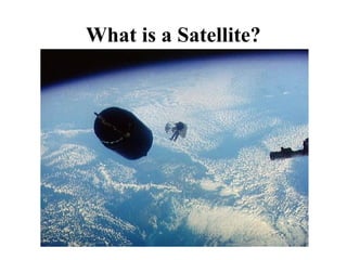
  • 3. What is a Satellite? Meteosat weather satellite Weight: 2000kg
  • 4. What is a Satellite?
  • 5. What is a Satellite?
  • 6. What is a Satellite?
  • 7. • Satellites offer global coverage without wiring costs for base stations
  • 8. What is a Satellite? • a satellite is any object that revolves around a planet • there are many manmade (artificial) satellites, – ~13,000 satellites are tracked in real time • some are inactive, some are debris from space missions … • the path a satellite follows is called an orbit, • to access a satellite requires ‘line of sight’ communication – the receiver (satellite dish) must be in the satellite’s ‘footprint’ • most satellites are custom built to perform a function.
  • 9. What are satellites used for? • television broadcasting – satellite TV (e.g. Sky) • telephone communications, – satellite ‘phones (e.g. “Iridium”) • weather forecasting, – satellite images (visible, infra red, radar) • Internet communications, • scientific research, – climate monitoring, global disaster monitoring, …. • Global Positioning System – GPS  satellite navigation (‘SatNav’) – satellite tracking, security • Military satellites
  • 10. 5.10 base station or gateway Classical satellite systems Inter Satellite Link (ISL) Mobile User Link (MUL) Gateway Link (GWL) footprint small cells (spotbeams) User data PSTN ISDN GSM GWL MUL PSTN: Public Switched Telephone Network
  • 11. satellites footprint (coverage) • The area of the Earth covered by the microwave radiation from a satellite dish (transponder) is called the satellites footprint. • Each satellite can cover a certain area on the earth with its beam (the so-called ‘footprint’
  • 13. Basics • Satellites in circular orbits – attractive force Fg = m g (R/r)² – centrifugal force Fc = m r ² – m: mass of the satellite – R: radius of the earth (R = 6370 km) – r: distance to the center of the earth – g: acceleration of gravity (g = 9.81 m/s²)  : angular velocity ( = 2  f, f: rotation frequency) • Stable orbit – Fg = Fc 3 2 2 ) 2 ( f gR r   Satellites orbit around the earth. Depending on the application, these orbits can be circular or elliptical. Satellites in circular orbits always keep the same distance
  • 14. 5.14 Basics  elliptical or circular orbits  complete rotation time depends on distance satellite-earth  inclination: angle between orbit and equator  elevation: angle between satellite and horizon  LOS (Line of Sight) to the satellite necessary for connection  high elevation needed, less absorption due to e.g. buildings  Uplink: connection base station - satellite  Downlink: connection satellite - base station  typically separated frequencies for uplink and downlink
  • 16. 5.16 Elevation Elevation: angle  between center of satellite beam and surface  minimal elevation: levation needed at least o communicate with the satellite footprint
  • 17. 5.17 • Four different types of satellite orbits can be identified depending on the shape and diameter of the orbit: GEO: geostationary orbit, ca. 36000 km above earth surface LEO (Low Earth Orbit): ca. 500 - 1500 km MEO (Medium Earth Orbit) or ICO (Intermediate Circular Orbit): ca. 6000 - 20000 km HEO (Highly Elliptical Orbit) elliptical orbits Orbits
  • 18. 5.18 Orbits earth km 35768 10000 1000 LEO (Globalstar, Irdium) HEO inner and outer Van Allen belts MEO (ICO) GEO (Inmarsat) Van-Allen-Belts: ionized particles 2000 - 6000 km and 15000 - 30000 km above earth surface
  • 19. Parameters in satellite communication
  • 20. How does Satellite Communications work? Generally: • there is a transmitter on the ground • the transmitter sends signals to a satellite – using microwaves • signal is received & amplified by the satellite • signal is retransmitted back to Earth • signal reaches its recipient – or is 'bounced back' to another satellite
  • 27. Where are these satellites? There are 2 main types of satellite orbit: • Geostationary orbit – always positioned over the same spot on Earth – orbit at 22,000 miles (36,000 km) • Low Earth Orbit (LEO) – orbit at 400-800km
  • 29. Geostationary Satellite • always positioned over the same spot on Earth • orbits at the same rotational speed as the Earth – approx 10,000 km/h • orbits 22,000 miles (36,000 km) above the Earth, – about a tenth of the distance to the Moon • able to capture images of the whole Earth disc • used by TV and weather satellites – this is why a satellite TV dish is bolted in a fixed position.
  • 32. LEO Satellites • much closer to Earth than a geostationary orbit, – orbit at 400-800km (aircraft fly at 11km, ISS ~300km), – orbit at ~27,000 km/h (17,000 mph) – each orbit takes ~ 90mins, • has a smaller footprint than a geostationary satellite – can resolve finer detail (optical resolution ~40cm in 2010) • usually employ a group of satellites, – each in the same orbit, – at least one satellite is visible at any time, • possible to access satellites from any point on Earth, – GPS & satellite navigation (‘Navstar’) – use satellite ‘phone in remote locations (‘Iridium’ satellites), – global Internet access.
  • 34. Advantages of Satellite Communication • can reach remote places – so people can be contacted wherever they are • e.g. areas where there is no cellular/fixed line connection • high bandwidth – many simultaneous calls can take place – video & audio can be transmitted in real time • cost of communication is distance independent – whether message is sent 10 km or 6000 km
  • 35. Disadvantages of using Satellites • are expensive to set up and maintain • needs line of sight – can lose signal out of footprint or in built up areas • affected by weather conditions/interference – leading to signal degradation • distance from Earth – means messages takes time – can cause unacceptable delay on communications • general congestion in space – limitation on number of satellites in geostationary orbit
  • 36. Uses for Satellite • Weather satellites • Communications satellites • Scientific satellites • Navigational satellites • Earth observation satellites • Military satellites
  • 37. Weather Satellite • can see what's happening at the moment.
  • 38. Weather Satellite • can see what's happening at the moment. • help meteorologists predict the weather
  • 39. Weather Satellite • can see what's happening at the moment. • help meteorologists predict the weather • typical weather satellites include the Meteosat, GOES and NOAA satellites.
  • 40. Weather Satellite • can see what's happening at the moment. • help meteorologists predict the weather • typical weather satellites include the Meteosat, GOES and NOAA satellites. • satellites generally contain cameras that can return photos of Earth's weather,
  • 41. Weather Satellite • can see what's happening at the moment. • help meteorologists predict the weather • typical weather satellites include the Meteosat, GOES and NOAA satellites. • satellites generally contain cameras that can return photos of Earth's weather, • use visible and infra red imaging
  • 42. Weather Satellite • can see what's happening at the moment. • help meteorologists predict the weather • typical weather satellites include the Meteosat, GOES and NOAA satellites. • satellites generally contain cameras that can return photos of Earth's weather, • use visible and infra red imaging • use either geostationary positions or polar orbits.
  • 48. Scientific & EO Satellites • climatic phenomena
  • 49. Scientific & EO Satellites • climatic phenomena – monitor, analyse and forecast future changes
  • 50. Scientific & EO Satellites • climatic phenomena – monitor, analyse and forecast future changes – chart sea-surface temperatures
  • 51. Scientific & EO Satellites • climatic phenomena – monitor, analyse and forecast future changes – chart sea-surface temperatures – global ocean colour • phytoplankton are a major influence on the amount of carbon in the atmosphere
  • 52. Scientific & EO Satellites • climatic phenomena – monitor, analyse and forecast future changes – chart sea-surface temperatures – global ocean colour • phytoplankton are a major influence on the amount of carbon in the atmosphere • NASA monitors lake and reservoir height variations for approximately 100 lakes
  • 53. Scientific & EO Satellites • climatic phenomena – monitor, analyse and forecast future changes – chart sea-surface temperatures – global ocean colour • phytoplankton are a major influence on the amount of carbon in the atmosphere • NASA monitors lake and reservoir height variations for approximately 100 lakes • track natural events in progress, – fires, floods, volcanic eruptions
  • 54. Scientific & EO Satellites • climatic phenomena – monitor, analyse and forecast future changes – chart sea-surface temperatures – global ocean colour • phytoplankton are a major influence on the amount of carbon in the atmosphere • NASA monitors lake and reservoir height variations for approximately 100 lakes • track natural events in progress, – fires, floods, volcanic eruptions • deforestation
  • 55. Scientific & EO Satellites • climatic phenomena – monitor, analyse and forecast future changes – chart sea-surface temperatures – global ocean colour • phytoplankton are a major influence on the amount of carbon in the atmosphere • NASA monitors lake and reservoir height variations for approximately 100 lakes • track natural events in progress, – fires, floods, volcanic eruptions • deforestation • astrophysical observations - Hubble Space Telescope
  • 56. Scientific & EO Satellites 1975 1985 1992 Deforestation in Brazil
  • 57. Scientific & EO Satellites 1975 1992 2006 Deforestation in Brazil http://earthobservatory.nasa.gov/IOTD/view.php?id=35891
  • 58. Scientific & EO Satellites Mineral Exploration Image displays the mineral abundance layer. Red = Mica, Cyan/Green= Kaolinite, Blue= Alunite, Beige = Carbonate, Brown = Silica, Mauve = Iron
  • 59. Scientific & EO Satellites Volcano Explosion on Montserrat (1997)
  • 60. Scientific & EO Satellites Dust Storms off the Sahara
  • 61. Scientific & EO Satellites UK cities in IR
  • 62. Military Satellites • applications may include: – relaying encrypted communications – nuclear monitoring – observing enemy movements – early warning of missile launches – eavesdropping on terrestrial radio links – radar imaging – photography • using what are essentially large telescopes that take pictures of militarily interesting areas
  • 65. Communications Satellites • usually in geosynchronous orbit – serve a particular area of the Earth – can use a cellular network of satellites • serve the whole Earth • allow telephone and data conversations to be relayed through the satellite – Internet, email, satellite ‘phone, TV – can broadcast television signals from one point on Earth to another • normally contain thousands of transponders – many simultaneous users