SlideShare a Scribd company logo
Spatial Prediction Using Modified
Bivariate Frequency Ratio
Using
Excel and ArcMap only !
Omar F. Althuwaynee, PhD
GIS and Geomatics Engineering
Spatial Prediction Using Modified Bivariate
Frequency Ratio
Omar F. Althuwaynee, PhD
GIS and Geomatics Engineering
In this session i will talk about
1. pairwise comparison of prediction rates.
2. producing Susceptibility index maps.
3. prediction accuracy assessment (validation) using AUC.
Let us begin..!
1. Calculate the spatial correlation between;
prediction factors, and the dependent factor.
2. Calculate autocorrelations between; the prediction
factors, by considering their prediction importance
or contribution.
3. Produce susceptibility map using; Microsoft Excel
and ESRI ArcMap only.
4. Validate the prediction accuracy using; most
common statistical method of Area under the curve
(AUC).
LET US BEGIN..! 
End of this session, you will be able to
Susceptibility mapping methods with GIS
Bivariate-statistics-based Multivariate statistical
Easy to apply and update • More realistic, accurate and sensitive
to the independents
• optimistic by showing evidences if
further investigations needed to enhance
the precision
Not considering the mutual
interrelationships among the
independents
Considering the mutual interrelationships
among the independents
ex. Probability statistics, like, FR
(Frequency ratio)
ex. Machine learning , like, ANN (artificial
neural network)
Common regression methods, like, LR
(Logistic regression)
Model application
requirements ..!
Dependent factor: prediction target locations inventory
(Landslides, wells, minerals test porholes).
Independent factors: predisposing factors (predictors) As
conditioning factors, the parameters slope angle, soil types,
and land use.
1. Identification and mapping of a set of dependent (target)
and independents factors that are directly or indirectly
correlated.
2. Estimating the relative contribution of these independents
factors in predicting of dependent factor.
What is FR..!
A bivariate statistical analysis method, based on the spatial
distribution (Probability) of dependent factor (landslides, pollutants),
and such of the considered conditioning factors (slope, aspect,
temperature, rainfall..etc..).
Probabilistic analysis considers the statistical relationships
between historical target locations and its conditioning factors
Relative Frequency (RF) = relative density index (RDI) = Frequency
Ratio (FR)
2001 El Salvador Landslide Located
Near San Salvador
Newark and Sherwood District Council
Natural hazards
Permit Times for Mining Exploration http://bit.ly/2keyuNP Gold mining: NYU Graduates Seeking $11
Billion of Gold in Ransacked Mine
http://bit.ly/2k2ZL6C
Minings and Groundwater
exploration
Groundwater: Agriculture Water Pump
http://bit.ly/2keDeHl
Calculating FR, RF, and PR
coefficients for each factor
Calculating Pairwise
comparison
Spatial validation using AUC
Producing Susceptibility
index map
Processing Steps..!
Calculations..!!
Where
FR : Frequency ratio
RF : Index of the spatial association (Relative frequency ) of spatial factors and
targets.
PR : Predictor rate.
FR =
% target occurrence in each subcategory
% category of an independent factor
=
(points in factor class total points)
(factor class area total area)
𝑅𝐹 =
𝑓𝑎𝑐𝑡𝑜𝑟 𝑐𝑙𝑎𝑠𝑠 𝐹𝑅
∑𝑓𝑎𝑐𝑡𝑜𝑟𝑐𝑙𝑎𝑠𝑠𝑒𝑠 𝐹𝑅
𝑃𝑅 = 𝑅𝐹 𝑀𝑎𝑥 − 𝑅𝐹 𝑀𝑖𝑛 𝑅𝐹 𝑀𝑎𝑥 − 𝑅𝐹 𝑀𝑖𝑛 Min
𝑆𝐼 =
∑ 𝑅𝐹 × 𝑃𝑅
𝑀𝑎𝑥 𝑅𝐹 × 𝑃𝑅
× 100
To consider the mutual
interrelationships
among the
independents.
Software's:
Microsoft Excel- Microsoft
ArcMap - ESRI
QGIS 2.18.0 - OpenSource
Data and Tools..!!
Data type Data structure Source
Landcover Raster European Environment Agency
[http://www.eea.europa.eu/data-and-
maps/data/clc-2000-raster-1
Topographic and NDVI Raster USGS
[https://earthexplorer.usgs.gov/]
Study area Vector DivaGIS
[diva-gis.org/gdata]
Training and testing
points
Vector Experimental data
• Althuwaynee, Omar F., et al. "A novel ensemble bivariate statistical
evidential belief function with knowledge-based analytical hierarchy
process and multivariate statistical logistic regression for landslide
susceptibility mapping." Catena 114 (2014): 21-36.
• Sabatakakis, N., et al. "Landslide susceptibility zonation in Greece." Natural
hazards 65.1 (2013): 523-543.
More literature..!!
Ad

More Related Content

What's hot (20)

ASSESSMENT OF SOIL SALINITY USING REMOTE SENSING
ASSESSMENT OF SOIL SALINITY USING REMOTE SENSINGASSESSMENT OF SOIL SALINITY USING REMOTE SENSING
ASSESSMENT OF SOIL SALINITY USING REMOTE SENSING
Abhiram Kanigolla
 
Iirs Role of Remote sensing and GIS in Ground water studies
Iirs Role of Remote sensing and GIS in Ground water studiesIirs Role of Remote sensing and GIS in Ground water studies
Iirs Role of Remote sensing and GIS in Ground water studies
Tushar Dholakia
 
Remote Sensing error sources
Remote Sensing error sourcesRemote Sensing error sources
Remote Sensing error sources
Gilbert Okoth
 
Fundamentals of Seismic Refraction
Fundamentals of Seismic RefractionFundamentals of Seismic Refraction
Fundamentals of Seismic Refraction
Ali Osman Öncel
 
Geo referencing
Geo referencingGeo referencing
Geo referencing
Jaweria Shamshad
 
Application of remote sensing
Application of remote sensingApplication of remote sensing
Application of remote sensing
Anurag Kumar
 
SBAS-DInSAR processing on the ESA Geohazards Exploitation Platform
SBAS-DInSAR processing on the ESA Geohazards Exploitation PlatformSBAS-DInSAR processing on the ESA Geohazards Exploitation Platform
SBAS-DInSAR processing on the ESA Geohazards Exploitation Platform
Emmanuel Mathot
 
Vector data model
Vector data modelVector data model
Vector data model
PRAMODA G
 
Toposheet indexing .
Toposheet indexing .Toposheet indexing .
Toposheet indexing .
Amit K. Mishra
 
nickel laterite dep phil
nickel laterite dep philnickel laterite dep phil
nickel laterite dep phil
Arjaylyn Babala
 
Exploration Geology- Radioactive method of exploration
Exploration Geology- Radioactive method of explorationExploration Geology- Radioactive method of exploration
Exploration Geology- Radioactive method of exploration
sruthy sajeev
 
Introduction to GIS
Introduction to GISIntroduction to GIS
Introduction to GIS
Joey Li
 
Atmospheric correction albufera_web
Atmospheric correction albufera_webAtmospheric correction albufera_web
Atmospheric correction albufera_web
Gabriel Parodi
 
Application of Basic Remote Sensing in Geology
Application of Basic Remote Sensing in GeologyApplication of Basic Remote Sensing in Geology
Application of Basic Remote Sensing in Geology
Uzair Khan
 
Landsat
LandsatLandsat
Landsat
HARITHANAIR15
 
Digital image processing
Digital image processingDigital image processing
Digital image processing
kaushal gadariya
 
SWaRMA_IRBM_Module6_#1, GLOF Risk Reduction, Finu Shrestha et al
SWaRMA_IRBM_Module6_#1, GLOF Risk Reduction, Finu Shrestha et al SWaRMA_IRBM_Module6_#1, GLOF Risk Reduction, Finu Shrestha et al
SWaRMA_IRBM_Module6_#1, GLOF Risk Reduction, Finu Shrestha et al
ICIMOD
 
Geospatial Technology for Sustainable Development
Geospatial Technology for Sustainable DevelopmentGeospatial Technology for Sustainable Development
Geospatial Technology for Sustainable Development
M S Swaminathan Research Foundation
 
Training and hands-on SNAP Sentinel-1 IW SLC Interferogram and Displacement
Training and hands-on SNAP Sentinel-1 IW SLC Interferogram and DisplacementTraining and hands-on SNAP Sentinel-1 IW SLC Interferogram and Displacement
Training and hands-on SNAP Sentinel-1 IW SLC Interferogram and Displacement
Emmanuel Mathot
 
Land use cover pptx.
Land use cover pptx.Land use cover pptx.
Land use cover pptx.
PratikRamteke4
 
ASSESSMENT OF SOIL SALINITY USING REMOTE SENSING
ASSESSMENT OF SOIL SALINITY USING REMOTE SENSINGASSESSMENT OF SOIL SALINITY USING REMOTE SENSING
ASSESSMENT OF SOIL SALINITY USING REMOTE SENSING
Abhiram Kanigolla
 
Iirs Role of Remote sensing and GIS in Ground water studies
Iirs Role of Remote sensing and GIS in Ground water studiesIirs Role of Remote sensing and GIS in Ground water studies
Iirs Role of Remote sensing and GIS in Ground water studies
Tushar Dholakia
 
Remote Sensing error sources
Remote Sensing error sourcesRemote Sensing error sources
Remote Sensing error sources
Gilbert Okoth
 
Fundamentals of Seismic Refraction
Fundamentals of Seismic RefractionFundamentals of Seismic Refraction
Fundamentals of Seismic Refraction
Ali Osman Öncel
 
Application of remote sensing
Application of remote sensingApplication of remote sensing
Application of remote sensing
Anurag Kumar
 
SBAS-DInSAR processing on the ESA Geohazards Exploitation Platform
SBAS-DInSAR processing on the ESA Geohazards Exploitation PlatformSBAS-DInSAR processing on the ESA Geohazards Exploitation Platform
SBAS-DInSAR processing on the ESA Geohazards Exploitation Platform
Emmanuel Mathot
 
Vector data model
Vector data modelVector data model
Vector data model
PRAMODA G
 
nickel laterite dep phil
nickel laterite dep philnickel laterite dep phil
nickel laterite dep phil
Arjaylyn Babala
 
Exploration Geology- Radioactive method of exploration
Exploration Geology- Radioactive method of explorationExploration Geology- Radioactive method of exploration
Exploration Geology- Radioactive method of exploration
sruthy sajeev
 
Introduction to GIS
Introduction to GISIntroduction to GIS
Introduction to GIS
Joey Li
 
Atmospheric correction albufera_web
Atmospheric correction albufera_webAtmospheric correction albufera_web
Atmospheric correction albufera_web
Gabriel Parodi
 
Application of Basic Remote Sensing in Geology
Application of Basic Remote Sensing in GeologyApplication of Basic Remote Sensing in Geology
Application of Basic Remote Sensing in Geology
Uzair Khan
 
SWaRMA_IRBM_Module6_#1, GLOF Risk Reduction, Finu Shrestha et al
SWaRMA_IRBM_Module6_#1, GLOF Risk Reduction, Finu Shrestha et al SWaRMA_IRBM_Module6_#1, GLOF Risk Reduction, Finu Shrestha et al
SWaRMA_IRBM_Module6_#1, GLOF Risk Reduction, Finu Shrestha et al
ICIMOD
 
Training and hands-on SNAP Sentinel-1 IW SLC Interferogram and Displacement
Training and hands-on SNAP Sentinel-1 IW SLC Interferogram and DisplacementTraining and hands-on SNAP Sentinel-1 IW SLC Interferogram and Displacement
Training and hands-on SNAP Sentinel-1 IW SLC Interferogram and Displacement
Emmanuel Mathot
 

Viewers also liked (10)

How to use R easily as GIS tools!
How to use R easily as GIS tools!How to use R easily as GIS tools!
How to use R easily as GIS tools!
Omar F. Althuwaynee
 
How to use Logistic Regression in GIS using ArcGIS and R statistics
How to use Logistic Regression in GIS using ArcGIS and R statisticsHow to use Logistic Regression in GIS using ArcGIS and R statistics
How to use Logistic Regression in GIS using ArcGIS and R statistics
Omar F. Althuwaynee
 
(R in GIS) دورة احترافية في استخدام برمجة كأداة لنظم المعلومات المكانية بال...
 (R in GIS)  دورة احترافية في استخدام برمجة كأداة لنظم المعلومات المكانية بال... (R in GIS)  دورة احترافية في استخدام برمجة كأداة لنظم المعلومات المكانية بال...
(R in GIS) دورة احترافية في استخدام برمجة كأداة لنظم المعلومات المكانية بال...
Omar F. Althuwaynee
 
Missing Data and data imputation techniques
Missing Data and data imputation techniquesMissing Data and data imputation techniques
Missing Data and data imputation techniques
Omar F. Althuwaynee
 
Dr Richard Fry - Using R as a GIS
Dr Richard Fry - Using R as a GISDr Richard Fry - Using R as a GIS
Dr Richard Fry - Using R as a GIS
Shaun Lewis
 
Using R to Visualize Spatial Data: R as GIS - Guy Lansley
Using R to Visualize Spatial Data: R as GIS - Guy LansleyUsing R to Visualize Spatial Data: R as GIS - Guy Lansley
Using R to Visualize Spatial Data: R as GIS - Guy Lansley
Guy Lansley
 
Collection of data
Collection of dataCollection of data
Collection of data
Tilok Chetri
 
Geo synchronous and Sun synchronous Satellites
Geo synchronous and Sun synchronous SatellitesGeo synchronous and Sun synchronous Satellites
Geo synchronous and Sun synchronous Satellites
Tilok Chetri
 
Using Decision trees with GIS data for modeling and prediction
Using Decision trees with GIS data for modeling and prediction Using Decision trees with GIS data for modeling and prediction
Using Decision trees with GIS data for modeling and prediction
Omar F. Althuwaynee
 
Remote Sensing PPT
Remote Sensing PPTRemote Sensing PPT
Remote Sensing PPT
Amal Murali
 
How to use R easily as GIS tools!
How to use R easily as GIS tools!How to use R easily as GIS tools!
How to use R easily as GIS tools!
Omar F. Althuwaynee
 
How to use Logistic Regression in GIS using ArcGIS and R statistics
How to use Logistic Regression in GIS using ArcGIS and R statisticsHow to use Logistic Regression in GIS using ArcGIS and R statistics
How to use Logistic Regression in GIS using ArcGIS and R statistics
Omar F. Althuwaynee
 
(R in GIS) دورة احترافية في استخدام برمجة كأداة لنظم المعلومات المكانية بال...
 (R in GIS)  دورة احترافية في استخدام برمجة كأداة لنظم المعلومات المكانية بال... (R in GIS)  دورة احترافية في استخدام برمجة كأداة لنظم المعلومات المكانية بال...
(R in GIS) دورة احترافية في استخدام برمجة كأداة لنظم المعلومات المكانية بال...
Omar F. Althuwaynee
 
Missing Data and data imputation techniques
Missing Data and data imputation techniquesMissing Data and data imputation techniques
Missing Data and data imputation techniques
Omar F. Althuwaynee
 
Dr Richard Fry - Using R as a GIS
Dr Richard Fry - Using R as a GISDr Richard Fry - Using R as a GIS
Dr Richard Fry - Using R as a GIS
Shaun Lewis
 
Using R to Visualize Spatial Data: R as GIS - Guy Lansley
Using R to Visualize Spatial Data: R as GIS - Guy LansleyUsing R to Visualize Spatial Data: R as GIS - Guy Lansley
Using R to Visualize Spatial Data: R as GIS - Guy Lansley
Guy Lansley
 
Collection of data
Collection of dataCollection of data
Collection of data
Tilok Chetri
 
Geo synchronous and Sun synchronous Satellites
Geo synchronous and Sun synchronous SatellitesGeo synchronous and Sun synchronous Satellites
Geo synchronous and Sun synchronous Satellites
Tilok Chetri
 
Using Decision trees with GIS data for modeling and prediction
Using Decision trees with GIS data for modeling and prediction Using Decision trees with GIS data for modeling and prediction
Using Decision trees with GIS data for modeling and prediction
Omar F. Althuwaynee
 
Remote Sensing PPT
Remote Sensing PPTRemote Sensing PPT
Remote Sensing PPT
Amal Murali
 
Ad

Similar to How to use Frequency Ratio with ArcMap and Excel for prediction (20)

2003-12-02 Environmental Information Systems for Monitoring, Assessment, and ...
2003-12-02 Environmental Information Systems for Monitoring, Assessment, and ...2003-12-02 Environmental Information Systems for Monitoring, Assessment, and ...
2003-12-02 Environmental Information Systems for Monitoring, Assessment, and ...
Rudolf Husar
 
IRJET - Prediction of Ground Water Level based on Machine Learning
IRJET - Prediction of Ground Water Level based on Machine LearningIRJET - Prediction of Ground Water Level based on Machine Learning
IRJET - Prediction of Ground Water Level based on Machine Learning
IRJET Journal
 
urpl969-group2-paper-03May06
urpl969-group2-paper-03May06urpl969-group2-paper-03May06
urpl969-group2-paper-03May06
Wintford Thornton
 
DEM-based Methods for Flood Risk Mapping at Large Scale
DEM-based Methods for Flood Risk Mapping at Large ScaleDEM-based Methods for Flood Risk Mapping at Large Scale
DEM-based Methods for Flood Risk Mapping at Large Scale
Salvatore Manfreda
 
Landslide Susceptibility Assessment Using Modified Frequency Ratio Model in K...
Landslide Susceptibility Assessment Using Modified Frequency Ratio Model in K...Landslide Susceptibility Assessment Using Modified Frequency Ratio Model in K...
Landslide Susceptibility Assessment Using Modified Frequency Ratio Model in K...
Dr. Amarjeet Singh
 
Flood Detection Using Empirical Bayesian Networks
Flood Detection Using Empirical Bayesian NetworksFlood Detection Using Empirical Bayesian Networks
Flood Detection Using Empirical Bayesian Networks
IOSRJECE
 
Rodriguez_et_al_SWOT_IGARSS2011.ppt
Rodriguez_et_al_SWOT_IGARSS2011.pptRodriguez_et_al_SWOT_IGARSS2011.ppt
Rodriguez_et_al_SWOT_IGARSS2011.ppt
grssieee
 
Rodriguez_et_al_SWOT_IGARSS2011.ppt
Rodriguez_et_al_SWOT_IGARSS2011.pptRodriguez_et_al_SWOT_IGARSS2011.ppt
Rodriguez_et_al_SWOT_IGARSS2011.ppt
grssieee
 
Components of Spatial Data Quality in GIS
Components of Spatial Data Quality in GISComponents of Spatial Data Quality in GIS
Components of Spatial Data Quality in GIS
Kaium Chowdhury
 
2003-12-04 Evaluation of the ASOS Light Scattering Network
2003-12-04 Evaluation of the ASOS Light Scattering Network2003-12-04 Evaluation of the ASOS Light Scattering Network
2003-12-04 Evaluation of the ASOS Light Scattering Network
Rudolf Husar
 
PROBABILISTIC SEISMIC HAZARD ANALYSIS FOR SEISMIC RISK ASSESSMENT
PROBABILISTIC SEISMIC HAZARD ANALYSIS FOR SEISMIC RISK ASSESSMENTPROBABILISTIC SEISMIC HAZARD ANALYSIS FOR SEISMIC RISK ASSESSMENT
PROBABILISTIC SEISMIC HAZARD ANALYSIS FOR SEISMIC RISK ASSESSMENT
IRJET Journal
 
Geospatial Tools for Targeting and Prioritisation in Agriculture
Geospatial Tools for Targeting and Prioritisation in AgricultureGeospatial Tools for Targeting and Prioritisation in Agriculture
Geospatial Tools for Targeting and Prioritisation in Agriculture
Leo Kris Palao
 
Presentation2 - GEOQUAL, ELCmapas & ECOGEO tools
Presentation2 - GEOQUAL, ELCmapas & ECOGEO toolsPresentation2 - GEOQUAL, ELCmapas & ECOGEO tools
Presentation2 - GEOQUAL, ELCmapas & ECOGEO tools
Mauricio Parra Quijano
 
On the characterisation of open-flow seeding conditions for image velocimetry...
On the characterisation of open-flow seeding conditions for image velocimetry...On the characterisation of open-flow seeding conditions for image velocimetry...
On the characterisation of open-flow seeding conditions for image velocimetry...
Salvatore Manfreda
 
NEW DEVELOPMENTS IN PSHA
NEW DEVELOPMENTS IN PSHANEW DEVELOPMENTS IN PSHA
NEW DEVELOPMENTS IN PSHA
Ali Osman Öncel
 
Interpolation 2013
Interpolation 2013Interpolation 2013
Interpolation 2013
Atiqa khan
 
Regional Income Convergence
Regional Income ConvergenceRegional Income Convergence
Regional Income Convergence
Cesar Sobrino
 
Local figure–ground cues are valid for natural imagesDepartm.docx
Local figure–ground cues are valid for natural imagesDepartm.docxLocal figure–ground cues are valid for natural imagesDepartm.docx
Local figure–ground cues are valid for natural imagesDepartm.docx
smile790243
 
PITFALLS IN 3-D SEISMIC INTERPRETATION
PITFALLS IN 3-D SEISMIC INTERPRETATION PITFALLS IN 3-D SEISMIC INTERPRETATION
PITFALLS IN 3-D SEISMIC INTERPRETATION
Debabrata Majumder
 
Assessment of wheat crop coefficient using remote sensing techniques
Assessment of wheat crop coefficient using remote sensing techniquesAssessment of wheat crop coefficient using remote sensing techniques
Assessment of wheat crop coefficient using remote sensing techniques
Premier Publishers
 
2003-12-02 Environmental Information Systems for Monitoring, Assessment, and ...
2003-12-02 Environmental Information Systems for Monitoring, Assessment, and ...2003-12-02 Environmental Information Systems for Monitoring, Assessment, and ...
2003-12-02 Environmental Information Systems for Monitoring, Assessment, and ...
Rudolf Husar
 
IRJET - Prediction of Ground Water Level based on Machine Learning
IRJET - Prediction of Ground Water Level based on Machine LearningIRJET - Prediction of Ground Water Level based on Machine Learning
IRJET - Prediction of Ground Water Level based on Machine Learning
IRJET Journal
 
urpl969-group2-paper-03May06
urpl969-group2-paper-03May06urpl969-group2-paper-03May06
urpl969-group2-paper-03May06
Wintford Thornton
 
DEM-based Methods for Flood Risk Mapping at Large Scale
DEM-based Methods for Flood Risk Mapping at Large ScaleDEM-based Methods for Flood Risk Mapping at Large Scale
DEM-based Methods for Flood Risk Mapping at Large Scale
Salvatore Manfreda
 
Landslide Susceptibility Assessment Using Modified Frequency Ratio Model in K...
Landslide Susceptibility Assessment Using Modified Frequency Ratio Model in K...Landslide Susceptibility Assessment Using Modified Frequency Ratio Model in K...
Landslide Susceptibility Assessment Using Modified Frequency Ratio Model in K...
Dr. Amarjeet Singh
 
Flood Detection Using Empirical Bayesian Networks
Flood Detection Using Empirical Bayesian NetworksFlood Detection Using Empirical Bayesian Networks
Flood Detection Using Empirical Bayesian Networks
IOSRJECE
 
Rodriguez_et_al_SWOT_IGARSS2011.ppt
Rodriguez_et_al_SWOT_IGARSS2011.pptRodriguez_et_al_SWOT_IGARSS2011.ppt
Rodriguez_et_al_SWOT_IGARSS2011.ppt
grssieee
 
Rodriguez_et_al_SWOT_IGARSS2011.ppt
Rodriguez_et_al_SWOT_IGARSS2011.pptRodriguez_et_al_SWOT_IGARSS2011.ppt
Rodriguez_et_al_SWOT_IGARSS2011.ppt
grssieee
 
Components of Spatial Data Quality in GIS
Components of Spatial Data Quality in GISComponents of Spatial Data Quality in GIS
Components of Spatial Data Quality in GIS
Kaium Chowdhury
 
2003-12-04 Evaluation of the ASOS Light Scattering Network
2003-12-04 Evaluation of the ASOS Light Scattering Network2003-12-04 Evaluation of the ASOS Light Scattering Network
2003-12-04 Evaluation of the ASOS Light Scattering Network
Rudolf Husar
 
PROBABILISTIC SEISMIC HAZARD ANALYSIS FOR SEISMIC RISK ASSESSMENT
PROBABILISTIC SEISMIC HAZARD ANALYSIS FOR SEISMIC RISK ASSESSMENTPROBABILISTIC SEISMIC HAZARD ANALYSIS FOR SEISMIC RISK ASSESSMENT
PROBABILISTIC SEISMIC HAZARD ANALYSIS FOR SEISMIC RISK ASSESSMENT
IRJET Journal
 
Geospatial Tools for Targeting and Prioritisation in Agriculture
Geospatial Tools for Targeting and Prioritisation in AgricultureGeospatial Tools for Targeting and Prioritisation in Agriculture
Geospatial Tools for Targeting and Prioritisation in Agriculture
Leo Kris Palao
 
Presentation2 - GEOQUAL, ELCmapas & ECOGEO tools
Presentation2 - GEOQUAL, ELCmapas & ECOGEO toolsPresentation2 - GEOQUAL, ELCmapas & ECOGEO tools
Presentation2 - GEOQUAL, ELCmapas & ECOGEO tools
Mauricio Parra Quijano
 
On the characterisation of open-flow seeding conditions for image velocimetry...
On the characterisation of open-flow seeding conditions for image velocimetry...On the characterisation of open-flow seeding conditions for image velocimetry...
On the characterisation of open-flow seeding conditions for image velocimetry...
Salvatore Manfreda
 
Interpolation 2013
Interpolation 2013Interpolation 2013
Interpolation 2013
Atiqa khan
 
Regional Income Convergence
Regional Income ConvergenceRegional Income Convergence
Regional Income Convergence
Cesar Sobrino
 
Local figure–ground cues are valid for natural imagesDepartm.docx
Local figure–ground cues are valid for natural imagesDepartm.docxLocal figure–ground cues are valid for natural imagesDepartm.docx
Local figure–ground cues are valid for natural imagesDepartm.docx
smile790243
 
PITFALLS IN 3-D SEISMIC INTERPRETATION
PITFALLS IN 3-D SEISMIC INTERPRETATION PITFALLS IN 3-D SEISMIC INTERPRETATION
PITFALLS IN 3-D SEISMIC INTERPRETATION
Debabrata Majumder
 
Assessment of wheat crop coefficient using remote sensing techniques
Assessment of wheat crop coefficient using remote sensing techniquesAssessment of wheat crop coefficient using remote sensing techniques
Assessment of wheat crop coefficient using remote sensing techniques
Premier Publishers
 
Ad

Recently uploaded (20)

Lecture 2 CLASSIFICATION OF PHYLUM ARTHROPODA UPTO CLASSES & POSITION OF_1.pptx
Lecture 2 CLASSIFICATION OF PHYLUM ARTHROPODA UPTO CLASSES & POSITION OF_1.pptxLecture 2 CLASSIFICATION OF PHYLUM ARTHROPODA UPTO CLASSES & POSITION OF_1.pptx
Lecture 2 CLASSIFICATION OF PHYLUM ARTHROPODA UPTO CLASSES & POSITION OF_1.pptx
Arshad Shaikh
 
spinal cord disorders (Myelopathies and radiculoapthies)
spinal cord disorders (Myelopathies and radiculoapthies)spinal cord disorders (Myelopathies and radiculoapthies)
spinal cord disorders (Myelopathies and radiculoapthies)
Mohamed Rizk Khodair
 
Rococo versus Neoclassicism. The artistic styles of the 18th century
Rococo versus Neoclassicism. The artistic styles of the 18th centuryRococo versus Neoclassicism. The artistic styles of the 18th century
Rococo versus Neoclassicism. The artistic styles of the 18th century
Gema
 
Lecture 4 INSECT CUTICLE and moulting.pptx
Lecture 4 INSECT CUTICLE and moulting.pptxLecture 4 INSECT CUTICLE and moulting.pptx
Lecture 4 INSECT CUTICLE and moulting.pptx
Arshad Shaikh
 
Cultivation Practice of Garlic in Nepal.pptx
Cultivation Practice of Garlic in Nepal.pptxCultivation Practice of Garlic in Nepal.pptx
Cultivation Practice of Garlic in Nepal.pptx
UmeshTimilsina1
 
dynastic art of the Pallava dynasty south India
dynastic art of the Pallava dynasty south Indiadynastic art of the Pallava dynasty south India
dynastic art of the Pallava dynasty south India
PrachiSontakke5
 
Kenan Fellows Participants, Projects 2025-26 Cohort
Kenan Fellows Participants, Projects 2025-26 CohortKenan Fellows Participants, Projects 2025-26 Cohort
Kenan Fellows Participants, Projects 2025-26 Cohort
EducationNC
 
Drugs in Anaesthesia and Intensive Care,.pdf
Drugs in Anaesthesia and Intensive Care,.pdfDrugs in Anaesthesia and Intensive Care,.pdf
Drugs in Anaesthesia and Intensive Care,.pdf
crewot855
 
Real GitHub Copilot Exam Dumps for Success
Real GitHub Copilot Exam Dumps for SuccessReal GitHub Copilot Exam Dumps for Success
Real GitHub Copilot Exam Dumps for Success
Mark Soia
 
How to Create Kanban View in Odoo 18 - Odoo Slides
How to Create Kanban View in Odoo 18 - Odoo SlidesHow to Create Kanban View in Odoo 18 - Odoo Slides
How to Create Kanban View in Odoo 18 - Odoo Slides
Celine George
 
How to Clean Your Contacts Using the Deduplication Menu in Odoo 18
How to Clean Your Contacts Using the Deduplication Menu in Odoo 18How to Clean Your Contacts Using the Deduplication Menu in Odoo 18
How to Clean Your Contacts Using the Deduplication Menu in Odoo 18
Celine George
 
How to Configure Scheduled Actions in odoo 18
How to Configure Scheduled Actions in odoo 18How to Configure Scheduled Actions in odoo 18
How to Configure Scheduled Actions in odoo 18
Celine George
 
03#UNTAGGED. Generosity in architecture.
03#UNTAGGED. Generosity in architecture.03#UNTAGGED. Generosity in architecture.
03#UNTAGGED. Generosity in architecture.
MCH
 
Grade 3 - English - Printable Worksheet (PDF Format)
Grade 3 - English - Printable Worksheet  (PDF Format)Grade 3 - English - Printable Worksheet  (PDF Format)
Grade 3 - English - Printable Worksheet (PDF Format)
Sritoma Majumder
 
Computer crime and Legal issues Computer crime and Legal issues
Computer crime and Legal issues Computer crime and Legal issuesComputer crime and Legal issues Computer crime and Legal issues
Computer crime and Legal issues Computer crime and Legal issues
Abhijit Bodhe
 
Ajanta Paintings: Study as a Source of History
Ajanta Paintings: Study as a Source of HistoryAjanta Paintings: Study as a Source of History
Ajanta Paintings: Study as a Source of History
Virag Sontakke
 
What is the Philosophy of Statistics? (and how I was drawn to it)
What is the Philosophy of Statistics? (and how I was drawn to it)What is the Philosophy of Statistics? (and how I was drawn to it)
What is the Philosophy of Statistics? (and how I was drawn to it)
jemille6
 
Link your Lead Opportunities into Spreadsheet using odoo CRM
Link your Lead Opportunities into Spreadsheet using odoo CRMLink your Lead Opportunities into Spreadsheet using odoo CRM
Link your Lead Opportunities into Spreadsheet using odoo CRM
Celine George
 
How to Configure Public Holidays & Mandatory Days in Odoo 18
How to Configure Public Holidays & Mandatory Days in Odoo 18How to Configure Public Holidays & Mandatory Days in Odoo 18
How to Configure Public Holidays & Mandatory Days in Odoo 18
Celine George
 
Ranking_Felicidade_2024_com_Educacao_Marketing Educacional_V2.pdf
Ranking_Felicidade_2024_com_Educacao_Marketing Educacional_V2.pdfRanking_Felicidade_2024_com_Educacao_Marketing Educacional_V2.pdf
Ranking_Felicidade_2024_com_Educacao_Marketing Educacional_V2.pdf
Rafael Villas B
 
Lecture 2 CLASSIFICATION OF PHYLUM ARTHROPODA UPTO CLASSES & POSITION OF_1.pptx
Lecture 2 CLASSIFICATION OF PHYLUM ARTHROPODA UPTO CLASSES & POSITION OF_1.pptxLecture 2 CLASSIFICATION OF PHYLUM ARTHROPODA UPTO CLASSES & POSITION OF_1.pptx
Lecture 2 CLASSIFICATION OF PHYLUM ARTHROPODA UPTO CLASSES & POSITION OF_1.pptx
Arshad Shaikh
 
spinal cord disorders (Myelopathies and radiculoapthies)
spinal cord disorders (Myelopathies and radiculoapthies)spinal cord disorders (Myelopathies and radiculoapthies)
spinal cord disorders (Myelopathies and radiculoapthies)
Mohamed Rizk Khodair
 
Rococo versus Neoclassicism. The artistic styles of the 18th century
Rococo versus Neoclassicism. The artistic styles of the 18th centuryRococo versus Neoclassicism. The artistic styles of the 18th century
Rococo versus Neoclassicism. The artistic styles of the 18th century
Gema
 
Lecture 4 INSECT CUTICLE and moulting.pptx
Lecture 4 INSECT CUTICLE and moulting.pptxLecture 4 INSECT CUTICLE and moulting.pptx
Lecture 4 INSECT CUTICLE and moulting.pptx
Arshad Shaikh
 
Cultivation Practice of Garlic in Nepal.pptx
Cultivation Practice of Garlic in Nepal.pptxCultivation Practice of Garlic in Nepal.pptx
Cultivation Practice of Garlic in Nepal.pptx
UmeshTimilsina1
 
dynastic art of the Pallava dynasty south India
dynastic art of the Pallava dynasty south Indiadynastic art of the Pallava dynasty south India
dynastic art of the Pallava dynasty south India
PrachiSontakke5
 
Kenan Fellows Participants, Projects 2025-26 Cohort
Kenan Fellows Participants, Projects 2025-26 CohortKenan Fellows Participants, Projects 2025-26 Cohort
Kenan Fellows Participants, Projects 2025-26 Cohort
EducationNC
 
Drugs in Anaesthesia and Intensive Care,.pdf
Drugs in Anaesthesia and Intensive Care,.pdfDrugs in Anaesthesia and Intensive Care,.pdf
Drugs in Anaesthesia and Intensive Care,.pdf
crewot855
 
Real GitHub Copilot Exam Dumps for Success
Real GitHub Copilot Exam Dumps for SuccessReal GitHub Copilot Exam Dumps for Success
Real GitHub Copilot Exam Dumps for Success
Mark Soia
 
How to Create Kanban View in Odoo 18 - Odoo Slides
How to Create Kanban View in Odoo 18 - Odoo SlidesHow to Create Kanban View in Odoo 18 - Odoo Slides
How to Create Kanban View in Odoo 18 - Odoo Slides
Celine George
 
How to Clean Your Contacts Using the Deduplication Menu in Odoo 18
How to Clean Your Contacts Using the Deduplication Menu in Odoo 18How to Clean Your Contacts Using the Deduplication Menu in Odoo 18
How to Clean Your Contacts Using the Deduplication Menu in Odoo 18
Celine George
 
How to Configure Scheduled Actions in odoo 18
How to Configure Scheduled Actions in odoo 18How to Configure Scheduled Actions in odoo 18
How to Configure Scheduled Actions in odoo 18
Celine George
 
03#UNTAGGED. Generosity in architecture.
03#UNTAGGED. Generosity in architecture.03#UNTAGGED. Generosity in architecture.
03#UNTAGGED. Generosity in architecture.
MCH
 
Grade 3 - English - Printable Worksheet (PDF Format)
Grade 3 - English - Printable Worksheet  (PDF Format)Grade 3 - English - Printable Worksheet  (PDF Format)
Grade 3 - English - Printable Worksheet (PDF Format)
Sritoma Majumder
 
Computer crime and Legal issues Computer crime and Legal issues
Computer crime and Legal issues Computer crime and Legal issuesComputer crime and Legal issues Computer crime and Legal issues
Computer crime and Legal issues Computer crime and Legal issues
Abhijit Bodhe
 
Ajanta Paintings: Study as a Source of History
Ajanta Paintings: Study as a Source of HistoryAjanta Paintings: Study as a Source of History
Ajanta Paintings: Study as a Source of History
Virag Sontakke
 
What is the Philosophy of Statistics? (and how I was drawn to it)
What is the Philosophy of Statistics? (and how I was drawn to it)What is the Philosophy of Statistics? (and how I was drawn to it)
What is the Philosophy of Statistics? (and how I was drawn to it)
jemille6
 
Link your Lead Opportunities into Spreadsheet using odoo CRM
Link your Lead Opportunities into Spreadsheet using odoo CRMLink your Lead Opportunities into Spreadsheet using odoo CRM
Link your Lead Opportunities into Spreadsheet using odoo CRM
Celine George
 
How to Configure Public Holidays & Mandatory Days in Odoo 18
How to Configure Public Holidays & Mandatory Days in Odoo 18How to Configure Public Holidays & Mandatory Days in Odoo 18
How to Configure Public Holidays & Mandatory Days in Odoo 18
Celine George
 
Ranking_Felicidade_2024_com_Educacao_Marketing Educacional_V2.pdf
Ranking_Felicidade_2024_com_Educacao_Marketing Educacional_V2.pdfRanking_Felicidade_2024_com_Educacao_Marketing Educacional_V2.pdf
Ranking_Felicidade_2024_com_Educacao_Marketing Educacional_V2.pdf
Rafael Villas B
 

How to use Frequency Ratio with ArcMap and Excel for prediction

  • 1. Spatial Prediction Using Modified Bivariate Frequency Ratio Using Excel and ArcMap only ! Omar F. Althuwaynee, PhD GIS and Geomatics Engineering
  • 2. Spatial Prediction Using Modified Bivariate Frequency Ratio Omar F. Althuwaynee, PhD GIS and Geomatics Engineering In this session i will talk about 1. pairwise comparison of prediction rates. 2. producing Susceptibility index maps. 3. prediction accuracy assessment (validation) using AUC. Let us begin..!
  • 3. 1. Calculate the spatial correlation between; prediction factors, and the dependent factor. 2. Calculate autocorrelations between; the prediction factors, by considering their prediction importance or contribution. 3. Produce susceptibility map using; Microsoft Excel and ESRI ArcMap only. 4. Validate the prediction accuracy using; most common statistical method of Area under the curve (AUC). LET US BEGIN..!  End of this session, you will be able to
  • 4. Susceptibility mapping methods with GIS Bivariate-statistics-based Multivariate statistical Easy to apply and update • More realistic, accurate and sensitive to the independents • optimistic by showing evidences if further investigations needed to enhance the precision Not considering the mutual interrelationships among the independents Considering the mutual interrelationships among the independents ex. Probability statistics, like, FR (Frequency ratio) ex. Machine learning , like, ANN (artificial neural network) Common regression methods, like, LR (Logistic regression)
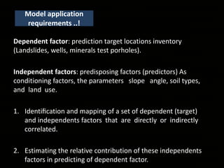
  • 5. Model application requirements ..! Dependent factor: prediction target locations inventory (Landslides, wells, minerals test porholes). Independent factors: predisposing factors (predictors) As conditioning factors, the parameters slope angle, soil types, and land use. 1. Identification and mapping of a set of dependent (target) and independents factors that are directly or indirectly correlated. 2. Estimating the relative contribution of these independents factors in predicting of dependent factor.
  • 6. What is FR..! A bivariate statistical analysis method, based on the spatial distribution (Probability) of dependent factor (landslides, pollutants), and such of the considered conditioning factors (slope, aspect, temperature, rainfall..etc..). Probabilistic analysis considers the statistical relationships between historical target locations and its conditioning factors Relative Frequency (RF) = relative density index (RDI) = Frequency Ratio (FR)
  • 7. 2001 El Salvador Landslide Located Near San Salvador Newark and Sherwood District Council Natural hazards
  • 8. Permit Times for Mining Exploration http://bit.ly/2keyuNP Gold mining: NYU Graduates Seeking $11 Billion of Gold in Ransacked Mine http://bit.ly/2k2ZL6C Minings and Groundwater exploration Groundwater: Agriculture Water Pump http://bit.ly/2keDeHl
  • 9. Calculating FR, RF, and PR coefficients for each factor Calculating Pairwise comparison Spatial validation using AUC Producing Susceptibility index map Processing Steps..!
  • 10. Calculations..!! Where FR : Frequency ratio RF : Index of the spatial association (Relative frequency ) of spatial factors and targets. PR : Predictor rate. FR = % target occurrence in each subcategory % category of an independent factor = (points in factor class total points) (factor class area total area) 𝑅𝐹 = 𝑓𝑎𝑐𝑡𝑜𝑟 𝑐𝑙𝑎𝑠𝑠 𝐹𝑅 ∑𝑓𝑎𝑐𝑡𝑜𝑟𝑐𝑙𝑎𝑠𝑠𝑒𝑠 𝐹𝑅 𝑃𝑅 = 𝑅𝐹 𝑀𝑎𝑥 − 𝑅𝐹 𝑀𝑖𝑛 𝑅𝐹 𝑀𝑎𝑥 − 𝑅𝐹 𝑀𝑖𝑛 Min 𝑆𝐼 = ∑ 𝑅𝐹 × 𝑃𝑅 𝑀𝑎𝑥 𝑅𝐹 × 𝑃𝑅 × 100 To consider the mutual interrelationships among the independents.
  • 11. Software's: Microsoft Excel- Microsoft ArcMap - ESRI QGIS 2.18.0 - OpenSource Data and Tools..!! Data type Data structure Source Landcover Raster European Environment Agency [http://www.eea.europa.eu/data-and- maps/data/clc-2000-raster-1 Topographic and NDVI Raster USGS [https://earthexplorer.usgs.gov/] Study area Vector DivaGIS [diva-gis.org/gdata] Training and testing points Vector Experimental data
  • 12. • Althuwaynee, Omar F., et al. "A novel ensemble bivariate statistical evidential belief function with knowledge-based analytical hierarchy process and multivariate statistical logistic regression for landslide susceptibility mapping." Catena 114 (2014): 21-36. • Sabatakakis, N., et al. "Landslide susceptibility zonation in Greece." Natural hazards 65.1 (2013): 523-543. More literature..!!