SlideShare a Scribd company logo
How to Use Spatial Data
Science in Your Site Planning
Process
FOLLOW @CARTO ON TWITTER
The Sum of Our Parts
Today’s Speakers
Giulia Carella Steve Isaac
Data Scientist Content Marketing Manager
CARTO — Turn Location Data into Business Outcomes
CARTO is the platform to build
powerful Location Intelligence apps
with the best data streams available.
CARTO
Customers
Pioneers in Location Intelligence
1,200 End-users
300K Team members
100+
CARTO — Turn Location Data into Business Outcomes
The Complete Journey
1. Data Ingestion & Management
2. Enrichment
3. Analysis
4. Solutions & Visualization
5. Integration
CARTO — Turn Location Data into Business Outcomes
The Complete Journey
1. Data Ingestion & Management
2. Enrichment
3. Analysis
4. Solutions & Visualization
5. Integration
Enrichment
● Save time in gathering spatial data,
augmenting your existing data with
demographics from across the globe
● Create locations from addresses and
understand travel time all from within
CARTO
● Develop robust ETL processes and update
mechanisms so your data is always enriched
● Premium data to understand and analyze
deeper trends and behavior
Data
Observatory
ETL
Processing
CARTO
Grid
Data Services
API
Routing &
Traffic
Geocoding
Analysis
● Bring maps and data into your Data Science
workflows and the Python data science
ecosystem with CARTOframes
● Machine learning embedded in CARTO as
simple SQL calls for clustering, outliers analysis,
time series predictions, and geospatial
weighted regression
● Use the power of PostGIS and our APIs to
productionalize analysis workflows in your
CARTO platform
CARTO Frames Analysis
API
SQL
API
Python
SDK
Spatial Data Science for Site Planning
Financial
Housing
Human Mobility
Road Traffic Points of Interest
Demographics
Merchant and ATM transaction
data from leading banks and
credit card companies
Mobile device and GPS data
provide insight into human
movement patterns
The most recent census data
including: age, income, household
types and more
Property statistics, prices, and
history to drive decisions in
investment portfolios
Data from routing apps and GPS
to analyse traffic patterns and
commuter behaviour
Location data for business
establishments, restaurants,
schools, attractions, and more
CARTO — Turn Location Data into Business Outcomes
The Age of Data Abundance?
AND ITS HIDDEN PITFALLS
Sampling Bias
Data may not be collected using
random samples, e.g. need
extrapolation to the total
population
AND ITS HIDDEN PITFALLS
Sampling Bias
Data may not be collected using
random samples, e.g. need
extrapolation to the total
population
Anonymisation
Data needs to be anonymised
to meet regulations, and
vendors have different
approaches for that
AND ITS HIDDEN PITFALLS
Sampling Bias
Data may not be collected using
random samples, e.g. need
extrapolation to the total
population
Anonymisation
Data need to be anonymised to
meet regulations, and vendors
have different approaches for
that
Different Aggregations
Data comes in different spatial
aggregations such as grid cells
of different sizes or
administrative boundaries
Financial
Grid 110x110m
POI
Points aggregated on a 70x70m grid
Demographics
Census tracts
Building a Common
Reference Grid
Which spatial scale is correct?
How do we change from one spatial scale to another?
THE CHANGE OF SUPPORT PROBLEM
Statistical downscale/upscale model to
DISAGGREGATE/AGGREGATE
the data at different spatial resolutions
A PRELIMINARY SOLUTION
AREA WEIGHTENING
Which spatial scale is correct?
How do we change from one spatial scale to another?
Exploring the available data:
CARTO DATA OBSERVATORY
Viz using vector maps
Connector to CARTO platform
WHAT IS CARTOframes?
● Python package
● To be used in Jupyter Notebooks
● Built for Data Scientists
● Part of CARTO Analysis stack
CARTOFrames Analysis API SQL API Python SDK
How to Use Spatial Data Science in your Site Planning Process? [CARTOframes]
Quadkeys
https://docs.microsoft.com/en-us/bingmaps/articles/bing-maps-tile-system
How to Use Spatial Data Science in your Site Planning Process? [CARTOframes]
Defining Similarity
for Site Planning
CARTO — Turn Location Data into Business Outcomes
WITH SOME CAVEATS:
1. Different variances?
2. Correlated variables?
3. Missing data?
4. When is a distance small enough? Or how to define
similarity?
TWIN AREA MODEL
DIFFERENT VARIANCES
CORRELATED VARIABLES
1. Eigen-decomposition of the sample covariance matrix
2. Rearrange the columns in the eigenvector matrix in order of decreasing eigenvalue
3. Keep only the eigenvectors that correspond to the p-largest eigenvalues
4. Compute the principal components (PC)
5. Reconstruct the original data
How many PCs? Let’s use an ensemble!
MISSING DATA
1. PCA can also be described as the ML solution of a probabilistic latent variable model (PPCA)
2. Find the ML estimate for the model parameters using the EM algorithm
2.1. E-step:
2.2. M-step
Similarity Score
HOW TO DEFINE SIMILARITY
So far we have only computed distances in the variable space
0 1
Actually since we are computing an K-ensemble of distances...
Let’s compare instead the score for each target location to the score from the mean vector data
Takeaways
CARTO Data Observatory
(DO) for data enrichment
CARTOframes as a connector
to the DO and for powerful
vector visualizations
Site-planning applications
require various sources of
location data streams
Easily derive data-driven
insights when opening,
relocating or consolidating
location sites
Thanks for listening! Any
questions?
Request a demo at CARTO.COM
Giulia Carella
Data Scientist // giulia@carto.com
Steve Isaac
Content Marketing Manager // sisaac@carto.com
Ad

More Related Content

What's hot (20)

Spatial Analytics in the Cloud Using Snowflake & CARTO
Spatial Analytics in the Cloud Using Snowflake & CARTOSpatial Analytics in the Cloud Using Snowflake & CARTO
Spatial Analytics in the Cloud Using Snowflake & CARTO
CARTO
 
Unlocking Geospatial Analytics Use Cases with CARTO and Databricks
Unlocking Geospatial Analytics Use Cases with CARTO and DatabricksUnlocking Geospatial Analytics Use Cases with CARTO and Databricks
Unlocking Geospatial Analytics Use Cases with CARTO and Databricks
Databricks
 
Data Platform Architecture Principles and Evaluation Criteria
Data Platform Architecture Principles and Evaluation CriteriaData Platform Architecture Principles and Evaluation Criteria
Data Platform Architecture Principles and Evaluation Criteria
ScyllaDB
 
Funnel Analysis with Apache Spark and Druid
Funnel Analysis with Apache Spark and DruidFunnel Analysis with Apache Spark and Druid
Funnel Analysis with Apache Spark and Druid
Databricks
 
Architecting Modern Data Platforms
Architecting Modern Data PlatformsArchitecting Modern Data Platforms
Architecting Modern Data Platforms
Ankit Rathi
 
Democratizing Data at Airbnb
Democratizing Data at AirbnbDemocratizing Data at Airbnb
Democratizing Data at Airbnb
Neo4j
 
Data Mesh for Dinner
Data Mesh for DinnerData Mesh for Dinner
Data Mesh for Dinner
Kent Graziano
 
Winning Market Expansion Strategies for CPG brands, Using Spatial Data and An...
Winning Market Expansion Strategies for CPG brands, Using Spatial Data and An...Winning Market Expansion Strategies for CPG brands, Using Spatial Data and An...
Winning Market Expansion Strategies for CPG brands, Using Spatial Data and An...
CARTO
 
Market analysis through Consumer Behavior Pattern Insights
Market analysis through Consumer Behavior Pattern InsightsMarket analysis through Consumer Behavior Pattern Insights
Market analysis through Consumer Behavior Pattern Insights
CARTO
 
Data Mesh
Data MeshData Mesh
Data Mesh
Piethein Strengholt
 
Data Warehouse Modernization: Accelerating Time-To-Action
Data Warehouse Modernization: Accelerating Time-To-Action Data Warehouse Modernization: Accelerating Time-To-Action
Data Warehouse Modernization: Accelerating Time-To-Action
MapR Technologies
 
Lessons learned from building practical deep learning systems
Lessons learned from building practical deep learning systemsLessons learned from building practical deep learning systems
Lessons learned from building practical deep learning systems
Xavier Amatriain
 
Knowledge Graphs and Generative AI
Knowledge Graphs and Generative AIKnowledge Graphs and Generative AI
Knowledge Graphs and Generative AI
Neo4j
 
7 Reasons Why CPG Marketers Are Turning To Location Analytics
7 Reasons Why CPG Marketers Are Turning To Location Analytics7 Reasons Why CPG Marketers Are Turning To Location Analytics
7 Reasons Why CPG Marketers Are Turning To Location Analytics
CARTO
 
AI and ML Series - Leveraging Generative AI and LLMs Using the UiPath Platfor...
AI and ML Series - Leveraging Generative AI and LLMs Using the UiPath Platfor...AI and ML Series - Leveraging Generative AI and LLMs Using the UiPath Platfor...
AI and ML Series - Leveraging Generative AI and LLMs Using the UiPath Platfor...
DianaGray10
 
Developing Spatial Applications with Google Maps and CARTO
Developing Spatial Applications with Google Maps and CARTODeveloping Spatial Applications with Google Maps and CARTO
Developing Spatial Applications with Google Maps and CARTO
CARTO
 
Enterprise Knowledge Graph
Enterprise Knowledge GraphEnterprise Knowledge Graph
Enterprise Knowledge Graph
Lukas Masuch
 
Democratizing Data Quality Through a Centralized Platform
Democratizing Data Quality Through a Centralized PlatformDemocratizing Data Quality Through a Centralized Platform
Democratizing Data Quality Through a Centralized Platform
Databricks
 
PHP ve NATS ile
 Mikroservis Mesajlaşma Sistemi
PHP ve NATS ile
 Mikroservis Mesajlaşma SistemiPHP ve NATS ile
 Mikroservis Mesajlaşma Sistemi
PHP ve NATS ile
 Mikroservis Mesajlaşma Sistemi
Erhan Yakut
 
Data Lakehouse Symposium | Day 1 | Part 1
Data Lakehouse Symposium | Day 1 | Part 1Data Lakehouse Symposium | Day 1 | Part 1
Data Lakehouse Symposium | Day 1 | Part 1
Databricks
 
Spatial Analytics in the Cloud Using Snowflake & CARTO
Spatial Analytics in the Cloud Using Snowflake & CARTOSpatial Analytics in the Cloud Using Snowflake & CARTO
Spatial Analytics in the Cloud Using Snowflake & CARTO
CARTO
 
Unlocking Geospatial Analytics Use Cases with CARTO and Databricks
Unlocking Geospatial Analytics Use Cases with CARTO and DatabricksUnlocking Geospatial Analytics Use Cases with CARTO and Databricks
Unlocking Geospatial Analytics Use Cases with CARTO and Databricks
Databricks
 
Data Platform Architecture Principles and Evaluation Criteria
Data Platform Architecture Principles and Evaluation CriteriaData Platform Architecture Principles and Evaluation Criteria
Data Platform Architecture Principles and Evaluation Criteria
ScyllaDB
 
Funnel Analysis with Apache Spark and Druid
Funnel Analysis with Apache Spark and DruidFunnel Analysis with Apache Spark and Druid
Funnel Analysis with Apache Spark and Druid
Databricks
 
Architecting Modern Data Platforms
Architecting Modern Data PlatformsArchitecting Modern Data Platforms
Architecting Modern Data Platforms
Ankit Rathi
 
Democratizing Data at Airbnb
Democratizing Data at AirbnbDemocratizing Data at Airbnb
Democratizing Data at Airbnb
Neo4j
 
Data Mesh for Dinner
Data Mesh for DinnerData Mesh for Dinner
Data Mesh for Dinner
Kent Graziano
 
Winning Market Expansion Strategies for CPG brands, Using Spatial Data and An...
Winning Market Expansion Strategies for CPG brands, Using Spatial Data and An...Winning Market Expansion Strategies for CPG brands, Using Spatial Data and An...
Winning Market Expansion Strategies for CPG brands, Using Spatial Data and An...
CARTO
 
Market analysis through Consumer Behavior Pattern Insights
Market analysis through Consumer Behavior Pattern InsightsMarket analysis through Consumer Behavior Pattern Insights
Market analysis through Consumer Behavior Pattern Insights
CARTO
 
Data Warehouse Modernization: Accelerating Time-To-Action
Data Warehouse Modernization: Accelerating Time-To-Action Data Warehouse Modernization: Accelerating Time-To-Action
Data Warehouse Modernization: Accelerating Time-To-Action
MapR Technologies
 
Lessons learned from building practical deep learning systems
Lessons learned from building practical deep learning systemsLessons learned from building practical deep learning systems
Lessons learned from building practical deep learning systems
Xavier Amatriain
 
Knowledge Graphs and Generative AI
Knowledge Graphs and Generative AIKnowledge Graphs and Generative AI
Knowledge Graphs and Generative AI
Neo4j
 
7 Reasons Why CPG Marketers Are Turning To Location Analytics
7 Reasons Why CPG Marketers Are Turning To Location Analytics7 Reasons Why CPG Marketers Are Turning To Location Analytics
7 Reasons Why CPG Marketers Are Turning To Location Analytics
CARTO
 
AI and ML Series - Leveraging Generative AI and LLMs Using the UiPath Platfor...
AI and ML Series - Leveraging Generative AI and LLMs Using the UiPath Platfor...AI and ML Series - Leveraging Generative AI and LLMs Using the UiPath Platfor...
AI and ML Series - Leveraging Generative AI and LLMs Using the UiPath Platfor...
DianaGray10
 
Developing Spatial Applications with Google Maps and CARTO
Developing Spatial Applications with Google Maps and CARTODeveloping Spatial Applications with Google Maps and CARTO
Developing Spatial Applications with Google Maps and CARTO
CARTO
 
Enterprise Knowledge Graph
Enterprise Knowledge GraphEnterprise Knowledge Graph
Enterprise Knowledge Graph
Lukas Masuch
 
Democratizing Data Quality Through a Centralized Platform
Democratizing Data Quality Through a Centralized PlatformDemocratizing Data Quality Through a Centralized Platform
Democratizing Data Quality Through a Centralized Platform
Databricks
 
PHP ve NATS ile
 Mikroservis Mesajlaşma Sistemi
PHP ve NATS ile
 Mikroservis Mesajlaşma SistemiPHP ve NATS ile
 Mikroservis Mesajlaşma Sistemi
PHP ve NATS ile
 Mikroservis Mesajlaşma Sistemi
Erhan Yakut
 
Data Lakehouse Symposium | Day 1 | Part 1
Data Lakehouse Symposium | Day 1 | Part 1Data Lakehouse Symposium | Day 1 | Part 1
Data Lakehouse Symposium | Day 1 | Part 1
Databricks
 

Similar to How to Use Spatial Data Science in your Site Planning Process? [CARTOframes] (20)

The Role of Data Science in Real Estate
The Role of Data Science in Real EstateThe Role of Data Science in Real Estate
The Role of Data Science in Real Estate
CARTO
 
Le rôle de l’intelligence géospatiale dans la reprise économique
Le rôle de l’intelligence géospatiale dans la reprise économiqueLe rôle de l’intelligence géospatiale dans la reprise économique
Le rôle de l’intelligence géospatiale dans la reprise économique
CARTO
 
CARTO en 5 Pasos: del Dato a la Toma de Decisiones [CARTO]
CARTO en 5 Pasos: del Dato a la Toma de Decisiones [CARTO]CARTO en 5 Pasos: del Dato a la Toma de Decisiones [CARTO]
CARTO en 5 Pasos: del Dato a la Toma de Decisiones [CARTO]
CARTO
 
Unlock the power of spatial analysis using CARTO and python [CARTOframes]
Unlock the power of spatial analysis using CARTO and python [CARTOframes]Unlock the power of spatial analysis using CARTO and python [CARTOframes]
Unlock the power of spatial analysis using CARTO and python [CARTOframes]
CARTO
 
Supercharging Site Planning in Retail & Real Estate [CARTO Reveal]
Supercharging Site Planning in Retail & Real Estate [CARTO Reveal]Supercharging Site Planning in Retail & Real Estate [CARTO Reveal]
Supercharging Site Planning in Retail & Real Estate [CARTO Reveal]
CARTO
 
Location Intelligence - the Next Evolution of Business Applications
Location Intelligence - the Next Evolution of Business ApplicationsLocation Intelligence - the Next Evolution of Business Applications
Location Intelligence - the Next Evolution of Business Applications
MISNet - Integeo SE Asia
 
Hedge Fund case study solution - Credit default swaps execution system and Gr...
Hedge Fund case study solution - Credit default swaps execution system and Gr...Hedge Fund case study solution - Credit default swaps execution system and Gr...
Hedge Fund case study solution - Credit default swaps execution system and Gr...
Naveen Kumar
 
Deploying Enterprise Scale Deep Learning in Actuarial Modeling at Nationwide
Deploying Enterprise Scale Deep Learning in Actuarial Modeling at NationwideDeploying Enterprise Scale Deep Learning in Actuarial Modeling at Nationwide
Deploying Enterprise Scale Deep Learning in Actuarial Modeling at Nationwide
Databricks
 
Tips and tricks for Working with Demographic Data [CARTOframes & Python]
Tips and tricks for Working with Demographic Data [CARTOframes & Python]Tips and tricks for Working with Demographic Data [CARTOframes & Python]
Tips and tricks for Working with Demographic Data [CARTOframes & Python]
CARTO
 
AGIT 2015 - Hans Viehmann: "Big Data and Smart Cities"
AGIT 2015  - Hans Viehmann: "Big Data and Smart Cities"AGIT 2015  - Hans Viehmann: "Big Data and Smart Cities"
AGIT 2015 - Hans Viehmann: "Big Data and Smart Cities"
jstrobl
 
Market pulse
Market pulseMarket pulse
Market pulse
Leptonmaps
 
Overview of business intelligence
Overview of business intelligenceOverview of business intelligence
Overview of business intelligence
Ahsan Kabir
 
Everyday Data Science
Everyday Data ScienceEveryday Data Science
Everyday Data Science
Paul Laughlin
 
Dista Insight Data Sheet.pdf
Dista Insight Data Sheet.pdfDista Insight Data Sheet.pdf
Dista Insight Data Sheet.pdf
Dista
 
QlikView and Location / Map Intelligence
QlikView and Location / Map IntelligenceQlikView and Location / Map Intelligence
QlikView and Location / Map Intelligence
MISNet - Integeo SE Asia
 
Improve Store Expansion (Territory Management Featuring)
Improve Store Expansion (Territory Management Featuring)Improve Store Expansion (Territory Management Featuring)
Improve Store Expansion (Territory Management Featuring)
Esri España
 
Big data solutions on cloud – the way forward
Big data solutions on cloud – the way forwardBig data solutions on cloud – the way forward
Big data solutions on cloud – the way forward
Kiththi Perera
 
Big Data Solutions on Cloud – The Way Forward by Kiththi Perera SLT
Big Data Solutions on Cloud – The Way Forward by Kiththi Perera SLTBig Data Solutions on Cloud – The Way Forward by Kiththi Perera SLT
Big Data Solutions on Cloud – The Way Forward by Kiththi Perera SLT
Kiththi Perera
 
Don't Get Lost in Data Without a Map
Don't Get Lost in Data Without a MapDon't Get Lost in Data Without a Map
Don't Get Lost in Data Without a Map
MISNet - Integeo SE Asia
 
Technical Research Document - Anurag
Technical Research Document - AnuragTechnical Research Document - Anurag
Technical Research Document - Anurag
anuragrajandekar
 
The Role of Data Science in Real Estate
The Role of Data Science in Real EstateThe Role of Data Science in Real Estate
The Role of Data Science in Real Estate
CARTO
 
Le rôle de l’intelligence géospatiale dans la reprise économique
Le rôle de l’intelligence géospatiale dans la reprise économiqueLe rôle de l’intelligence géospatiale dans la reprise économique
Le rôle de l’intelligence géospatiale dans la reprise économique
CARTO
 
CARTO en 5 Pasos: del Dato a la Toma de Decisiones [CARTO]
CARTO en 5 Pasos: del Dato a la Toma de Decisiones [CARTO]CARTO en 5 Pasos: del Dato a la Toma de Decisiones [CARTO]
CARTO en 5 Pasos: del Dato a la Toma de Decisiones [CARTO]
CARTO
 
Unlock the power of spatial analysis using CARTO and python [CARTOframes]
Unlock the power of spatial analysis using CARTO and python [CARTOframes]Unlock the power of spatial analysis using CARTO and python [CARTOframes]
Unlock the power of spatial analysis using CARTO and python [CARTOframes]
CARTO
 
Supercharging Site Planning in Retail & Real Estate [CARTO Reveal]
Supercharging Site Planning in Retail & Real Estate [CARTO Reveal]Supercharging Site Planning in Retail & Real Estate [CARTO Reveal]
Supercharging Site Planning in Retail & Real Estate [CARTO Reveal]
CARTO
 
Location Intelligence - the Next Evolution of Business Applications
Location Intelligence - the Next Evolution of Business ApplicationsLocation Intelligence - the Next Evolution of Business Applications
Location Intelligence - the Next Evolution of Business Applications
MISNet - Integeo SE Asia
 
Hedge Fund case study solution - Credit default swaps execution system and Gr...
Hedge Fund case study solution - Credit default swaps execution system and Gr...Hedge Fund case study solution - Credit default swaps execution system and Gr...
Hedge Fund case study solution - Credit default swaps execution system and Gr...
Naveen Kumar
 
Deploying Enterprise Scale Deep Learning in Actuarial Modeling at Nationwide
Deploying Enterprise Scale Deep Learning in Actuarial Modeling at NationwideDeploying Enterprise Scale Deep Learning in Actuarial Modeling at Nationwide
Deploying Enterprise Scale Deep Learning in Actuarial Modeling at Nationwide
Databricks
 
Tips and tricks for Working with Demographic Data [CARTOframes & Python]
Tips and tricks for Working with Demographic Data [CARTOframes & Python]Tips and tricks for Working with Demographic Data [CARTOframes & Python]
Tips and tricks for Working with Demographic Data [CARTOframes & Python]
CARTO
 
AGIT 2015 - Hans Viehmann: "Big Data and Smart Cities"
AGIT 2015  - Hans Viehmann: "Big Data and Smart Cities"AGIT 2015  - Hans Viehmann: "Big Data and Smart Cities"
AGIT 2015 - Hans Viehmann: "Big Data and Smart Cities"
jstrobl
 
Overview of business intelligence
Overview of business intelligenceOverview of business intelligence
Overview of business intelligence
Ahsan Kabir
 
Everyday Data Science
Everyday Data ScienceEveryday Data Science
Everyday Data Science
Paul Laughlin
 
Dista Insight Data Sheet.pdf
Dista Insight Data Sheet.pdfDista Insight Data Sheet.pdf
Dista Insight Data Sheet.pdf
Dista
 
Improve Store Expansion (Territory Management Featuring)
Improve Store Expansion (Territory Management Featuring)Improve Store Expansion (Territory Management Featuring)
Improve Store Expansion (Territory Management Featuring)
Esri España
 
Big data solutions on cloud – the way forward
Big data solutions on cloud – the way forwardBig data solutions on cloud – the way forward
Big data solutions on cloud – the way forward
Kiththi Perera
 
Big Data Solutions on Cloud – The Way Forward by Kiththi Perera SLT
Big Data Solutions on Cloud – The Way Forward by Kiththi Perera SLTBig Data Solutions on Cloud – The Way Forward by Kiththi Perera SLT
Big Data Solutions on Cloud – The Way Forward by Kiththi Perera SLT
Kiththi Perera
 
Technical Research Document - Anurag
Technical Research Document - AnuragTechnical Research Document - Anurag
Technical Research Document - Anurag
anuragrajandekar
 
Ad

More from CARTO (20)

4 Ways Telecoms are Using GIS & Location Intelligence.pdf
4 Ways Telecoms are Using GIS & Location Intelligence.pdf4 Ways Telecoms are Using GIS & Location Intelligence.pdf
4 Ways Telecoms are Using GIS & Location Intelligence.pdf
CARTO
 
Understanding Residential Energy Usage with CARTO & Doorda.pdf
Understanding Residential Energy Usage with CARTO & Doorda.pdfUnderstanding Residential Energy Usage with CARTO & Doorda.pdf
Understanding Residential Energy Usage with CARTO & Doorda.pdf
CARTO
 
How to Use Spatial Data to Create a Wildfire Risk Index.pdf
How to Use Spatial Data to Create a Wildfire Risk Index.pdfHow to Use Spatial Data to Create a Wildfire Risk Index.pdf
How to Use Spatial Data to Create a Wildfire Risk Index.pdf
CARTO
 
Advancing Spatial Analysis in BigQuery using CARTO Analytics Toolbox
Advancing Spatial Analysis in BigQuery using CARTO Analytics ToolboxAdvancing Spatial Analysis in BigQuery using CARTO Analytics Toolbox
Advancing Spatial Analysis in BigQuery using CARTO Analytics Toolbox
CARTO
 
Can Kanye West Save Gap? Real-Time Consumer Social Media Segmentation On CARTO
Can Kanye West Save Gap? Real-Time Consumer Social Media Segmentation On CARTOCan Kanye West Save Gap? Real-Time Consumer Social Media Segmentation On CARTO
Can Kanye West Save Gap? Real-Time Consumer Social Media Segmentation On CARTO
CARTO
 
Location Intelligence: The Secret Sauce for OOH Advertising
Location Intelligence: The Secret Sauce for OOH AdvertisingLocation Intelligence: The Secret Sauce for OOH Advertising
Location Intelligence: The Secret Sauce for OOH Advertising
CARTO
 
Developing Spatial Applications with CARTO for React v1.1
Developing Spatial Applications with CARTO for React v1.1Developing Spatial Applications with CARTO for React v1.1
Developing Spatial Applications with CARTO for React v1.1
CARTO
 
Scaling Spatial Analytics with Google Cloud & CARTO
Scaling Spatial Analytics with Google Cloud & CARTOScaling Spatial Analytics with Google Cloud & CARTO
Scaling Spatial Analytics with Google Cloud & CARTO
CARTO
 
Sentiment, Popularity & Potentiality: 3 Unique KPIs to add to your Site Selec...
Sentiment, Popularity & Potentiality: 3 Unique KPIs to add to your Site Selec...Sentiment, Popularity & Potentiality: 3 Unique KPIs to add to your Site Selec...
Sentiment, Popularity & Potentiality: 3 Unique KPIs to add to your Site Selec...
CARTO
 
CARTO Cloud Native – An Introduction to the Spatial Extension for BigQuery
CARTO Cloud Native – An Introduction to the Spatial Extension for BigQueryCARTO Cloud Native – An Introduction to the Spatial Extension for BigQuery
CARTO Cloud Native – An Introduction to the Spatial Extension for BigQuery
CARTO
 
What Spatial Analytics Tells Us About the Future of the UK High Street
What Spatial Analytics Tells Us About the Future of the UK High StreetWhat Spatial Analytics Tells Us About the Future of the UK High Street
What Spatial Analytics Tells Us About the Future of the UK High Street
CARTO
 
Using Spatial Analysis to Drive Post-Pandemic Site Selection in Retail
Using Spatial Analysis to Drive Post-Pandemic Site Selection in RetailUsing Spatial Analysis to Drive Post-Pandemic Site Selection in Retail
Using Spatial Analysis to Drive Post-Pandemic Site Selection in Retail
CARTO
 
6 Ways CPG Brands are Using Location Data to Prepare for the "Post-Pandemic"
6 Ways CPG Brands are Using Location Data to Prepare for the "Post-Pandemic"6 Ways CPG Brands are Using Location Data to Prepare for the "Post-Pandemic"
6 Ways CPG Brands are Using Location Data to Prepare for the "Post-Pandemic"
CARTO
 
Using Places (POI) Data for QSR Site Selection
Using Places (POI) Data for QSR Site SelectionUsing Places (POI) Data for QSR Site Selection
Using Places (POI) Data for QSR Site Selection
CARTO
 
5 Ways to Strategize for Emerging Short-Term Rental Trends
5 Ways to Strategize for Emerging Short-Term Rental Trends5 Ways to Strategize for Emerging Short-Term Rental Trends
5 Ways to Strategize for Emerging Short-Term Rental Trends
CARTO
 
How to Use Geospatial Data to Identify CPG Demnd Hotspots
How to Use Geospatial Data to Identify CPG Demnd HotspotsHow to Use Geospatial Data to Identify CPG Demnd Hotspots
How to Use Geospatial Data to Identify CPG Demnd Hotspots
CARTO
 
Using Location Data to Adapt to the New normal
Using Location Data to Adapt to the New normalUsing Location Data to Adapt to the New normal
Using Location Data to Adapt to the New normal
CARTO
 
Analyzing the Rise of the Staycation during COVID-19
Analyzing the Rise of the Staycation during COVID-19Analyzing the Rise of the Staycation during COVID-19
Analyzing the Rise of the Staycation during COVID-19
CARTO
 
Why High-Resolution Spatial Data on Population Matters
 Why High-Resolution Spatial Data on Population Matters Why High-Resolution Spatial Data on Population Matters
Why High-Resolution Spatial Data on Population Matters
CARTO
 
Google Analytics location data visualised with CARTO & BigQuery
Google Analytics location data visualised with CARTO & BigQueryGoogle Analytics location data visualised with CARTO & BigQuery
Google Analytics location data visualised with CARTO & BigQuery
CARTO
 
4 Ways Telecoms are Using GIS & Location Intelligence.pdf
4 Ways Telecoms are Using GIS & Location Intelligence.pdf4 Ways Telecoms are Using GIS & Location Intelligence.pdf
4 Ways Telecoms are Using GIS & Location Intelligence.pdf
CARTO
 
Understanding Residential Energy Usage with CARTO & Doorda.pdf
Understanding Residential Energy Usage with CARTO & Doorda.pdfUnderstanding Residential Energy Usage with CARTO & Doorda.pdf
Understanding Residential Energy Usage with CARTO & Doorda.pdf
CARTO
 
How to Use Spatial Data to Create a Wildfire Risk Index.pdf
How to Use Spatial Data to Create a Wildfire Risk Index.pdfHow to Use Spatial Data to Create a Wildfire Risk Index.pdf
How to Use Spatial Data to Create a Wildfire Risk Index.pdf
CARTO
 
Advancing Spatial Analysis in BigQuery using CARTO Analytics Toolbox
Advancing Spatial Analysis in BigQuery using CARTO Analytics ToolboxAdvancing Spatial Analysis in BigQuery using CARTO Analytics Toolbox
Advancing Spatial Analysis in BigQuery using CARTO Analytics Toolbox
CARTO
 
Can Kanye West Save Gap? Real-Time Consumer Social Media Segmentation On CARTO
Can Kanye West Save Gap? Real-Time Consumer Social Media Segmentation On CARTOCan Kanye West Save Gap? Real-Time Consumer Social Media Segmentation On CARTO
Can Kanye West Save Gap? Real-Time Consumer Social Media Segmentation On CARTO
CARTO
 
Location Intelligence: The Secret Sauce for OOH Advertising
Location Intelligence: The Secret Sauce for OOH AdvertisingLocation Intelligence: The Secret Sauce for OOH Advertising
Location Intelligence: The Secret Sauce for OOH Advertising
CARTO
 
Developing Spatial Applications with CARTO for React v1.1
Developing Spatial Applications with CARTO for React v1.1Developing Spatial Applications with CARTO for React v1.1
Developing Spatial Applications with CARTO for React v1.1
CARTO
 
Scaling Spatial Analytics with Google Cloud & CARTO
Scaling Spatial Analytics with Google Cloud & CARTOScaling Spatial Analytics with Google Cloud & CARTO
Scaling Spatial Analytics with Google Cloud & CARTO
CARTO
 
Sentiment, Popularity & Potentiality: 3 Unique KPIs to add to your Site Selec...
Sentiment, Popularity & Potentiality: 3 Unique KPIs to add to your Site Selec...Sentiment, Popularity & Potentiality: 3 Unique KPIs to add to your Site Selec...
Sentiment, Popularity & Potentiality: 3 Unique KPIs to add to your Site Selec...
CARTO
 
CARTO Cloud Native – An Introduction to the Spatial Extension for BigQuery
CARTO Cloud Native – An Introduction to the Spatial Extension for BigQueryCARTO Cloud Native – An Introduction to the Spatial Extension for BigQuery
CARTO Cloud Native – An Introduction to the Spatial Extension for BigQuery
CARTO
 
What Spatial Analytics Tells Us About the Future of the UK High Street
What Spatial Analytics Tells Us About the Future of the UK High StreetWhat Spatial Analytics Tells Us About the Future of the UK High Street
What Spatial Analytics Tells Us About the Future of the UK High Street
CARTO
 
Using Spatial Analysis to Drive Post-Pandemic Site Selection in Retail
Using Spatial Analysis to Drive Post-Pandemic Site Selection in RetailUsing Spatial Analysis to Drive Post-Pandemic Site Selection in Retail
Using Spatial Analysis to Drive Post-Pandemic Site Selection in Retail
CARTO
 
6 Ways CPG Brands are Using Location Data to Prepare for the "Post-Pandemic"
6 Ways CPG Brands are Using Location Data to Prepare for the "Post-Pandemic"6 Ways CPG Brands are Using Location Data to Prepare for the "Post-Pandemic"
6 Ways CPG Brands are Using Location Data to Prepare for the "Post-Pandemic"
CARTO
 
Using Places (POI) Data for QSR Site Selection
Using Places (POI) Data for QSR Site SelectionUsing Places (POI) Data for QSR Site Selection
Using Places (POI) Data for QSR Site Selection
CARTO
 
5 Ways to Strategize for Emerging Short-Term Rental Trends
5 Ways to Strategize for Emerging Short-Term Rental Trends5 Ways to Strategize for Emerging Short-Term Rental Trends
5 Ways to Strategize for Emerging Short-Term Rental Trends
CARTO
 
How to Use Geospatial Data to Identify CPG Demnd Hotspots
How to Use Geospatial Data to Identify CPG Demnd HotspotsHow to Use Geospatial Data to Identify CPG Demnd Hotspots
How to Use Geospatial Data to Identify CPG Demnd Hotspots
CARTO
 
Using Location Data to Adapt to the New normal
Using Location Data to Adapt to the New normalUsing Location Data to Adapt to the New normal
Using Location Data to Adapt to the New normal
CARTO
 
Analyzing the Rise of the Staycation during COVID-19
Analyzing the Rise of the Staycation during COVID-19Analyzing the Rise of the Staycation during COVID-19
Analyzing the Rise of the Staycation during COVID-19
CARTO
 
Why High-Resolution Spatial Data on Population Matters
 Why High-Resolution Spatial Data on Population Matters Why High-Resolution Spatial Data on Population Matters
Why High-Resolution Spatial Data on Population Matters
CARTO
 
Google Analytics location data visualised with CARTO & BigQuery
Google Analytics location data visualised with CARTO & BigQueryGoogle Analytics location data visualised with CARTO & BigQuery
Google Analytics location data visualised with CARTO & BigQuery
CARTO
 
Ad

Recently uploaded (20)

Principles of information security Chapter 5.ppt
Principles of information security Chapter 5.pptPrinciples of information security Chapter 5.ppt
Principles of information security Chapter 5.ppt
EstherBaguma
 
How iCode cybertech Helped Me Recover My Lost Funds
How iCode cybertech Helped Me Recover My Lost FundsHow iCode cybertech Helped Me Recover My Lost Funds
How iCode cybertech Helped Me Recover My Lost Funds
ireneschmid345
 
Digilocker under workingProcess Flow.pptx
Digilocker  under workingProcess Flow.pptxDigilocker  under workingProcess Flow.pptx
Digilocker under workingProcess Flow.pptx
satnamsadguru491
 
03 Daniel 2-notes.ppt seminario escatologia
03 Daniel 2-notes.ppt seminario escatologia03 Daniel 2-notes.ppt seminario escatologia
03 Daniel 2-notes.ppt seminario escatologia
Alexander Romero Arosquipa
 
chapter 4 Variability statistical research .pptx
chapter 4 Variability statistical research .pptxchapter 4 Variability statistical research .pptx
chapter 4 Variability statistical research .pptx
justinebandajbn
 
VKS-Python Basics for Beginners and advance.pptx
VKS-Python Basics for Beginners and advance.pptxVKS-Python Basics for Beginners and advance.pptx
VKS-Python Basics for Beginners and advance.pptx
Vinod Srivastava
 
C++_OOPs_DSA1_Presentation_Template.pptx
C++_OOPs_DSA1_Presentation_Template.pptxC++_OOPs_DSA1_Presentation_Template.pptx
C++_OOPs_DSA1_Presentation_Template.pptx
aquibnoor22079
 
Adobe Analytics NOAM Central User Group April 2025 Agent AI: Uncovering the S...
Adobe Analytics NOAM Central User Group April 2025 Agent AI: Uncovering the S...Adobe Analytics NOAM Central User Group April 2025 Agent AI: Uncovering the S...
Adobe Analytics NOAM Central User Group April 2025 Agent AI: Uncovering the S...
gmuir1066
 
04302025_CCC TUG_DataVista: The Design Story
04302025_CCC TUG_DataVista: The Design Story04302025_CCC TUG_DataVista: The Design Story
04302025_CCC TUG_DataVista: The Design Story
ccctableauusergroup
 
Day 1 - Lab 1 Reconnaissance Scanning with NMAP, Vulnerability Assessment wit...
Day 1 - Lab 1 Reconnaissance Scanning with NMAP, Vulnerability Assessment wit...Day 1 - Lab 1 Reconnaissance Scanning with NMAP, Vulnerability Assessment wit...
Day 1 - Lab 1 Reconnaissance Scanning with NMAP, Vulnerability Assessment wit...
Abodahab
 
Calories_Prediction_using_Linear_Regression.pptx
Calories_Prediction_using_Linear_Regression.pptxCalories_Prediction_using_Linear_Regression.pptx
Calories_Prediction_using_Linear_Regression.pptx
TijiLMAHESHWARI
 
Data Analytics Overview and its applications
Data Analytics Overview and its applicationsData Analytics Overview and its applications
Data Analytics Overview and its applications
JanmejayaMishra7
 
IAS-slides2-ia-aaaaaaaaaaain-business.pdf
IAS-slides2-ia-aaaaaaaaaaain-business.pdfIAS-slides2-ia-aaaaaaaaaaain-business.pdf
IAS-slides2-ia-aaaaaaaaaaain-business.pdf
mcgardenlevi9
 
Perencanaan Pengendalian-Proyek-Konstruksi-MS-PROJECT.pptx
Perencanaan Pengendalian-Proyek-Konstruksi-MS-PROJECT.pptxPerencanaan Pengendalian-Proyek-Konstruksi-MS-PROJECT.pptx
Perencanaan Pengendalian-Proyek-Konstruksi-MS-PROJECT.pptx
PareaRusan
 
How to join illuminati Agent in uganda call+256776963507/0741506136
How to join illuminati Agent in uganda call+256776963507/0741506136How to join illuminati Agent in uganda call+256776963507/0741506136
How to join illuminati Agent in uganda call+256776963507/0741506136
illuminati Agent uganda call+256776963507/0741506136
 
Developing Security Orchestration, Automation, and Response Applications
Developing Security Orchestration, Automation, and Response ApplicationsDeveloping Security Orchestration, Automation, and Response Applications
Developing Security Orchestration, Automation, and Response Applications
VICTOR MAESTRE RAMIREZ
 
Template_A3nnnnnnnnnnnnnnnnnnnnnnnnnnnnnnnnnnn
Template_A3nnnnnnnnnnnnnnnnnnnnnnnnnnnnnnnnnnnTemplate_A3nnnnnnnnnnnnnnnnnnnnnnnnnnnnnnnnnnn
Template_A3nnnnnnnnnnnnnnnnnnnnnnnnnnnnnnnnnnn
cegiver630
 
Ppt. Nikhil.pptxnshwuudgcudisisshvehsjks
Ppt. Nikhil.pptxnshwuudgcudisisshvehsjksPpt. Nikhil.pptxnshwuudgcudisisshvehsjks
Ppt. Nikhil.pptxnshwuudgcudisisshvehsjks
panchariyasahil
 
LLM finetuning for multiple choice google bert
LLM finetuning for multiple choice google bertLLM finetuning for multiple choice google bert
LLM finetuning for multiple choice google bert
ChadapornK
 
Ch3MCT24.pptx measure of central tendency
Ch3MCT24.pptx measure of central tendencyCh3MCT24.pptx measure of central tendency
Ch3MCT24.pptx measure of central tendency
ayeleasefa2
 
Principles of information security Chapter 5.ppt
Principles of information security Chapter 5.pptPrinciples of information security Chapter 5.ppt
Principles of information security Chapter 5.ppt
EstherBaguma
 
How iCode cybertech Helped Me Recover My Lost Funds
How iCode cybertech Helped Me Recover My Lost FundsHow iCode cybertech Helped Me Recover My Lost Funds
How iCode cybertech Helped Me Recover My Lost Funds
ireneschmid345
 
Digilocker under workingProcess Flow.pptx
Digilocker  under workingProcess Flow.pptxDigilocker  under workingProcess Flow.pptx
Digilocker under workingProcess Flow.pptx
satnamsadguru491
 
chapter 4 Variability statistical research .pptx
chapter 4 Variability statistical research .pptxchapter 4 Variability statistical research .pptx
chapter 4 Variability statistical research .pptx
justinebandajbn
 
VKS-Python Basics for Beginners and advance.pptx
VKS-Python Basics for Beginners and advance.pptxVKS-Python Basics for Beginners and advance.pptx
VKS-Python Basics for Beginners and advance.pptx
Vinod Srivastava
 
C++_OOPs_DSA1_Presentation_Template.pptx
C++_OOPs_DSA1_Presentation_Template.pptxC++_OOPs_DSA1_Presentation_Template.pptx
C++_OOPs_DSA1_Presentation_Template.pptx
aquibnoor22079
 
Adobe Analytics NOAM Central User Group April 2025 Agent AI: Uncovering the S...
Adobe Analytics NOAM Central User Group April 2025 Agent AI: Uncovering the S...Adobe Analytics NOAM Central User Group April 2025 Agent AI: Uncovering the S...
Adobe Analytics NOAM Central User Group April 2025 Agent AI: Uncovering the S...
gmuir1066
 
04302025_CCC TUG_DataVista: The Design Story
04302025_CCC TUG_DataVista: The Design Story04302025_CCC TUG_DataVista: The Design Story
04302025_CCC TUG_DataVista: The Design Story
ccctableauusergroup
 
Day 1 - Lab 1 Reconnaissance Scanning with NMAP, Vulnerability Assessment wit...
Day 1 - Lab 1 Reconnaissance Scanning with NMAP, Vulnerability Assessment wit...Day 1 - Lab 1 Reconnaissance Scanning with NMAP, Vulnerability Assessment wit...
Day 1 - Lab 1 Reconnaissance Scanning with NMAP, Vulnerability Assessment wit...
Abodahab
 
Calories_Prediction_using_Linear_Regression.pptx
Calories_Prediction_using_Linear_Regression.pptxCalories_Prediction_using_Linear_Regression.pptx
Calories_Prediction_using_Linear_Regression.pptx
TijiLMAHESHWARI
 
Data Analytics Overview and its applications
Data Analytics Overview and its applicationsData Analytics Overview and its applications
Data Analytics Overview and its applications
JanmejayaMishra7
 
IAS-slides2-ia-aaaaaaaaaaain-business.pdf
IAS-slides2-ia-aaaaaaaaaaain-business.pdfIAS-slides2-ia-aaaaaaaaaaain-business.pdf
IAS-slides2-ia-aaaaaaaaaaain-business.pdf
mcgardenlevi9
 
Perencanaan Pengendalian-Proyek-Konstruksi-MS-PROJECT.pptx
Perencanaan Pengendalian-Proyek-Konstruksi-MS-PROJECT.pptxPerencanaan Pengendalian-Proyek-Konstruksi-MS-PROJECT.pptx
Perencanaan Pengendalian-Proyek-Konstruksi-MS-PROJECT.pptx
PareaRusan
 
Developing Security Orchestration, Automation, and Response Applications
Developing Security Orchestration, Automation, and Response ApplicationsDeveloping Security Orchestration, Automation, and Response Applications
Developing Security Orchestration, Automation, and Response Applications
VICTOR MAESTRE RAMIREZ
 
Template_A3nnnnnnnnnnnnnnnnnnnnnnnnnnnnnnnnnnn
Template_A3nnnnnnnnnnnnnnnnnnnnnnnnnnnnnnnnnnnTemplate_A3nnnnnnnnnnnnnnnnnnnnnnnnnnnnnnnnnnn
Template_A3nnnnnnnnnnnnnnnnnnnnnnnnnnnnnnnnnnn
cegiver630
 
Ppt. Nikhil.pptxnshwuudgcudisisshvehsjks
Ppt. Nikhil.pptxnshwuudgcudisisshvehsjksPpt. Nikhil.pptxnshwuudgcudisisshvehsjks
Ppt. Nikhil.pptxnshwuudgcudisisshvehsjks
panchariyasahil
 
LLM finetuning for multiple choice google bert
LLM finetuning for multiple choice google bertLLM finetuning for multiple choice google bert
LLM finetuning for multiple choice google bert
ChadapornK
 
Ch3MCT24.pptx measure of central tendency
Ch3MCT24.pptx measure of central tendencyCh3MCT24.pptx measure of central tendency
Ch3MCT24.pptx measure of central tendency
ayeleasefa2
 

How to Use Spatial Data Science in your Site Planning Process? [CARTOframes]

  • 1. How to Use Spatial Data Science in Your Site Planning Process FOLLOW @CARTO ON TWITTER
  • 2. The Sum of Our Parts Today’s Speakers Giulia Carella Steve Isaac Data Scientist Content Marketing Manager
  • 3. CARTO — Turn Location Data into Business Outcomes CARTO is the platform to build powerful Location Intelligence apps with the best data streams available.
  • 4. CARTO Customers Pioneers in Location Intelligence 1,200 End-users 300K Team members 100+
  • 5. CARTO — Turn Location Data into Business Outcomes The Complete Journey 1. Data Ingestion & Management 2. Enrichment 3. Analysis 4. Solutions & Visualization 5. Integration
  • 6. CARTO — Turn Location Data into Business Outcomes The Complete Journey 1. Data Ingestion & Management 2. Enrichment 3. Analysis 4. Solutions & Visualization 5. Integration
  • 7. Enrichment ● Save time in gathering spatial data, augmenting your existing data with demographics from across the globe ● Create locations from addresses and understand travel time all from within CARTO ● Develop robust ETL processes and update mechanisms so your data is always enriched ● Premium data to understand and analyze deeper trends and behavior Data Observatory ETL Processing CARTO Grid Data Services API Routing & Traffic Geocoding
  • 8. Analysis ● Bring maps and data into your Data Science workflows and the Python data science ecosystem with CARTOframes ● Machine learning embedded in CARTO as simple SQL calls for clustering, outliers analysis, time series predictions, and geospatial weighted regression ● Use the power of PostGIS and our APIs to productionalize analysis workflows in your CARTO platform CARTO Frames Analysis API SQL API Python SDK
  • 9. Spatial Data Science for Site Planning
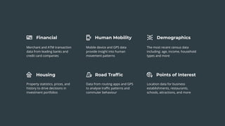
  • 10. Financial Housing Human Mobility Road Traffic Points of Interest Demographics Merchant and ATM transaction data from leading banks and credit card companies Mobile device and GPS data provide insight into human movement patterns The most recent census data including: age, income, household types and more Property statistics, prices, and history to drive decisions in investment portfolios Data from routing apps and GPS to analyse traffic patterns and commuter behaviour Location data for business establishments, restaurants, schools, attractions, and more
  • 11. CARTO — Turn Location Data into Business Outcomes The Age of Data Abundance?
  • 12. AND ITS HIDDEN PITFALLS Sampling Bias Data may not be collected using random samples, e.g. need extrapolation to the total population
  • 13. AND ITS HIDDEN PITFALLS Sampling Bias Data may not be collected using random samples, e.g. need extrapolation to the total population Anonymisation Data needs to be anonymised to meet regulations, and vendors have different approaches for that
  • 14. AND ITS HIDDEN PITFALLS Sampling Bias Data may not be collected using random samples, e.g. need extrapolation to the total population Anonymisation Data need to be anonymised to meet regulations, and vendors have different approaches for that Different Aggregations Data comes in different spatial aggregations such as grid cells of different sizes or administrative boundaries
  • 15. Financial Grid 110x110m POI Points aggregated on a 70x70m grid Demographics Census tracts
  • 17. Which spatial scale is correct? How do we change from one spatial scale to another? THE CHANGE OF SUPPORT PROBLEM Statistical downscale/upscale model to DISAGGREGATE/AGGREGATE the data at different spatial resolutions
  • 18. A PRELIMINARY SOLUTION AREA WEIGHTENING Which spatial scale is correct? How do we change from one spatial scale to another?
  • 19. Exploring the available data: CARTO DATA OBSERVATORY
  • 20. Viz using vector maps Connector to CARTO platform WHAT IS CARTOframes? ● Python package ● To be used in Jupyter Notebooks ● Built for Data Scientists ● Part of CARTO Analysis stack CARTOFrames Analysis API SQL API Python SDK
  • 27. CARTO — Turn Location Data into Business Outcomes WITH SOME CAVEATS: 1. Different variances? 2. Correlated variables? 3. Missing data? 4. When is a distance small enough? Or how to define similarity? TWIN AREA MODEL
  • 31. 1. Eigen-decomposition of the sample covariance matrix 2. Rearrange the columns in the eigenvector matrix in order of decreasing eigenvalue 3. Keep only the eigenvectors that correspond to the p-largest eigenvalues 4. Compute the principal components (PC) 5. Reconstruct the original data How many PCs? Let’s use an ensemble!
  • 33. 1. PCA can also be described as the ML solution of a probabilistic latent variable model (PPCA) 2. Find the ML estimate for the model parameters using the EM algorithm 2.1. E-step: 2.2. M-step
  • 34. Similarity Score HOW TO DEFINE SIMILARITY So far we have only computed distances in the variable space 0 1 Actually since we are computing an K-ensemble of distances... Let’s compare instead the score for each target location to the score from the mean vector data
  • 35. Takeaways CARTO Data Observatory (DO) for data enrichment CARTOframes as a connector to the DO and for powerful vector visualizations Site-planning applications require various sources of location data streams Easily derive data-driven insights when opening, relocating or consolidating location sites
  • 36. Thanks for listening! Any questions? Request a demo at CARTO.COM Giulia Carella Data Scientist // [email protected] Steve Isaac Content Marketing Manager // [email protected]