Mapping, GIS and geolocating data in Java @ JAX London
Download as odp, pdf0 likes1,047 views

Introduction to mapping, GIS and geolocation in Java. Focusing on open source Java projects which can help you.


More Related Content
What's hot (20)
Similar to Mapping, GIS and geolocating data in Java @ JAX London (20)


More from Joachim Van der Auwera (7)


Recently uploaded (20)


Mapping, GIS and geolocating data in Java @ JAX London
- 1. Mapping, GIS and Geolocating data in Java Using open source software Joachim Van der Auwera / Geosparc nv
- 3. Data and data formats
- 6. Java servers and frameworks
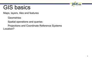
- 7. GIS basics Maps, layers, tiles and features Geometries
- 8. Spatial operations and queries
- 9. Projections and Coordinate Reference Systems Location?
- 11. Data is split
- 12. Overlays
- 13. Transparency
- 15. Data is split
- 16. Stitched together at joins
- 17. Fixed size
- 18. WMTS
- 20. Features Represents a real-world phenomenon
- 21. Has geometry, linking to location on earth
- 22. Has attributes, e.g. “maximum depth” for a lake
- 26. Polygon, multi- Usually only one type per layer Constraints on allowed shapes
- 27. Spatial queries Distance, buffers, joins, intersections
- 28. CQL, ECQL
- 29. Coordinate Reference Systems Coordinate notation
- 30. Spherical or ellipsoid approximation Which ellipsoid Origin: (Meridian, Greenwich)?
- 33. WGS84 : global, used by GPS (lat,lon) or (lon,lat) Many local variants
- 34. Projections The world is not flat
- 35. But a screen/paper is
- 36. Approximate using a sphere
- 37. Approximate using an ellipsoid
- 39. Start from a point (azimuthal)
- 40. Conical
- 41. Projections, always a compromise Conformal
- 42. Equal-area
- 43. Equidistant
- 44. e.g Mercator
- 45. Winkel Tripel
- 46. Lambert cyl
- 47. Equirectangular
- 48. Sinusoidal
- 49. Molleweide
- 50. Waterman to the rescue?
- 51. Coordinate Reference Systems EPSG database http://www.epsg-registry.org/ EPSG:4326 is WGS84 EPSG:3857 is Mercator
- 52. Google Mercator (originally 900913, then 3785, now gone?) Duplicates EPSG:4326 (lat-lon or lon-lat) urn:x-ogc:def:crs:EPSG:6.11.2:4326
- 53. WG:84
- 54. CRS, SRS, SRID Coordinate Reference System (CRS)
- 55. often expressed as Well Known Text (WKT)
- 56. SRS, Spatial Reference Code EPSG:54019 SRID, Spatial Reference ID 54019
- 58. Usually EPSG
- 59. Projecting raster images? Aereal images need corrections
- 60. Image affected by Height of camera
- 61. Projection + location (e.g. Mercator!)
- 62. Angle of photo + height of surface
- 63. Precision Precision allows aligning coordinates on a grid Can skew results on spatial operations
- 64. CRS transformations Transformations can be inaccurate as lines turn into curves
- 65. Location Where am I? In browser, HTML5, based on IP, GPS, GSM signal Where is …? Mostly through geocoder web-services Geonames (http://www.geonames.org/) Nominatim (http://nominatim.openstreetmap.org/) Google API, Mappy, Yahoo! PlaceFinder
- 66. Data and data formats OGC Standards: WMS, WFS, WMST
- 67. Raster formats: GeoTiff, JPEG2000, ...
- 68. Vector formats: GeoJSON, KML, shape, ...
- 69. Free data: OpenStreetMap, Natural Earth, local data
- 70. Open Geospatial Consortium Home to most of the GIS related standards http://www.opengeospatial.org/
- 71. WMS, Web Map Service
- 72. WFS, Web Feature Service
- 73. WMTS, Web Map Tile Service
- 74. WKT, Well Known Text
- 75. GML, Geographic Markup Language
- 76. KML, Keyhole Markup Language (Google)
- 77. SLD, Styled Layer Description
- 78. WPS, Web Processing Service
- 79. WCS, Web Coverage Service
- 80. ...
- 81. Other raster formats GeoTIFF
- 82. JPEG2000
- 84. SDTS
- 85. ECW
- 86. DTED
- 87. NITF
- 88. NASA ELAS
- 89. GRASS rasters
- 90. ESRI grid
- 91. NetCDF
- 92. ...
- 93. Other vector formats Shape file (ESRI), very common
- 94. GeoJSON
- 95. TIGER
- 96. DXF (AutoCad)
- 98. Open / free data OpenStreetMap, community built map http://www.openstreetmap.org/ Natural Earth http://www.naturalearthdata.com/ Local data
- 99. Database options Why a spatial database? Spatial operations
- 100. OGC “Simple Features for SQL” support … WHERE ST_Intersection(roads.geom, city.geom) Spatial indexes Relational PostGis
- 101. GeoDB / H2 NoSQL Neo4j
- 102. GeoCouch / CouchDB
- 105. High Performance
- 106. Data Integrity
- 107. Complete support All spatial operations
- 109. n-dimensional project PostGis version 1.5.3 site http://postgis.refractions.net/ license GPL (JDBC driver is BSD)
- 110. GeoDB Spatial H2
- 111. In-memory DB ideal for junit testing Does not support all methods, but can easily be extended project GeoDB version 0.4 site https://github.com/jdeolive/geodb/wiki license BSD-like
- 112. Neo4j NoSQL, graph database geographic features stored as graphs
- 113. Great OpenStreetMap support (import etc)
- 114. Not all spatial operations (e.g. buffer) project Neo4j spatial version 0.6 site wiki.neo4j.org/content/Neo4j_Spatial license AGPL
- 115. Java Libraries JTS
- 116. GeoTools
- 117. Hibernate Spatial
- 118. GeoToolkit
- 119. Proj4j
- 120. GeoLatte
- 121. OpenLayers ?
- 122. Google, Bing!, Yahoo! Maps ?
- 123. JTS JTS Topology Suite
- 124. Geometric model
- 125. Geometric operations
- 126. Spatial structures and algorithms
- 127. I/O capabilities WKT, WKB, GML project JTS version 1.12 site http://tsusiatsoftware.net/jts/main.html license LGPL
- 128. GeoTools GIS tools covering a wide
- 129. range of topics project GeoTools version 2.7.3 site http://www.geotools.org/ license LGPL
- 130. Many modules Referencing (CRS, transformations,...)
- 132. Rendering
- 133. Coverage (raster images in many formats)
- 134. Data access (DB, WFS, raster, shape,...) Extensions Schema
- 135. Graph
- 136. WMS client
- 138. Hibernate Spatial Spatial extension for
- 139. Hibernate
- 140. Register your data provider hibernate.dialect=org.hibernatespatial.postgis.PostgisDialect Special type for storing a Geometry @Column(name = "geom")
- 142. private Geometry geometry; Spatial queries, also using Criteria
- 143. DB support: PostGis, Oracle10i, MySQL, MSSQL, GeoDB (H2) project Hibernate Spatial version 1.1 site http://www.hibernatespatial.org/ license LGPL
- 144. GeoToolkit GIS tools covering a wide range of topics Module based Referencing
- 145. Coverage
- 146. Display (swing)
- 147. Analytics Originally a fork of (part of) GeoTools but with cleanup and refactoring, and Java6 only project GeoToolkit version 3.19 site http://www.geotoolkit.org/ license LGPL
- 148. Proj4J Java version of Proj4
- 149. CRS handling
- 150. transformations project Proj4J version 0.1 (-snapshot) site http://trac.osgeo.org/proj4j/ license MIT?
- 152. components
- 153. Modules Base: transformations, filtering, GeoJSON
- 154. Featureserver: access data through Hibernate spatial
- 155. Graph
- 156. Mapserver
- 157. Maprenderer project GeoLatte version ? site http://www.geolatte.org/ license LGPL
- 158. Notable non-Java projects OpenLayers JavaScript
- 159. Powerful
- 160. Popular Not open source Google maps / Bing / Yahoo! maps Free/open?
- 161. Data +/-
- 162. Java servers and frameworks GeoServer
- 163. Deegree
- 164. uDig
- 165. gvSig
- 166. Puzzle-GIS
- 167. OpenJUMP
- 168. GeoKettle
- 169. GeoNetwork
- 170. SEXTANTE
- 171. Geomajas
- 172. GeoServer Share and edit geospatial data
- 173. Render data to WMS
- 174. WFS interface to your data
- 175. Integrated OpenLayers as default viewing engine
- 176. Built on GeoTools
- 177. Integrate with ArcGIS, Google Maps/Earth; Yahoo! Maps, MS Virtual Earth project GeoServer version 2.1.2 site http://geoserver.org/ license GPL
- 178. project GeoServer
- 179. deegree supplies building blocks for Spatial Data Infrastructure
- 180. Implements OGC and ISO/TC 211 standards
- 181. Building blocks Web services (WMS, WFS, WPS, WCS, Gazetteer,...)
- 182. iGeoPortal
- 183. iGeoSecurity
- 184. iGeo3D
- 185. iGeoDesktop project deegree version 3.0.4 Celcius site http://www.deegree.org/ license LGPL
- 186. project deegree
- 187. uDig Desktop GIS
- 188. Based on Eclipse RCP, JTS, GeoTools
- 189. View, edit and print GIS data
- 190. Can be extended/customized using plug-ins Jgrass, Eurobios, DEWS project uDig version 1.2.2 site http://udig.refractions.net/ license LGPL
- 191. project uDIG
- 192. gvSig Desktop GIS
- 193. Same view local and remote
- 195. Extensible
- 196. GvSig Mobile
- 197. Remote sensing
- 198. 3D support project gvSig version 1.11 site http://www.gvsig.org/ license GPL
- 199. project gvSIG
- 201. Based on NetBeans platform
- 202. and GeoToolkit
- 203. Multi-screen, multi-project at same time
- 204. Clear separation source/map/view project Puzzle-GIS version .07 site http://puzzle-gis.codehaus.org/ license LGPL
- 205. project Puzzle-GIS
- 206. OpenJUMP Desktop GIS
- 207. Save, edit-analyze GIS data
- 208. Flexible plug-ins project OpenJUMP version 1.4.2 site http://www.openjump.org/ license GPL
- 209. project OpenJUMP
- 210. GeoKettle Spatial extension of Kettle
- 212. ETL tool, build spatial
- 213. data warehouse
- 214. Builds on GeoMondrian, spatial extension of Mondrian
- 215. Extract also from spatial data sources
- 216. Transform also spatial operations (project, geocode,...) project GeoKettle version 2.0 site www.spatialytics.org/projects/geokettle/ license LGPL
- 217. project GeoKettle
- 218. GeoNetwork Catalog application to manage spatial resources
- 219. Metadata editing
- 220. Search functions
- 221. Embeds GeoServer (optional) project GeoNetwork version 2.6.4 site http://geonetwork-opensource.org/ license GPL
- 222. project GeoNetwork
- 223. SEXTANTE Spatial data analysis library
- 225. raster and vector data processing
- 226. Graphical components to run and use those algorithms Including graphical modeler Integrates with many GIS tools gvSig, OpenJUMP, uDIG Split of from gvSig project SEXTANTE version 0.6 site http://sextante.forge.osor.eu/ license MIT
- 227. project SEXTANTE
- 228. project SEXTANTE
- 229. Geomajas Integrate, transform and secure GIS data
- 230. (web) application framework / Spatial Application Server
- 231. Built on GeoTools, JTS, Spring, GWT, Hibernate Spatial
- 232. Faces for front-end/clients GWT, SmartGWT, GeoJSON Generic layers for data access WMS, WFS, GeoTools data source, Hibernate Spatial Plug-ins for extension Caching and rasterization, printing/PDF, security services, geocoder project Geomajas version 1.9.0 site http://www.geomajas.org/ license AGPL
- 233. project Geomajas
- 234. Thin client
- 235. Server for heavy-lifting Allows security
- 236. Data transformation
- 237. Integration with back-end processes project Geomajas
- 238. project Geomajas
- 239. Q & A Joachim Van der Auwera http://blog.progs.be/ Geosparc [email_address] @joachimvda http://geosparc.com/