SC7 Workshop 3: Big Data Initiatives in the Space & Security domainBigData_Europe
The document discusses the European Union Satellite Centre's initiatives relating to big data and space security. It outlines four research projects the centre is involved in: BigDataEurope, EVER-EST, NextGEOSS, and BETTER. The projects aim to develop solutions for improved access and processing of earth observation and other complex datasets. The centre is implementing pilot programs within each project focused on space and security issues. The goals are to enhance capabilities through better exploitation of data and application of techniques like machine learning.
SC7 Workshop 3: Big Data and Secure SocietiesBigData_Europe
The European Union Satellite Centre provides geospatial intelligence services and analyzes earth observation data to support EU policymaking and operations. With increasing amounts of data from new satellite constellations and sources like social media, the Centre aims to use big data and artificial intelligence techniques like machine learning and computer vision to automate analysis and improve detection of irregular activities. Adapting workflows to leverage big data, GIS, and partnerships will help the Centre meet growing demands and support security and humanitarian goals.
This document contains an agenda for a workshop on Big Data in Secure Societies. The workshop will bring together stakeholders from the European Commission, EU agencies, space organizations, and private companies to discuss big data needs and challenges in security domains. It will also present outcomes from the BigDataEurope project, including a pilot on using big data for secure societies. The day-long workshop will include presentations on big data and security, space data for secure societies, and initiatives in applying big data to space and security issues. There will also be a session for questions and discussion. The goal is to help build a community around applying big data and new technologies to security problems.
SC7 Workshop 2: Industry view of Big Data Challenges for Secure SocietiesBigData_Europe
This document summarizes Geoff Sawyer's presentation on big data challenges for secure societies from an industry perspective. It provides information about EARSC, a network of commercial remote sensing companies in Europe. EARSC envisions establishing a European Marketplace Alliance for Earth Observation Services (MAEOS) to help overcome fragmentation in the European industry and enable companies to develop business globally. MAEOS would provide services like a common identity, governance policies, and market support. An operational marketplace called EOMall could also be established under MAEOS to facilitate transactions between buyers and sellers.
SC7 Workshop 2: Space Data for Secure SocietiesBigData_Europe
The document provides information about the Copernicus program, which is the European Union's Earth observation program. It summarizes the six Copernicus services that use Earth observation data to deliver information. It then describes some of the Copernicus satellites, including Sentinel-1, Sentinel-2, and Sentinel-3, and discusses how Sentinel data is accessed. Finally, it addresses some of the challenges around big data and moving towards the Copernicus Data and Information Access Service (DIAS) to improve access to Copernicus data and information.
Big Data Europe at eHealth Week 2017: Linking Big Data in HealthBigData_Europe
Of the four V's of big data – Volume, Velocity, Variety and Veracity – the most challenging for the health sector is Variety. Health data comes from many sources, formats and standards – how can we bring these together to reap the benefits of big data technologies?
Big Data Europe is tackling this challenge head-on, building a big data infrastructure flexible enough to tackle all seven Societal Challenges identified by Horizon 2020. Here we demonstrate our pilot implementation of Open PHACTS, which integrates life science data for drug discovery.
12 May 2017
BDE Webinar: SC6 - EUROPE IN A CHANGING WORLD -INCLUSIVE, INNOVATIVE AND REFL...BigData_Europe
BIG DATA EUROPE WEBINAR: SC6 - EUROPE IN A CHANGING WORLD -INCLUSIVE, INNOVATIVE AND REFLECTIVE SOCIETIES: NEW GENERAL DATA PROTECTION REGULATION ADOPTED. 25.05.2016, 15.00PM CEST –16.00PM CEST by VIGDIS KVALHEIM (CESSDA, DEPUTY DIRECTOR, NSD).
Big Data Europe Introduction Ivana IlijasicVersic (CESSDA) and Martin Kaltenböck (SWC).
BDE Technical Webinar 1 : Pilot InstantiationBigData_Europe
This document describes 7 pilots for addressing societal challenges through big data projects. The first pilot focuses on linking and integrating pharmaceutical research data for life sciences. The second pilot aims to support advanced crop data discovery, processing, and visualization for food and agriculture. The third pilot focuses on real-time turbine monitoring, stream processing and analytics for energy production monitoring. Further pilots address data integration for transport planning, supporting climate data research, integrating budget data for social sciences, and detecting man-made changes using remote sensing and social data for security applications.
BDE SC4 Hangout - Simon Scerri, IntroductionBigData_Europe
The document summarizes a transport pilot project within the Big Data Europe initiative. The project aims to utilize real-time probe data from multiple sources to provide accurate transportation information and advanced planning services to address congestion issues in Thessaloniki, Greece. Specifically, the pilot will collect mobility data from various sources to identify mobility patterns and inform citizens about traffic conditions. The data will be integrated and processed in real-time to provide up-to-date information mobility services. The Fraunhofer Society, CERTH, and ERTICO organizations are collaborating on the pilot to demonstrate the societal value of big data in the transport domain.
4th RDA Europe Science Workshop - The e-ROSA projecte-ROSA
The document discusses eROSA, a project that received EU funding to develop a roadmap for an e-infrastructure for open science in agriculture. It aims to illustrate the value of a virtual research environment for the agricultural domain through the Aginfra+ project. The document outlines the different types of agricultural data that exist, challenges around data silos and access, and varying levels of data practices maturity. It proposes some initial resources and services that could be included in an e-infrastructure, focusing on semantics. It emphasizes sustainability and governance models. The overall goal is to facilitate open sharing of agricultural data and knowledge through standardized e-infrastructure tools and services.
Sshoc kick off meeting - 1.2.3 EOSC board - Social Sciences and Humanities Op...SSHOC
This document discusses the Social Sciences & Humanities Open Cloud (SSHOC) and its role within the European Open Science Cloud (EOSC). It notes that an integrated approach is needed to research data infrastructures that goes beyond individual layers and national/disciplinary silos. The goal of EOSC is to provide a virtual environment for storage, management, analysis and reuse of research data across borders and disciplines. EOSC aims to federate existing initiatives within a single, consolidated platform. The document outlines the EC policy and governance structure behind EOSC, as well as related projects that have received funding. It discusses how SSHOC could be seamlessly integrated within EOSC and the expected impacts, including increased availability of
Snap4City November 2019 Course: Smart City IOT Data AnalyticsPaolo Nesi
• Data Analytics: Examples from Snap4City
o Smart parking: Predictions
o User Behavior Analysis, via Wi-Fi, OD, Trajectories
o Recognition of Used Transportation means
o Traffic Flow Reconstruction, from Traffic Sensors Data
o Quality of Public Transport Service
o Origin Destination Matrices from: Wi-Fi, Mobile Apps, etc.
o Demand of Mobility vs Offer of Transportation
o Modal and Multimodal Routing for Navigation and Travel Planning
o Environmental Data Analysis and Predictions, early Warning
o Prediction of Air Quality Conditions
o Anomaly Detection
o What-IF Analysis
• Data Analytics: Enforcing and Exploiting
o Real Time Data Analytics: using R Studio Exploitation in IOT Applications
• Decision Support Systems, Smart DS and Resilience DS
• Twitter Vigilance: Social Media Analysis: Early Warning, Predictions
The document discusses open data and its impacts. It notes that open data must be freely accessible, in reusable formats, and under an open license. Open data can impact politics, society, and the economy by enabling open innovation and business opportunities. Implementing an open data policy faces challenges regarding policy, regulation, capacity, and technology. The Open Data Charter provides principles for open data policies. OpenDataSoft is a company that helps make data scale and create value through visualizations, APIs, and enabling data reuse. It discusses using open data in areas like transportation, smart cities, and performance management.
Join us for an exciting session where you can explore the future of open-source technology and innovation projects based on FIWARE and supported by FIWARE team. Our experts will share their insights on how FIWARE standards and components are revolutionizing the tech industry. Attendees will have the opportunity to hear from a variety of presenters showcasing ongoing projects that leverage FIWARE. From dynamic digital twins to satellite open data for smart cities, to boosting EU high-value datasets, this session will provide a glimpse into the exciting possibilities of FIWARE technology. Don't miss out on this chance to learn about the latest innovation and collaborate with like-minded professionals!
OpenTransportNet: Stimulating Innovation with Open Geographic Information21cConsultancy_2012
1) The document discusses OpenTransportNet (OTN), a European project that aims to stimulate business innovation and enhance public services by improving access to open geographic information.
2) In its first year, OTN worked to create an INSPIRE-compliant data model for transport networks and expose aggregated and harmonized transport data through virtual service hubs.
3) OTN addresses challenges of disharmonized and scattered data by bringing together spatial, dynamic, and non-spatial data sources and using techniques like metadata catalogues, data visualization tools, and privacy controls.
Snap4City November 2019 Course: Smart City IOT Data Ingestion Interoperabilit...Paolo Nesi
• Data Ingestion Capabilities
• Data Ingestion Strategy
• Setting Up the Road Graph on Knowledge Base
• Data Set Load via Data Gate (plus how to load triples into Knowledge base)
• Data Ingestion and Transformation via ETL Processes
• Data Ingestion via IOT Brokers
• IOT Network: recall of basic concepts
• IOT Directory
• IOT Devices and IOT Brokers Registration
• Data Ingestion via IOT Applications
• Data Ingestion from API, External Services, Custom MicroServices
• Data Ingestion via Web Scraping
• Data Streams from Smart City API, participatory
• Data Streams from Mobile Devices
• Data Streams from Dashboards
• GIS Data Import and Export
• Social Media data collection and exploitation
• Acknowledgements
F. Altarocca, F. Amato, F. Brogi, M. Bruno, E. Cerasti, S. Causo, F. De Fausti, B. Guardabascio, P. Pizzo, M. Scannapieco, D. Zardetto,
5 maggio 2021 - towards trusted smart statistics
This document discusses Earth observation exploitation platforms from a business perspective. It outlines the context of data spaces and exploitation platforms in Earth observation. It then discusses the business perspectives of a platform provider and user. For providers, it notes the opportunity to build platforms through 2-3 year contracts, but also barriers around legal issues, costs of moving to cloud/platform models, and maturity of the ecosystem. For users, it discusses barriers of legal deficiencies, financial costs, and trust in transferring data to external platforms, but also opportunities to finance developing new platform capabilities.
Technical article reproduced with permission from Transportation Professional - the magazine of the Chartered Institution of Highways & Transportation
www.ciht.org.uk/en/knowledge/publications/transportation-professional/index.cfm
Ontology Building vs Data Harvesting and Cleaning for Smart-city ServicesPaolo Nesi
Presently, a very large number of public and private data sets are available around the local governments. In most cases, they are not semantically interoperable and a huge human effort is needed to create integrated ontologies and knowledge base for smart city. Smart City ontology is not yet standardized, and a lot of research work is needed to identify models that can easily support the data reconciliation, the management of the complexity and reasoning. In this paper, a system for data ingestion and reconciliation of smart cities related aspects as road graph, services available on the roads, traffic sensors etc., is proposed. The system allows managing a big volume of data coming from a variety of sources considering both static and dynamic data. These data are mapped to smart-city ontology and stored into an RDF-Store where they are available for applications via SPARQL queries to provide new services to the users. The paper presents the process adopted to produce the ontology and the knowledge base and the mechanisms adopted for the verification, reconciliation and validation. Some examples about the possible usage of the coherent knowledge base produced are also offered and are accessible from the RDF-Store and related services. The article also presented the work performed about reconciliation algorithms and their comparative assessment and selection. Keywords Smart city, knowledge base construction, reconciliation, validation and verification of knowledge base, smart city ontology, linked open graph.
Slide presentations developed to demonstrate how Information and Communication Technologies (ICTs) be used to address climate change, and why ICTs are a crucial part of the solution – i.e. in promoting efficiency, Green Growth & sustainable development, in dealing with climate change and for climate and environmental action. These slide presentations were delivered in February 2011 in Seongnam, near Seoul in Korea.
These presentations were developed and delivered over 2.5 days on the occasion of a Regional Training of Trainers Workshop for upcoming Academy modules on ICT for Disaster Risk Management and Climate Change Abatement. These modules were developed as part of the Academy of ICT Essentials for Government leaders developed by the United Nations (UN) Asia Pacific Centre for ICT Training (APCICT), based in Songdo City, in the Republic of South Korea.
These presentations were developed in 2011, and are somewhat out of date, but most of the principles still apply. Module 10, which has been published, does not include much of the information outlined in these presentations, which are fairly technical. They were developed to address a significant gap in understanding of the technical basis of using ICTs for climate action and because there is a clear bias in development circles against the importance of dealing with climate change mitigation in developing countries. These presentations are an attempt to redress this lack and are published here with this purpose in mind.
The author, Richard Labelle, is presently working on updating these presentations to further highlight the importance of addressing climate change and the important role that technology including ICTs, play in this effort.
Programme on Climate Information for Resilient Development in AfricaUNDP Climate
The NAP-Ag webinar on The Role of Climate Information Services in Adaptation Planning for Agriculture provided insights into the role of Climate Information Services (CIS) in planning for adaptation in agricultural sectors.
Case study: Programme on Climate Information for Resilient Development in Afr...ExternalEvents
http://www.fao.org/in-action/naps/resources/webinars/en/
The NAP-Ag webinar on Climate Information Services in Adaptation Planning for Agriculture will provide insights into the role of Climate Information Services (CIS) in planning for adaptation in agricultural sectors. Country case studies and extended exploration of best practices will create a strong learning environment for country-to-country exchange on institutional arrangements, and gaps in Climate Information Services for the implementation and formulation of National Adaptation Plans. This webinar is a follow up to the March 2017 peer-to-peer exchange on “Effective Climate Information Services for Agriculture in ASEAN.”
A Smart City Development kit for designing Web and Mobile AppsPaolo Nesi
Presentation of some of the Km4City development tools: ServiceMap and App Development Kit, ADK.
ServiceMap is focused on providing information to the developers, to help them learning how to access to the data model, to exploit and use the API
ADK is a drafted modular web and mobile application based on HTML5 and JavaScript (apache Cordova) that can be used to exploit Smart City API to develop a large range of applications.
It is modular, flexible, etc. and allow performing users behavior analysis.
The solutions are currently in use on several EC and national Projects such as: Sii-Mobility, RESOLUTE, REPLICATE, Weee, …
Cities aims at providing new Smart Services to city users:
operators, final users, etc.
In most cases via Web and Mobile Apps which exploit data:
Structural data, open data, real time data, etc., private data from companies
to be aggregated and transformed in services (providing: prediction, information, early warning, relations)
at reasonable cost for: developers, operators, and SME to realize new Apps and services.
If cost is not affordable, Services and Apps are not developed, in most cases the Apps are also provided for free, so that high costs are not sustainable Public Private Partnership
Scenarious vs SmartCity API
Search data: by text, near, along, etc...
Resolving text to GPS and formal city nodes model
Empowering the city users
Access to event information
Supporting City Users in using Public Mobility
Supporting City Users in using Private Mobility
New Experience to access at Cultural and Touristic info
New way to access at health services
Access at Environmental information
Profiled Suggestions to City Users
Personal Assistant
Sharing knowledge among cities
ServiceMap tool
with Km4City are substantially a Smart City Expert System, SCES
includes the Smart City API
is a for developers to: search and browse on Smart City Knowledge, also to generate examples of the Smart City API call to be used in the development of Web and Mobile Apps
The IEEE Smart World Congress originated from the 2005 Workshop on Ubiquitous Smart Worlds (USW, Taipei) and the 2005 Symposium on Ubiquitous Intelligence and Smart World (UISW, Nagasaki). SmartWorld 2017 in San Francisco is the next edition after the successful SmartWorld 2016 in Toulouse France and SmartWorld 2015 in Beijing China. SmartWorld 2017 is to provide a high-profile, leading-edge platform for researchers and engineers to exchange and explore state-of-art advances and innovations in graceful integrations of Cyber, Physical, Social, and Thinking Worlds for the theme
http://ieee-smartworld.org/2017/smartworld/
BigDataEurope: Project Introduction @ Year #1 WorkshopsBigData_Europe
An overview of the BDE project's objective, as presented in the introduction (with some variations) in each of the 1st Year series of workshops (seven: one per societal challenge).
Workshop #1 Year Schedule available at: http://www.big-data-europe.eu/first-round-of-bigdataeurope-workshops-announced/
A presentation by Neil Frost (Chief Executive Officer: iSAHA), at the Transport Forum SIG: "Cost Effective Public Transport Management Systems" on 12 May 2016 hosted by University of Johannesburg. The theme of the presentation was: "Big Data and Public Transport."
BDE-SC1 Webinar: OpenPHACTS Re-engineered with Big Data EuropeBigData_Europe
Watch this webinar on YouTube: https://youtu.be/MwG0yhrctDs
Slides for the latest update on our Big Data Europe pilot in Societal Challenge 1: Health, Demographic Change and Wellbeing.
Last year we successfully completed the first phase of this pilot, replicating the functionality of the Open PHACTS Discovery Platform on the BDE infrastructure. The Open PHACTS Discovery Platform brings together pharmacological data resources in an integrated, interoperable infrastructure, and has been developed to reduce barriers to drug discovery for industry, academia, and small businesses.
Learn more about the progress we’ve made, and what’s coming next.
1. General overview of the Big Data Europe project and Societal Challenges it addresses (Ronald Siebes, VU Amsterdam)
2. The Big Data Europe infrastructure, generic components that are being developed, and their flexibility for different applications (Hajira Jabeen, University of Bonn)
3. Latest details of the current state of the Open PHACTS architecture in BDE, and ongoing work (Nick Lynch, CTO, Open PHACTS Foundation)
A glimpse at the ICARUS policy perspectives provided during the European Big Data Value Forum 2018, BDVA Workshop 2.3 "Policy issues, opportunities and barriers in big data-driven transport", on November 14th, 2018, in Vienna
The use of Digital Tools and Geoinformation for Developmentbfnd
This document provides an overview of ICT4D (Information and Communication Technologies for Development) and how technology and geospatial information can support development efforts. It discusses the history and definition of ICT4D, examples of ICT4D tools and applications in various sectors like health, finance, agriculture, and humanitarian response. The document also outlines challenges in ICT4D project implementation and lessons learned from Gnucoop's experience with geospatial technologies on projects in Malawi, Jordan, and Haiti. It concludes with suggestions for a successful ICT4D project and considerations for the future of the field.
Luigi Selmi - The Big Data Integrator PlatformBigData_Europe
The document discusses the SC4 pilot project, which aims to build a scalable and fault-tolerant platform for processing large datasets using open source frameworks. The platform utilizes a microservices architecture and processes real-time floating car data for tasks like map matching and short-term traffic forecasting using algorithms like feedforward artificial neural networks. It also discusses how semantic technologies from projects like SANSA-Stack and LinkedGeoData could enable additional use cases for the SC4 platform.
Josep Maria Salanova - Introduction to BDE+SC4BigData_Europe
The BigDataEurope project aims to empower mobility management with big data. It has developed a modular platform that allows end-users to easily deploy functionality in their own systems using Docker containers. The platform is being tested through 7 pilot projects aligned with European societal challenges related to data-driven solutions. One pilot focuses on transport in Thessaloniki, Greece, using GPS, Bluetooth, and other probe data to improve map matching and mobility pattern recognition and forecasting to better manage traffic. The project coordinators are available for any questions.
The LeMO project aims to leverage big data to manage transport operations. It will identify issues around effective data mining and exploitation in transportation. The project will analyze barriers and opportunities for using big data in transport. It will also design recommendations for research and policy regarding big data in transport. The project involves 5 partners from 5 countries and will run from 2017 to 2020. It seeks to produce a roadmap for data collection, sharing, and exploitation to support European transport stakeholders. The project will study big data in transport through case studies focusing on issues like infrastructure innovation, transport efficiency, and data protection. It expects its recommendations and roadmap to help policymakers and industry better utilize big data.
Big Data Europe SC6 WS #3: PILOT SC6: CITIZEN BUDGET ON MUNICIPAL LEVEL, Mart...BigData_Europe
This document describes a pilot project that aims to create an online dashboard of municipal budget and spending data from multiple European cities. The project will harvest, link, analyze and visualize open budget data to make it more useful for citizens, researchers and decision makers. Data will be integrated from Athens, Thessaloniki and Kalamaria in Greece initially, and potentially Vienna, Linz and Barcelona. The technical architecture uses Apache tools like Flume, Kafka and Spark to ingest, store and analyze the heterogeneous data sources in real-time. The goal is to evaluate how a big data approach can provide new insights into public finances from an integrated, multilingual and longitudinal perspective.
Big Data Europe SC6 WS #3: Big Data Europe Platform: Apps, challenges, goals ...BigData_Europe
This document discusses Big Data Europe (BDE), an open source big data platform. It provides an overview of BDE's goals, architecture, and applications. The key points are:
1) BDE's goals are to make it easy to install, develop for, deploy, and integrate big data applications. It aims to unlock the value of data through an open platform.
2) BDE supports a variety of frameworks and uses Docker to package components. Its architecture includes layers for resources, data, processing, and applications.
3) BDE is being applied to challenges in domains like health, transport, energy, and security. Examples analyze traffic patterns, perform predictive maintenance, and detect changes in infrastructure
Big Data Europe SC6 WS 3: Where we are and are going for Big Data in OpenScie...BigData_Europe
Where we are and are going for Big Data in OpenScience
Keynote talk at the Big Data Europe SC6 Workshop on 11.9.2017 in Amsterdam co-located with SEMANTiCS2017: The perspective of European official statistics by Fernando Reis, Task-Force Big Data, European Commission (Eurostat).
Big Data Europe SC6 WS 3: Ron Dekker, Director CESSDA European Open Science A...BigData_Europe
Slides for keynote talk at the Big Data Europe workshop nr 3 on 11.9.2017 in Amsterdam co-located with SEMANTiCS2017 conference by Ron Dekker, Director CESSDA: European Open Science Agenda: where we are and where we are going?
Big Data Europe: SC6 Workshop 3: The European Research Data Landscape: Opport...BigData_Europe
Slides of the keynote at the 3rd Big Data Europe SC6 Workshop co-located at SEMANTiCS2018 in Amsterdam (NL) on: The European Research Data Landscape: Opportunities for CESSDA by Peter Doorn, Director DANS, Chair, Science Europe W.G. on Research Data. Chair, CESSDA ERIC General Assembly
The BigDataEurope 3rd Workshop took place on November 28, 2017 in Amsterdam. The workshop focused on learning about current and future data management challenges, Big Data tools, and the Open Big Data Platform. The agenda included talks on EU priorities on energy and digitalization, asset management and Big Data in wind energy, the BDE Open Platform, and system monitoring case studies. There was also a roundtable discussion on future data needs, the BDE platform, and research opportunities.
BDE SC3.3 Workshop - Data management in WT testing and monitoring BigData_Europe
Aresse Engineering is a company that provides engineering services including data acquisition, analysis, and monitoring for industries like wind energy. They have grown from 9 engineers in 2007 to over 20 staff members today. To address challenges of big data, Aresse developed tools like XDAS for acquisition, Hivex for data transfer, and a cloud platform called Hive for storage, analysis, and visualization of data. These tools allow customers to access massive amounts of synchronized measurement data. Machine learning and physical models are areas of ongoing development to enhance data quality.
BDE SC3.3 Workshop - Options for Wind Farm performance assessment and Power f...BigData_Europe
Options for Wind Farm performance assessment and Power forecasting (Mr. A. Kyritsis, ALTSOL/TERNA) at the BigDataEurope Workshop, Amsterdam, Novermber 2017.
Big Data Europe: Workshop 3 SC6 Social Science: THE IMPORTANCE OF METADATA & ...BigData_Europe
Big Data Europe: Workshop 3 SC6 Social Science - 11.09.2017 in Amsterdam, co-located with SEMANTiCS2017 titled: THE IMPORTANCE OF METADATA & BIG DATA IN OPEN SCIENCE. Slides by Ivana Versic (Cessda) and Martin Kaltenböck (SWC)
This document summarizes the MIDAS project, which is funded by the European Union to develop a platform using big data to support public health policies. The key points are:
1) MIDAS has received top funding scores and will receive €4.5 million over 40 months. It involves universities, technical partners, and policy boards across Europe.
2) The project aims to improve public health policies across Europe by facilitating analysis of diverse health datasets using its platform. This could lead to more effective policies and citizen benefits.
3) MIDAS will develop a secure data integration and analysis platform, with visualization tools to help policymakers. It will gather data from various sources to inform policy creation and evaluation
Linux Support for SMARC: How Toradex Empowers Embedded DevelopersToradex
Toradex brings robust Linux support to SMARC (Smart Mobility Architecture), ensuring high performance and long-term reliability for embedded applications. Here’s how:
• Optimized Torizon OS & Yocto Support – Toradex provides Torizon OS, a Debian-based easy-to-use platform, and Yocto BSPs for customized Linux images on SMARC modules.
• Seamless Integration with i.MX 8M Plus and i.MX 95 – Toradex SMARC solutions leverage NXP’s i.MX 8 M Plus and i.MX 95 SoCs, delivering power efficiency and AI-ready performance.
• Secure and Reliable – With Secure Boot, over-the-air (OTA) updates, and LTS kernel support, Toradex ensures industrial-grade security and longevity.
• Containerized Workflows for AI & IoT – Support for Docker, ROS, and real-time Linux enables scalable AI, ML, and IoT applications.
• Strong Ecosystem & Developer Support – Toradex offers comprehensive documentation, developer tools, and dedicated support, accelerating time-to-market.
With Toradex’s Linux support for SMARC, developers get a scalable, secure, and high-performance solution for industrial, medical, and AI-driven applications.
Do you have a specific project or application in mind where you're considering SMARC? We can help with Free Compatibility Check and help you with quick time-to-market
For more information: https://www.toradex.com/computer-on-modules/smarc-arm-family
Massive Power Outage Hits Spain, Portugal, and France: Causes, Impact, and On...Aqusag Technologies
In late April 2025, a significant portion of Europe, particularly Spain, Portugal, and parts of southern France, experienced widespread, rolling power outages that continue to affect millions of residents, businesses, and infrastructure systems.
Mobile App Development Company in Saudi ArabiaSteve Jonas
EmizenTech is a globally recognized software development company, proudly serving businesses since 2013. With over 11+ years of industry experience and a team of 200+ skilled professionals, we have successfully delivered 1200+ projects across various sectors. As a leading Mobile App Development Company In Saudi Arabia we offer end-to-end solutions for iOS, Android, and cross-platform applications. Our apps are known for their user-friendly interfaces, scalability, high performance, and strong security features. We tailor each mobile application to meet the unique needs of different industries, ensuring a seamless user experience. EmizenTech is committed to turning your vision into a powerful digital product that drives growth, innovation, and long-term success in the competitive mobile landscape of Saudi Arabia.
Spark is a powerhouse for large datasets, but when it comes to smaller data workloads, its overhead can sometimes slow things down. What if you could achieve high performance and efficiency without the need for Spark?
At S&P Global Commodity Insights, having a complete view of global energy and commodities markets enables customers to make data-driven decisions with confidence and create long-term, sustainable value. 🌍
Explore delta-rs + CDC and how these open-source innovations power lightweight, high-performance data applications beyond Spark! 🚀
AI EngineHost Review: Revolutionary USA Datacenter-Based Hosting with NVIDIA ...SOFTTECHHUB
I started my online journey with several hosting services before stumbling upon Ai EngineHost. At first, the idea of paying one fee and getting lifetime access seemed too good to pass up. The platform is built on reliable US-based servers, ensuring your projects run at high speeds and remain safe. Let me take you step by step through its benefits and features as I explain why this hosting solution is a perfect fit for digital entrepreneurs.
Procurement Insights Cost To Value Guide.pptxJon Hansen
Procurement Insights integrated Historic Procurement Industry Archives, serves as a powerful complement — not a competitor — to other procurement industry firms. It fills critical gaps in depth, agility, and contextual insight that most traditional analyst and association models overlook.
Learn more about this value- driven proprietary service offering here.
Dev Dives: Automate and orchestrate your processes with UiPath MaestroUiPathCommunity
This session is designed to equip developers with the skills needed to build mission-critical, end-to-end processes that seamlessly orchestrate agents, people, and robots.
📕 Here's what you can expect:
- Modeling: Build end-to-end processes using BPMN.
- Implementing: Integrate agentic tasks, RPA, APIs, and advanced decisioning into processes.
- Operating: Control process instances with rewind, replay, pause, and stop functions.
- Monitoring: Use dashboards and embedded analytics for real-time insights into process instances.
This webinar is a must-attend for developers looking to enhance their agentic automation skills and orchestrate robust, mission-critical processes.
👨🏫 Speaker:
Andrei Vintila, Principal Product Manager @UiPath
This session streamed live on April 29, 2025, 16:00 CET.
Check out all our upcoming Dev Dives sessions at https://community.uipath.com/dev-dives-automation-developer-2025/.
Big Data Analytics Quick Research Guide by Arthur MorganArthur Morgan
This is a Quick Research Guide (QRG).
QRGs include the following:
- A brief, high-level overview of the QRG topic.
- A milestone timeline for the QRG topic.
- Links to various free online resource materials to provide a deeper dive into the QRG topic.
- Conclusion and a recommendation for at least two books available in the SJPL system on the QRG topic.
QRGs planned for the series:
- Artificial Intelligence QRG
- Quantum Computing QRG
- Big Data Analytics QRG
- Spacecraft Guidance, Navigation & Control QRG (coming 2026)
- UK Home Computing & The Birth of ARM QRG (coming 2027)
Any questions or comments?
- Please contact Arthur Morgan at [email protected].
100% human made.
Technology Trends in 2025: AI and Big Data AnalyticsInData Labs
At InData Labs, we have been keeping an ear to the ground, looking out for AI-enabled digital transformation trends coming our way in 2025. Our report will provide a look into the technology landscape of the future, including:
-Artificial Intelligence Market Overview
-Strategies for AI Adoption in 2025
-Anticipated drivers of AI adoption and transformative technologies
-Benefits of AI and Big data for your business
-Tips on how to prepare your business for innovation
-AI and data privacy: Strategies for securing data privacy in AI models, etc.
Download your free copy nowand implement the key findings to improve your business.
Noah Loul Shares 5 Steps to Implement AI Agents for Maximum Business Efficien...Noah Loul
Artificial intelligence is changing how businesses operate. Companies are using AI agents to automate tasks, reduce time spent on repetitive work, and focus more on high-value activities. Noah Loul, an AI strategist and entrepreneur, has helped dozens of companies streamline their operations using smart automation. He believes AI agents aren't just tools—they're workers that take on repeatable tasks so your human team can focus on what matters. If you want to reduce time waste and increase output, AI agents are the next move.
Complete Guide to Advanced Logistics Management Software in Riyadh.pdfSoftware Company
Explore the benefits and features of advanced logistics management software for businesses in Riyadh. This guide delves into the latest technologies, from real-time tracking and route optimization to warehouse management and inventory control, helping businesses streamline their logistics operations and reduce costs. Learn how implementing the right software solution can enhance efficiency, improve customer satisfaction, and provide a competitive edge in the growing logistics sector of Riyadh.
TrsLabs - Fintech Product & Business ConsultingTrs Labs
Hybrid Growth Mandate Model with TrsLabs
Strategic Investments, Inorganic Growth, Business Model Pivoting are critical activities that business don't do/change everyday. In cases like this, it may benefit your business to choose a temporary external consultant.
An unbiased plan driven by clearcut deliverables, market dynamics and without the influence of your internal office equations empower business leaders to make right choices.
Getting things done within a budget within a timeframe is key to Growing Business - No matter whether you are a start-up or a big company
Talk to us & Unlock the competitive advantage
What is Model Context Protocol(MCP) - The new technology for communication bw...Vishnu Singh Chundawat
The MCP (Model Context Protocol) is a framework designed to manage context and interaction within complex systems. This SlideShare presentation will provide a detailed overview of the MCP Model, its applications, and how it plays a crucial role in improving communication and decision-making in distributed systems. We will explore the key concepts behind the protocol, including the importance of context, data management, and how this model enhances system adaptability and responsiveness. Ideal for software developers, system architects, and IT professionals, this presentation will offer valuable insights into how the MCP Model can streamline workflows, improve efficiency, and create more intuitive systems for a wide range of use cases.
Enhancing ICU Intelligence: How Our Functional Testing Enabled a Healthcare I...Impelsys Inc.
Impelsys provided a robust testing solution, leveraging a risk-based and requirement-mapped approach to validate ICU Connect and CritiXpert. A well-defined test suite was developed to assess data communication, clinical data collection, transformation, and visualization across integrated devices.
SAP Modernization: Maximizing the Value of Your SAP S/4HANA Migration.pdfPrecisely
SC7 Workshop 3: Space-based applications and Big Data
1. Antonino Coppola | 13/07/2016 | Slide 1ESA UNCLASSIFIED - For Official Use
European Space Agency
ESA Business Applications
→ SPACE IS OPEN FOR BUSINESS
Space-based applications and Big Data
Big Data in Secure Societies – 3rd Workshop, October 3rd 2017
Rita Rinaldo
[email protected]
Directorate of Telecommunication and Integrated Applications
2. Antonino Coppola | 13/07/2016 | Slide 2ESA UNCLASSIFIED - For Official Use
Aviation & RPAS
Education & Development
Energy
Environmental
Resource
Management
Finance,
Investment &
Insurance
Food &
Agriculture
Health
Infrastructures &
Smart Cities
Maritime &
Offshore
Media &
Broadcasting
Safety &
Security
Tourism
Transport & Logistics
≈300 projects
ARTES
Applications
> 300 activities
473 entities
26 countries
ESA Business Applications: thematic areas
Big Data in Secure Societies
3. Antonino Coppola | 13/07/2016 | Slide 3ESA UNCLASSIFIED - For Official Use
ESA Business Applications:
Big Data for Secure Societies
1.Big data applications to boost preparedness and
response to migration
2.High Altitude Platforms (HAPS) applications
3.Big Data for monitoring and protection of critical
infrastructure
4.Big Data for Safety of Transport (e.g. aeronautical,
maritime)
4. Antonino Coppola | 13/07/2016 | Slide 4ESA UNCLASSIFIED - For Official Use
Big Data for Migration: Background
Europe is being confronted with the most significant influxes of
migrants and refugees in its history.
One burning issue is the lack of timely information on migration
trends, flows and rates.
Big data applications have been recognized as a potentially powerful
tool to provide direct and indirect indicators of migration trends.
ESA’s IAP is preparing an invitation to tender of the feasibility study
“Big data applications to boost preparedness and response to
migration".
Europe is being confronted with the most significant influxes of
migrants and refugees in its history.
One burning issue is the lack of timely information on migration
trends, flows and rates.
In September 2016, ESA’s IAP has the “Big data
applications to boost preparedness and response to
migration“ invitation to tender.
5. Antonino Coppola | 13/07/2016 | Slide 5ESA UNCLASSIFIED - For Official Use
Feasibility study overview
Objectives:
Assess if and how space technology combined with big data can
support the identification of migration flows
(focus on mitigation, preparedness and response)
Assess the viability of the proposed services
Propose a roadmap for service(s) implementation
and demonstration.
Users/stakeholders involved in the study through ESA
Four contracts have been awarded, respectively led by:
6. Antonino Coppola | 13/07/2016 | Slide 6ESA UNCLASSIFIED - For Official Use
Why Big data? Which data? Why space tech?
Why Big Data?
Big data applications have been recognized as a potentially powerful
tool to provide direct and indirect indicators of migration trends and
human movements.
Blumenstock 2012 to track migration patterns in Rwanda from
call detail records
Studies on use of geo-located social media (Twitter) data to infer
migration trends.
…
Which Data?
Geolocated social media (e.g.: Facebook, twitter )
Geolocation provided by smartphone’s apps
IP addresses of website logins and sent e-mails
Call detail records
….
Why space tech?
Direct and indirect indicators of migratory flows (e.g.: information on socio-economic factors ,
unusual human activities, etc.) derived from EO data to provide a medium term human
migration forecast (relevant to the mitigation phase)
RPAS are typically part of humanitarian relief activities may provide valuable info
GNSS
7. Migration Radar 2.0
7
The proposed services
Online platform where EO imagery is combined
with Social Media algorithms to obtain early
warning indicators about migration flows like
routings and migration-initiators.
The contribution of big data and space assets
• Automated Time-series analysis over a defined geographic location;
• Linking earth observation data with other GIS administrative data, various biophysical, socio-economic
indices;
• Deep learning methods on (social) media data to deepen the understanding of what moves people.
Users directly involved by the consortium
Ministry of Security and Justice Netherlands (potential launch customer)
Status
First version demonstrator has been built. Invitation from projected launch customer to create a plan to come to
a successful co-development project towards a demonstration.
Prime contractor: CGI Nederland B.V. | Sub contractor: Statistics Netherlands (Center for Big Data Statistics)
8. - 8 -
Big Data Applications to Preparedness and Response to Migration
Feasibility Study
Service 1: Migration Flows Mapping
Elaboration of a comprehensive mapping of historical migratory flows, elaborated through the
integration of data coming from multiple sources such as the Internet, mobile phones, satellites imagery
Service 2: Trends & Forecasts Elaboration
Provision of migration events forecasts, elaborated through tailored models fed with historical data
correlated with information stemming from: big data analyses, Internet sources and satellite imagery
Service 3: Advanced Surveillance & Rescue
RPAS-based surveillance & rescue service allowing an up-to-date, reliable and close-to-real-time
situational picture, which contributes to increased situational awareness
Consortium
Stakeholders Involved
Current Status
Feasibility Study:
System and Service Definition
9. ESA IAP Feasibility Study
Big data applications to boost preparedness and response to migration
Geospatial layers integrated with collateral big data supporting the migrations flow monitoring
Provide services for supporting
migration mitigation and early
warning, illegal migration
prosecution, from land to sea:
1. Departure points
2. Through traces
3. External Border monitoring
4. Coast to the open sea
5. EU Borders
6. Conflicts Analysis
7. Internal Movements
Explore big data source including:
• Mobile phone data
• Social Media data
• Traditional source of data
• Satellite data (e.g.: HR and VHR SAR, EO,
SAT-AIS, microsatellites);
• Intelligence data (e.g. OSINT and HUMINT)
Status: End User requirements, SoTA and
preliminary sustainability have been finalized, the
project team is now fine tuning the Service portfolio
and the Platform Service concept
With support of the Italian Ministry
of Interior, Guardia di Finanza-
Frontex ICC and ISTAT
10. INFORMACIÓN NO CLASIFICADA Código Doc.
16/10/2017 Página 10
GMVINBIGDATAFOR
MIGRATION GMV service porfolio is built on company’s extensive experience in Remote Sensing
applications and include in-house data analytics services and massive data processing
capabilities from third-party companies in the consortium
IDP and Refugee Camps Monitoring
Migration Routes Identification and
Monitoring
Social Media Monitoring Service
Migration Advice Portal
EO Imagery Mobile CDR
-Social Sensing
-Geolocation
Web content
Actionable Information
Insights from Social Media
Information Outreach
11. Antonino Coppola | 13/07/2016 | Slide 11ESA UNCLASSIFIED - For Official Use
High Altitude Platform Stations (also called
High Altitude Pseudo Satellites)
Significant uptake of HAPS is expected in the medium/long term (Market volume
for HAPS is estimated to grow at 11% CAGR attaining over USD 7 billion by 2024
1)
HAPS could offer advantages and complementary applications over satellites,
terrestrial infrastructures and Remotely Piloted Aircraft Systems (RPAS), at
relatively low cost.
The use of HAPS is considered for a variety of applications, such as maritime and
land surveillance, environmental monitoring, land border control applications,
telecommunications, emergency/public safety communications, intelligent
transportation systems, etc
A number of HAPS development projects have recently reached more advanced
development stages in particular in Europe, which indicates that first operational
services could be expected by 2018 - 2023.
HAPS are aircraft positioned above 20 km altitude, in the stratosphere, for very-
long-duration flights counted in months and even years. These unmanned aircraft
may be airplanes, airships or balloons.
1 https://www.gminsights.com/industry-analysis/high-altitude-platform-hap-market
12. Antonino Coppola | 13/07/2016 | Slide 12ESA UNCLASSIFIED - For Official Use
HAPS as future contributors to Big Data
o Enabling applications related to monitoring and surveillance for
maritime, security, environment and emergency response domains
o Enabling Machine-to-Machine communication applications for
connected homes, connected cars, smart office, connected cities,
factories of the future, asset tracking, smart grids.
Main benefits wrt. satellites and terrestrial infrastructure
• HAPS in comparison to terrestrial networks offer larger coverage area, less
interference caused by obstacles and shorter time to deployment.
• A single HAPS platform can replace a large number of terrestrial towers, with
savings in cost, site acquisition time, and environmental impact.
• HAPS offer improved propagation connectivity conditions with respect to
satellites, lower latency, as well as better resolution of images.
• HAPS have the ability to remain continuously over an area for very long
periods (persistence), and can be returned for maintenance or payload
reconfiguration.
13. Antonino Coppola | 13/07/2016 | Slide 13ESA UNCLASSIFIED - For Official Use
SERVICES ENABLED BY HAPS COMPLEMENTED BY
SATELLITES Feasibility Study: Upcoming ITT
https://business.esa.int/funding/intended-tender/services-enabled-high-altitude-
pseudo-satellites-haps-complemented-satellites
100% funding, €200k
Duration: 9 months
ITT issue: Q4 2017
Several parallel contracts possible
In collaboration with :
Application domains (non exhaustive):
• EO applications (maritime and land border surveillance,
environment monitoring Humanitarian operations)
• Telecommunications applications (Emergency communications,
Broadband Access, Mobile internet- 5G type applications, M2M)
• Navigation applications (GNSS Augmentation, Navigation support)
Objectives: define and assess technically and economically
potentially sustainable services relying on HAPS complemented by
satellites
14. Antonino Coppola | 13/07/2016 | Slide 14ESA UNCLASSIFIED - For Official Use
Big Data for Critical Infrastructures
…
CI are defined as asset (or system) which, if disrupted or destroyed, seriously
impact the health safety, security or economic well-being of citizens and even the
effective functioning of governments
15. Antonino Coppola | 13/07/2016 | Slide 15ESA UNCLASSIFIED - For Official Use
Critical Infrastructures & Big Data
Rapid exchange of digital information, access to large volumes of data, massive
computing power and access to community tools facilitate the process of turning
data into knowledge, enabling new applications and services that create value for
end users.
Example of such services relevant for the CI are:
Real-time monitoring of the asset and its main sub-systems;
Early warning of problem and associated damage diagnosis;
Protection of the information assets (data and systems) from unauthorized
access
Support the land use planning
The economic and operational benefits are evident in terms of :
Improvement of safety /security and reduction of emergency situations
reduction of service disruption;
optimization of site inspections;
less expenses for damage recovery;
less unauthorized access;
reduction of distress on the surrounding environment.
16. Antonino Coppola | 13/07/2016 | Slide 16ESA UNCLASSIFIED - For Official Use
Role of Space
• Satellite Earth Observation data are valuable for providing med/high
resolution images to enhance situational awareness and enabling change
detection. SatEO data enables wide coverage which is a winning feature
for monitoring of large asset.
• Satellite Navigation provides accurate Position, Navigation and Timing
(PNT). SatNav enables tracking and tracing services (for knowing people
and assets location), and geo-tagging services. SatNav is also required
for Remotely Piloted Aircraft Systems (RPAS) operations.
• Satellite Communications provide a means to communicate with the
coordinating centre to and from remote locations where there is no
terrestrial network. In case of network failures or cyber-attacks targeting
terrestrial communication, SatCom is an effective means to increase
communication network robustness and communication resilience.
17. Antonino Coppola | 13/07/2016 | Slide 17ESA UNCLASSIFIED - For Official Use
Gridwatch
(https://business.esa.int/projects/gridwatch)
Gridwatch service addresses the needs of the transmission and distribution system
operators that are in charge of delivering the electrical energy along their
overhead lines.
Distribution tower
collapsed because of the
wind
Tower failure due to ice
load on the conductors
18. Antonino Coppola | 13/07/2016 | Slide 18ESA UNCLASSIFIED - For Official Use
Structural Bridge Monitoring: GeoSHM
https://business.esa.int/projects/geoshm-demo-project
GeoSHM is a Structural Health Monitoring service integrating Remote Sensing (EO) and GPS-
based sensors (GNSS) monitoring the structural health of long suspension bridges.
19. Antonino Coppola | 13/07/2016 | Slide 19ESA UNCLASSIFIED - For Official Use
GEOSHM @ the Forth Road Bridge, EdinburghGEOSHM in CHINA
20. Antonino Coppola | 13/07/2016 | Slide 20ESA UNCLASSIFIED - For Official Use
Upcoming Invitation To Tender:
Space-Based services to support resilient and sustainable
Critical Infrastructure (CI)
Focus: Enhancing the
information safety of the
critical infrastructure (protection
from unauthorized access,
unauthorized modification or the
denial of access)
Focus: Enhancing the monitoring of
infrastructure and assessing their
operational status for providing early
warning of potential crises
Focus: enhancing energy networks
resiliency to malicious cyber attacks,
to geophysical (i.e.earthquakes) and
to climate-related disasters (i.e.floods,
droughts, landslides)
And more stakeholders/users from the
private sector: factory owners and operators,
shipping company operators, fleet owners,
electricity operators..
The ITT is planned to be released in Q12018
User needs and operational scenario are still to be finalized, you are welcome to
become part of it, come forward and contact us.
Focus is on increasing infrastructure security as well as making infrastructure more
integrated and interconnected with the surrounding landscape and population.
21. Antonino Coppola | 13/07/2016 | Slide 21ESA UNCLASSIFIED - For Official Use
SPACE BASED SERVICES FOR SMART AIRPORTS
1 https://www.gminsights.com/industry-analysis/high-altitude-platform-hap-market
SMART airports : ensemble of solutions,
devices and services that optimize and
automate the usage of airways and
airspace infrastructures, checkpoints,
passengers-luggage-cargo control
system, info points and internal
communications of the airports
Smart airports will be :
a) distributed – secure entry gates located within cities offering choice for
baggage/drop collection;
b) environmentally friendly ;
c) interactive, in the sense that optimized airport management will exploit
predictive data analytics, passengers will personalize their journey experience
and baggage will be tracked end-to-end.
22. Antonino Coppola | 13/07/2016 | Slide 22ESA UNCLASSIFIED - For Official Use
BIG DATA
Analytics
How Big Data is transforming Airports in SMART
AIRPORTS
BIG DATA
Massive collection of
information about distances
between airport gates,
baggage handling efficiency,
flight durations, remote virtual
tower…
• Increased efficiency;
• Improved customer
experience;
• Cost reduction
• Higher security
Maintenanc
e/Inventory
Asset
manageme
nt
Flight
operations
Pilots&crew
In 2015, the security systems
segment dominated the
investments in the aviation
market mainly in view of rising
terrorist attacks
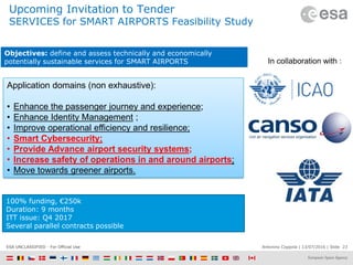
23. Antonino Coppola | 13/07/2016 | Slide 23ESA UNCLASSIFIED - For Official Use
Upcoming Invitation to Tender
SERVICES for SMART AIRPORTS Feasibility Study
100% funding, €250k
Duration: 9 months
ITT issue: Q4 2017
Several parallel contracts possible
In collaboration with :
Application domains (non exhaustive):
• Enhance the passenger journey and experience;
• Enhance Identity Management ;
• Improve operational efficiency and resilience;
• Smart Cybersecurity;
• Provide Advance airport security systems;
• Increase safety of operations in and around airports;
• Move towards greener airports.
Objectives: define and assess technically and economically
potentially sustainable services for SMART AIRPORTS
24. Antonino Coppola | 13/07/2016 | Slide 24ESA UNCLASSIFIED - For Official Use
Artes-apps.esa.int. | European Space Agency
UMS applications
and services could
emerge
Mine counter
Measures
(Detection,
identification
and
detonation)
Protection of
critical
Infrastructures
Maritime
Surveillance
Environmental
Monitoring
Logistics and
maintenance
of marine
infrastructures
for the
offshore wind
farms
Feasibility Study Objectives: to identify and characterize UMS based services exploiting
at least one space asset, addressing potentially interesting application domains, carry out
the analysis of their technical feasibility and commercial viability, select the most promising
ones for further development and exploitation, and propose a roadmap for the
implementation and demonstration of the proposed services.
Coming in
the Q1
2018
Space and Unmanned Maritime Systems (UMS) -
based Maritime Services
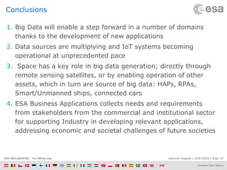
25. Antonino Coppola | 13/07/2016 | Slide 25ESA UNCLASSIFIED - For Official Use
Conclusions
1. Big Data will enable a step forward in a number of domains
thanks to the development of new applications
2. Data sources are multiplying and IoT systems becoming
operational at unprecedented pace
3. Space has a key role in big data generation; directly through
remote sensing satellites, or by enabling operation of other
assets, which in turn are source of big data: HAPs, RPAs,
Smart/Unmanned ships, connected cars
4. ESA Business Applications collects needs and requirements
from stakeholders from the commercial and institutional sector
for supporting Industry in developing relevant applications,
addressing economic and societal challenges of future societies
26. Antonino Coppola | 13/07/2016 | Slide 26ESA UNCLASSIFIED - For Official Use
European Space Agency
ESA Business Applications
→ SPACE IS OPEN FOR BUSINESS
[email protected]